MyTopo
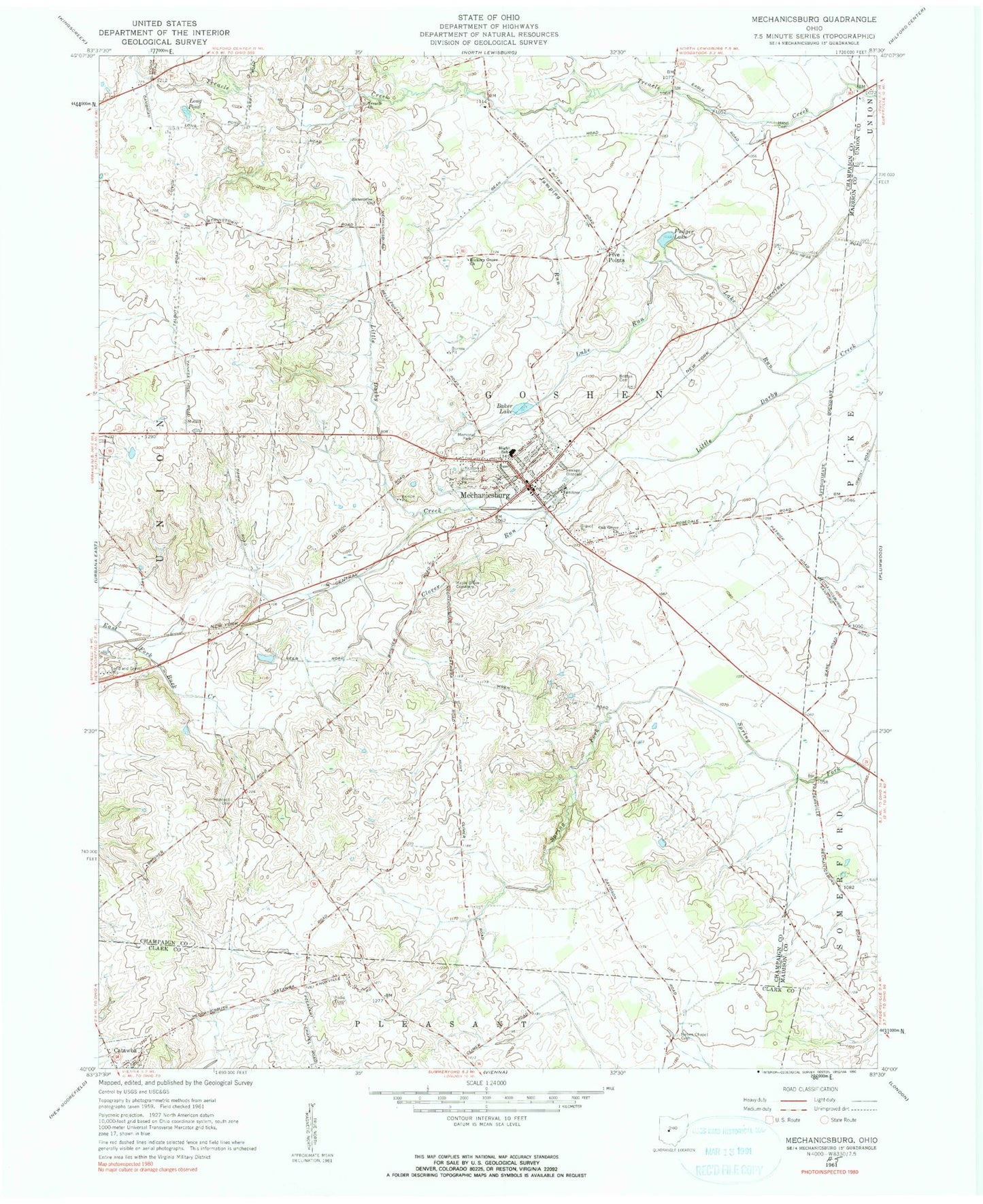
Classic USGS Mechanicsburg Ohio 7.5'x7.5' Topo Map
Couldn't load pickup availability
Historical USGS topographic quad map of Mechanicsburg in the state of Ohio. Map scale may vary for some years, but is generally around 1:24,000. Print size is approximately 24" x 27"
This quadrangle is in the following counties: Champaign, Clark, Madison, Union.
The map contains contour lines, roads, rivers, towns, and lakes. Printed on high-quality waterproof paper with UV fade-resistant inks, and shipped rolled.
Contains the following named places: Baker Lake, Britton Cemetery, Church of Our Savior, Clover Run, Clover Run School, Dohron Wilson Elementary School, Eagle School, East Fork Buck Creek Structure Number 1B Dam, East Fork Buck Creek Structure Number One Reservoir, Enterprise Church, Five Points, Five Points School, Frost Mobile Home Park, Fudger Lake, Goshen School, Hazel Cemetery, Hickory Grove Church, Hopewell Cemetery, Jumping Run, Lake Run, Long Pond, Maple Grove Cemetery, Mechanicsburg, Mechanicsburg Baptist Church, Mechanicsburg Commercial Historic District, Mechanicsburg Fire and EMS Department, Mechanicsburg High School, Mechanicsburg Police Department, Mechanicsburg Post Office, Mechanicsburg United Methodist Church, Memorial Park, Mitchell School, Mustang Valley Farm, Nation Chapel Cemetery, Oak Grove Church, Oakridge School, Reynolds, Saint Michael Catholic Church, School Number 6, Second Baptist Church, Township of Goshen, Treacle Church, Treacles Creek Cemetery, Village of Mechanicsburg, Wild Rose School, ZIP Code: 43044