MyTopo
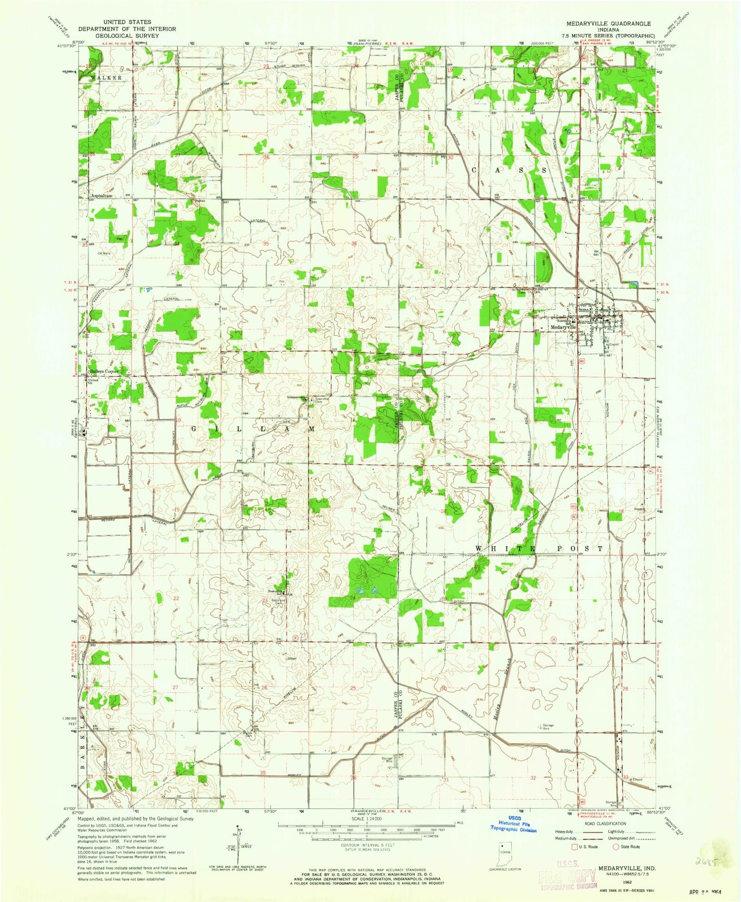
Classic USGS Medaryville Indiana 7.5'x7.5' Topo Map
Couldn't load pickup availability
Historical USGS topographic quad map of Medaryville in the state of Indiana. Map scale may vary for some years, but is generally around 1:24,000. Print size is approximately 24" x 27"
This quadrangle is in the following counties: Jasper, Pulaski.
The map contains contour lines, roads, rivers, towns, and lakes. Printed on high-quality waterproof paper with UV fade-resistant inks, and shipped rolled.
Contains the following named places: Antonian Airport, Antrim Ditch, Asphaltum, Baileys Corner, Chris Salrin Lateral, Culp Airport, Gehring and Gumz Ditch, Hansell Ditch, Iliff Slough Lateral, Independence Church, Madaus Ditch, Mason Cemetery, Meade Rayburn Arm, Medaryville, Medaryville Fire Department, Medaryville Post Office, Mosley Branch, Mosley Ditch, Record Lateral, Robinson Cemetery, Rufus Rayburn Arm, Saint Henrys Cemetery, Saint Marks Lutheran Cemetery, Salrin and Cox Ditch, Stump Ditch, Stump Slough Ditch, Tatertown Airport, Town of Medaryville, Township of Gillam, Vanatta Lateral, Washburn Lateral