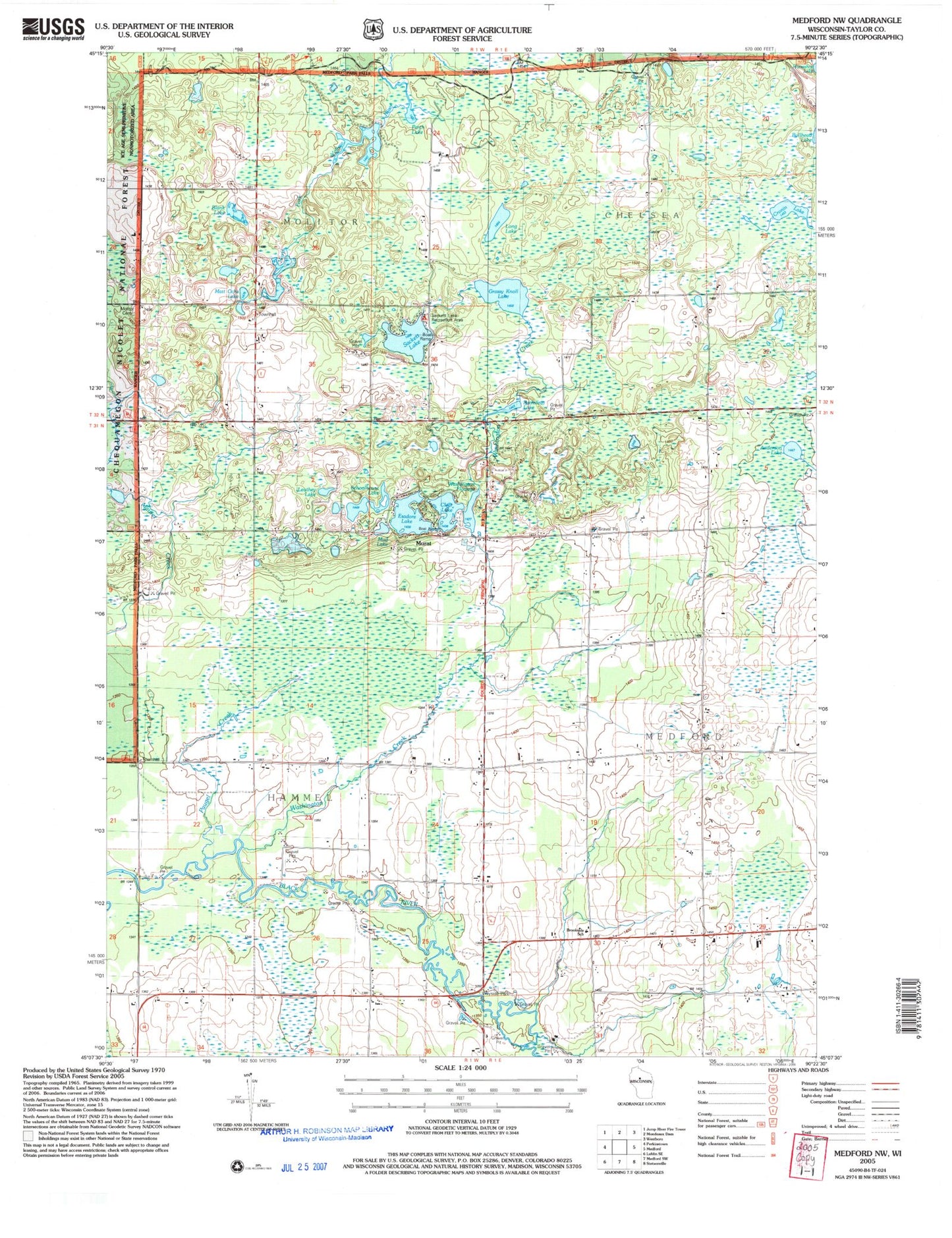
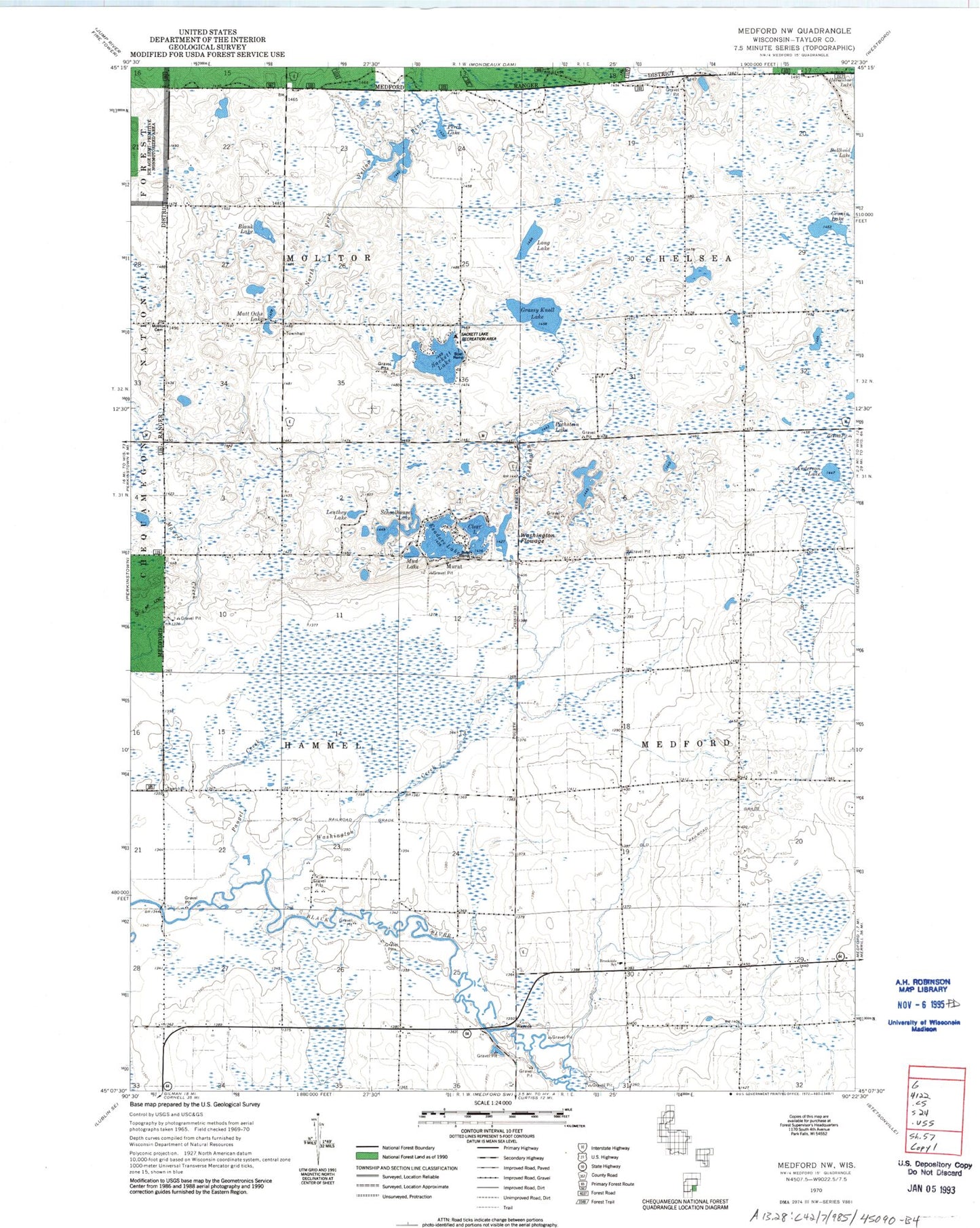
MyTopo
Classic USGS Medford NW Wisconsin 7.5'x7.5' Topo Map
Couldn't load pickup availability
Historical USGS topographic quad map of Medford NW in the state of Wisconsin. Map scale may vary for some years, but is generally around 1:24,000. Print size is approximately 24" x 27"
This quadrangle is in the following counties: Taylor.
The map contains contour lines, roads, rivers, towns, and lakes. Printed on high-quality waterproof paper with UV fade-resistant inks, and shipped rolled.
Contains the following named places: 0.4 Reservoir, 0.6 Reservoir, 1.5 Reservoir, 54451, Anderson Lake, Blank Lake, Bradow Dam D 8092, Brookside School, Clear Lake, Clear Lake Dam, Cleveland School, Cronin Lake, Dr Walther W Meyer Number 1 D4754 Dam, Esadore Lake, Farm View School, Grassy Knoll Lake, Hammel Townhall, Leuthey Creek, Leuthey Lake, Long Lake, Matt Ochs Lake, Meadowbrook School, Meadownook School, Meyer 1 G3582.1 Dam, Meyer 2 G3582.1 Dam, Meyer 4 G3582.1 Dam, Meyer 5 G3582.1 Dam, Meyer 6 E1355.1 Dam, Molitor Cemetery, Molitor Townhall, Mud Lake, Murat, Nick Henrichs G-9011 Dam, Patrick J Meyer 3NW78801 Dam, Paugel Creek, Pechstein Lake, Perch Lake, Pine Tree School, Romeo Lake, Sackett Lake, Sackett Lake Recreation Area, Schoolhouse Lake, Steenhoven Dam, Thielke School, Tiffany Lake, Town of Hammel, Town of Molitor, Washington Creek, Washington Flowage, Wayside School