MyTopo
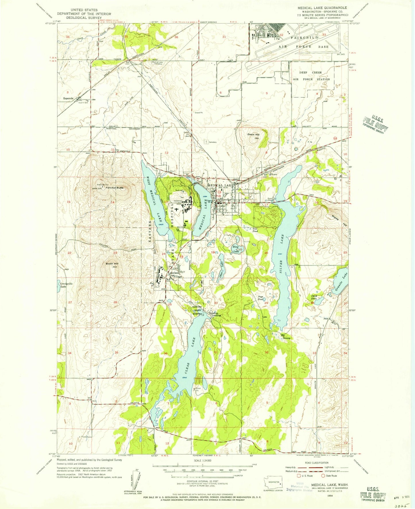
Classic USGS Medical Lake Washington 7.5'x7.5' Topo Map
Couldn't load pickup availability
Historical USGS topographic quad map of Medical Lake in the state of Washington. Map scale may vary for some years, but is generally around 1:24,000. Print size is approximately 24" x 27"
This quadrangle is in the following counties: Spokane.
The map contains contour lines, roads, rivers, towns, and lakes. Printed on high-quality waterproof paper with UV fade-resistant inks, and shipped rolled.
Contains the following named places: American Medical Response, Big Swamp, Booth Hill, Cheney-Medical Lake Division, City of Medical Lake, Clear Lake, Duck Lake, Eastern State Hospital, Espanola, Fairchild Air Force Base, Fairchild Air Force Base Census Designated Place, Fairchild Air Force Base Fire Department, Fairchild Air Force Base Fire Department Fire Station 2, Fancher Butte, Flying R Ranch Airport, Granite Lake, Interlake School, Lakeland Village, Lakes Memorial Cemetery, Malloy Prairie, Medical Lake, Medical Lake Cemetery, Medical Lake Elementary School, Medical Lake Fire Department, Medical Lake High School, Medical Lake Middle School, Medical Lake Police Department, Medical Lake Post Office, Medical Lake Waterfront Park, Olson Hill, Otter Lake, Page Pond, Riddle Hill, Ring Lake, Saint Annes Cemetery, Silver Lake, Spokane County Fire District 3 Station 32 - Medical Lake, Tule Pond, Washington State Veterans Cemetery, West Medical Lake, ZIP Codes: 99011, 99022