
MyTopo
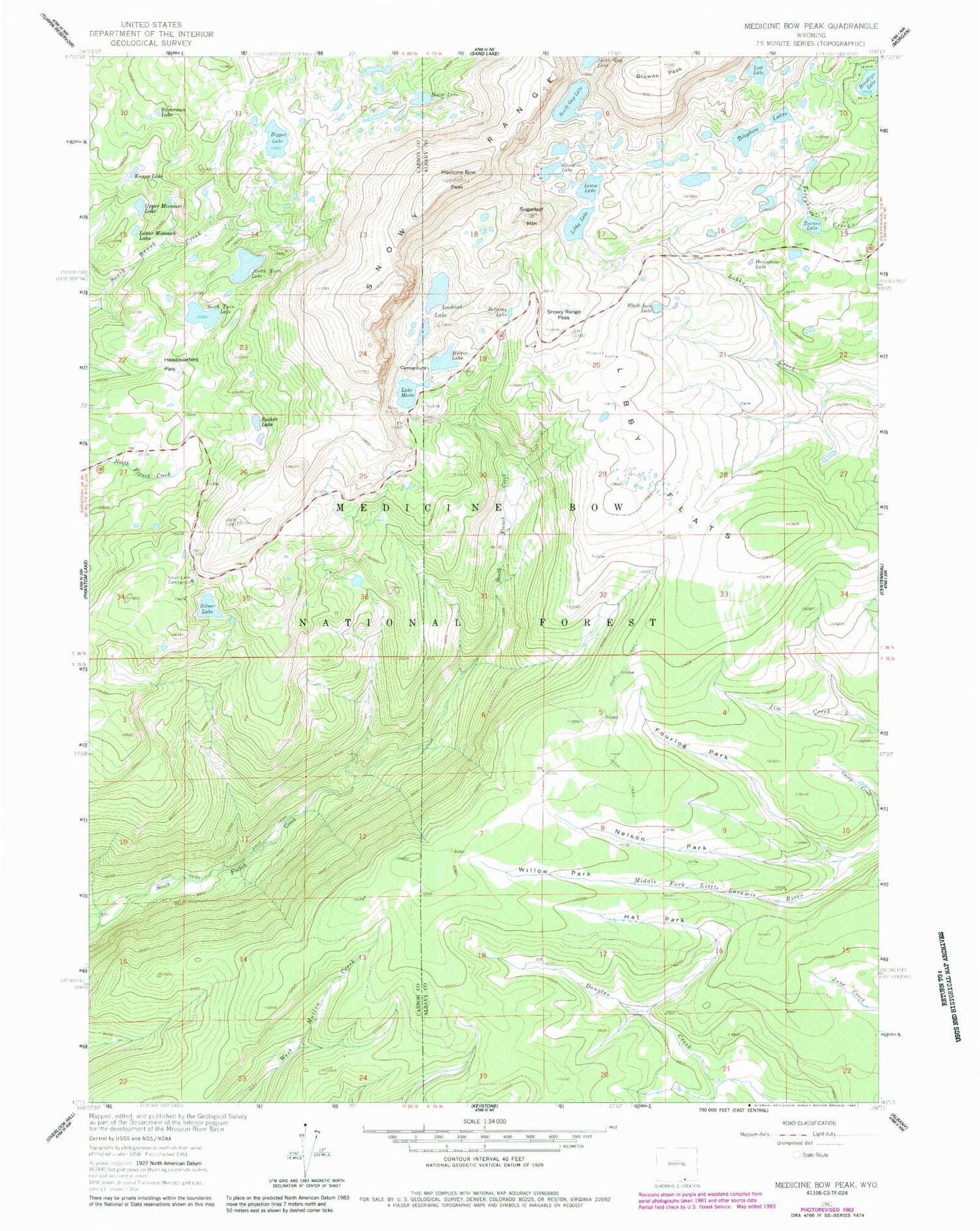
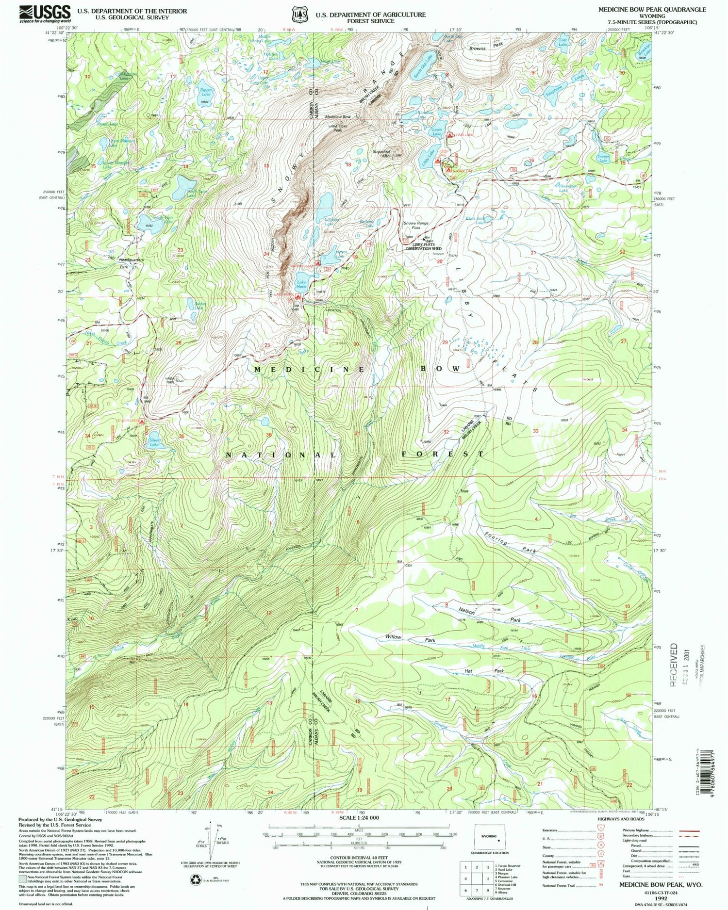
USGS Classic Medicine Bow Peak Wyoming 7.5'x7.5' Topo Map
Couldn't load pickup availability
Historical USGS topographic quad map of Medicine Bow Peakin the states of Wyoming, Colorado. Scale: 1:24000. Print size: 24" x 27"
This quadrangle is in the following counties: Albany, Carbon.
The map contains contour lines, roads, rivers, towns, lakes, and grids including latitude / longitude and UTM / MGRS. Printed on high-quality waterproof paper with UV fade-resistant inks.
Contains the following named places: Bellamy Lake, Black Jack Lake, Browns Peak, Dipper Lake, Fourlog Park, Hat Park, Headquarters Park, Heart Lake, Hourglass Lake, Klondike Lake, Lewis Lake, Lewis Lake Campground, Libby Flats, Libby Lake, Lookout Lake, Lost Lake, Lake Marie, Medicine Bow Peak, Mirror Lake, Nelson Park, North Twin Lake, Silver Lake, Silver Lake Campground, Snowy Range Pass, South Gap Lake, South Twin Lake, Sugarloaf Mountain, Telephone Lakes, Willow Park, Medicine Bow National Forest, Upper Missouri Lake, Silverman Lake, Lower Missouri Lake, Knapp Lake, Circle Trail, Libby Flats Observation Shed, Sucker Lake, Mirror Lake Campground, Lake Marie Picnic Ground, Sugarloaf Recreation Area, Lakes Trail, Medicine Bow Trail, Keystone Dam, Keystone Reservoir, Sucker Dam, Ryan Brothers Lake Dam, Ryan Brothers Lake, First Enlargement of Wiant Dam, Wiant Reservoir, Wiant Number 2 Dam, Dipper Lake, Little Brooklyn Lake Dam, Brooklyn Lake, Towner Lake, Brady Lake, Class Lake, Fishhook Lake, Hatchet Lake, Jeep Lake, Highway 130 Lake, Middle Long Lake, Pinchot Lake, Round Lake, Sandy Lake, Scott Lake, Lorain Group Mine, Missouri Lakes, Medicine Bow National Forest


