MyTopo
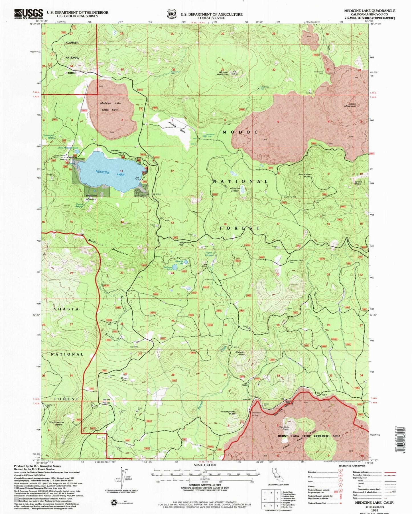
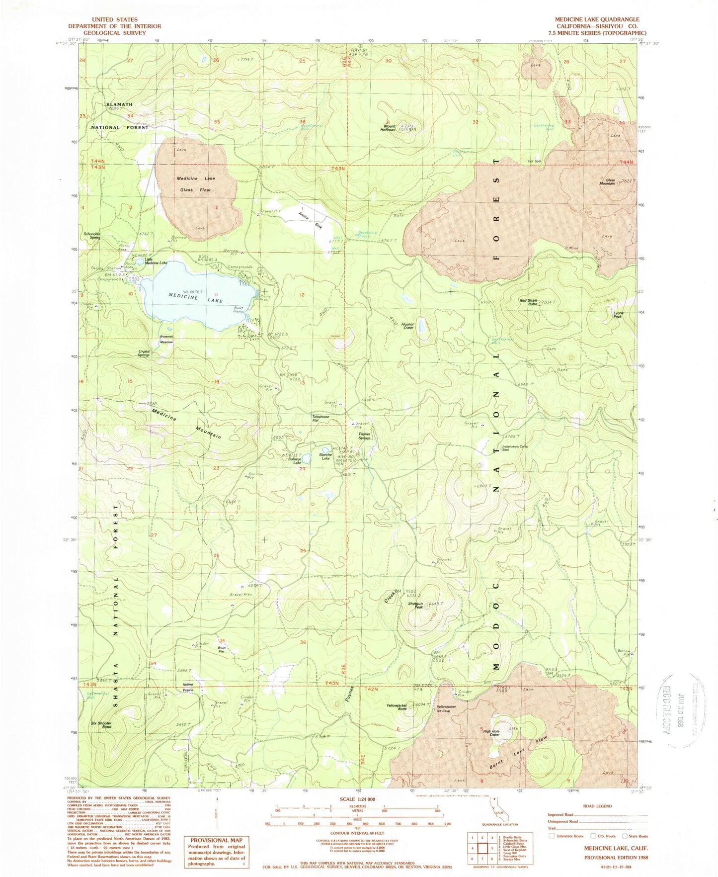
Classic USGS Medicine Lake California 7.5'x7.5' Topo Map
Couldn't load pickup availability
Historical USGS topographic quad map of Medicine Lake in the state of California. Map scale may vary for some years, but is generally around 1:24,000. Print size is approximately 24" x 27"
This quadrangle is in the following counties: Siskiyou.
The map contains contour lines, roads, rivers, towns, and lakes. Printed on high-quality waterproof paper with UV fade-resistant inks, and shipped rolled.
Contains the following named places: Alcohol Crater, Arnica Sink, Blanche Lake, Brownell Meadow, Bruin Flat, Bullseye Lake, Burnt Lava Flow Geological Area, Crystal Springs, Glass Mountain, High Hole Crater, Iodine Prairie, Little Medicine Lake, Lyons Peak, Medicine Lake, Medicine Lake Glass Flow, Medicine Mountain, Mount Hoffman, Paynes Springs, Red Shale Butte, Schonchin Spring, Shotgun Peak, Six Shooter Butte, Telephone Flat, Undertakers Camp, Yellowjacket Butte