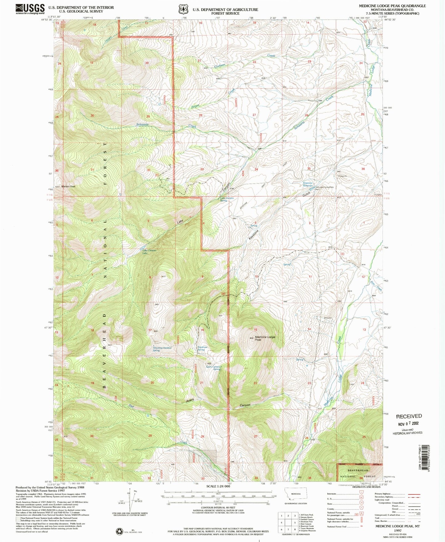
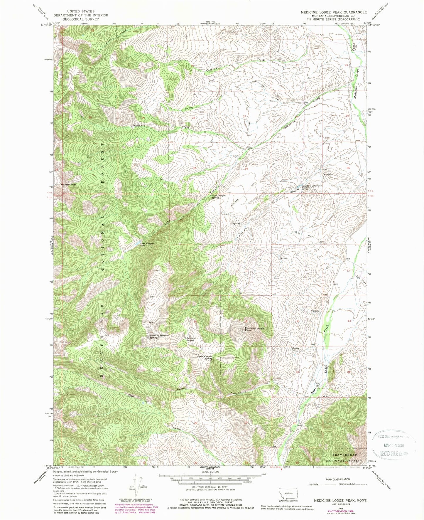
MyTopo
Classic USGS Medicine Lodge Peak Montana 7.5'x7.5' Topo Map
Couldn't load pickup availability
Historical USGS topographic quad map of Medicine Lodge Peak in the state of Montana. Map scale may vary for some years, but is generally around 1:24,000. Print size is approximately 24" x 27"
This quadrangle is in the following counties: Beaverhead.
The map contains contour lines, roads, rivers, towns, and lakes. Printed on high-quality waterproof paper with UV fade-resistant inks, and shipped rolled.
Contains the following named places: Anton Creek, Ayers Canyon, Ayers Canyon Spring, Kate Creek, Keystone Drift Fence, Keystone Gulch, Keystone Reservoir, Keystone Spring, Lake Canyon, Lake Canyon Lake, Lake Canyon Spring, Maiden Peak, Medicine Lodge, Medicine Lodge Peak, Schwartz Creek, Shooting Herders Spring