MyTopo
Classic USGS Medicine Mountain California 7.5'x7.5' Topo Map
Couldn't load pickup availability
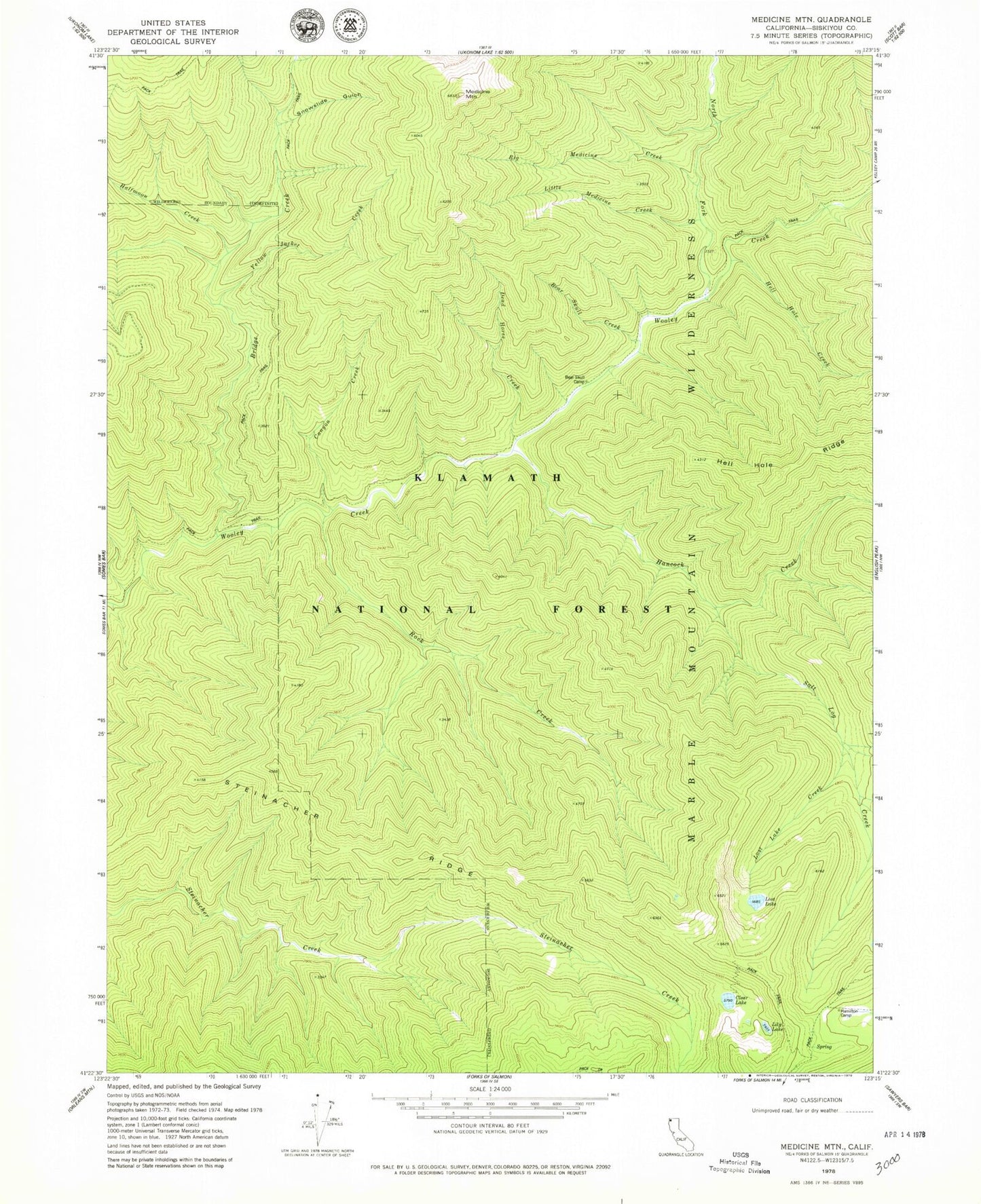
Historical USGS topographic quad map of Medicine Mountain in the state of California. Map scale may vary for some years, but is generally around 1:24,000. Print size is approximately 24" x 27"
This quadrangle is in the following counties: Siskiyou.
The map contains contour lines, roads, rivers, towns, and lakes. Printed on high-quality waterproof paper with UV fade-resistant inks, and shipped rolled.
Contains the following named places: Bear Skull Camp, Bear Skull Creek, Big Medicine Creek, Bridge Creek, Canyon Creek, Clear Lake, Dead Horse Creek, Halfmoon Creek, Hamilton Camp, Hancock Creek, Hell Hole Creek, Lily Lake, Little Medicine Creek, Lost Lake, Lost Lake Creek, Medicine Mountain, North Fork Camp, North Fork Wooley Creek, Rock Creek, Salt Log Creek, Snowslide Gulch, Steinacher Ridge, Yellow Jacket Creek