MyTopo
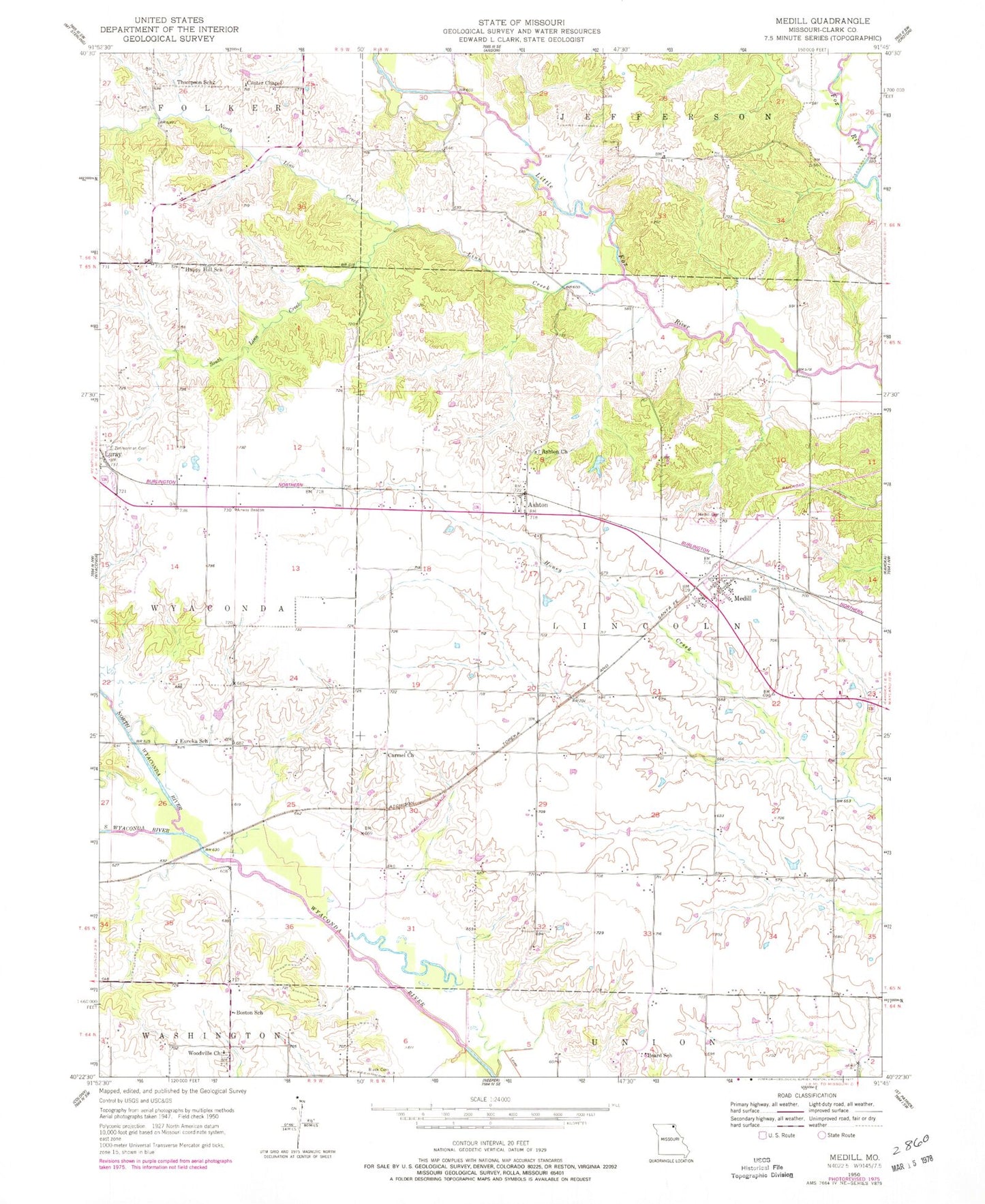
Classic USGS Medill Missouri 7.5'x7.5' Topo Map
Couldn't load pickup availability
Historical USGS topographic quad map of Medill in the state of Missouri. Map scale may vary for some years, but is generally around 1:24,000. Print size is approximately 24" x 27"
This quadrangle is in the following counties: Clark.
The map contains contour lines, roads, rivers, towns, and lakes. Printed on high-quality waterproof paper with UV fade-resistant inks, and shipped rolled.
Contains the following named places: Ashton, Ashton Church, Ashton Lake, Beard School, Boston School, Brotherton Lake Dam, Cama, Carmel Church, Cemetery Chapel, Center Chapel, Drew Bridge, Eureka School, Happy Hill School, Hays School, Lebanon School, Linn Creek, Medill, Medill Cemetery, Medill Census Designated Place, Medill Presbyterian Church, North Linn Creek, North Wyaconda River, Seyb Lake Dam, South Linn Creek, South Wyaconda River, Thompson School, Todd Branch, Toops School, Township of Lincoln, Woodville Baptist Church, Woodville Church, Zimmerman Cemetery