MyTopo
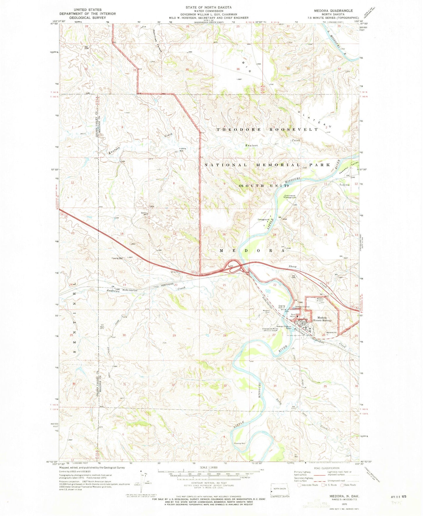
Classic USGS Medora North Dakota 7.5'x7.5' Topo Map
Couldn't load pickup availability
Historical USGS topographic quad map of Medora in the state of North Dakota. Map scale may vary for some years, but is generally around 1:24,000. Print size is approximately 24" x 27"
This quadrangle is in the following counties: Billings, Golden Valley.
The map contains contour lines, roads, rivers, towns, and lakes. Printed on high-quality waterproof paper with UV fade-resistant inks, and shipped rolled.
Contains the following named places: Andrews Creek, Big Plateau, Big Plateau Spring, Billings County Ambulance Service, Billings County Courthouse, Billings County Courthouse Museum, Billings County Sheriff's Office, Buddy Ranch Airport, Burning Hills Amphitheatre, Chateau de Mores, Chautea de Mores Visitor Center, City of Medora, Cottonwood Campground, DeMores Elementary School, Ekblom Spring, Harold Schafer Heritage Center, Hellickson Ranch, Knutson Creek, Lone Tree Spring, Medora, Medora Cemetery, Medora City Hall, Medora Fire Department, Medora Police Department, Medora Post Office, Medora Ranger Station, North Dakota Cowboy Hall of Fame, Peaceful Valley Ranch, Peaceful Valley Recreation Site, Railroad Creek, Rough Rider Campground, Sheep Creek, Sheep Pasture Spring, Spurgeon and Myers Ranch, Sully Creek, Sully Creek State Primitive Park, Tomamichael Spring, Wannagan Seeps, ZIP Code: 58645