MyTopo
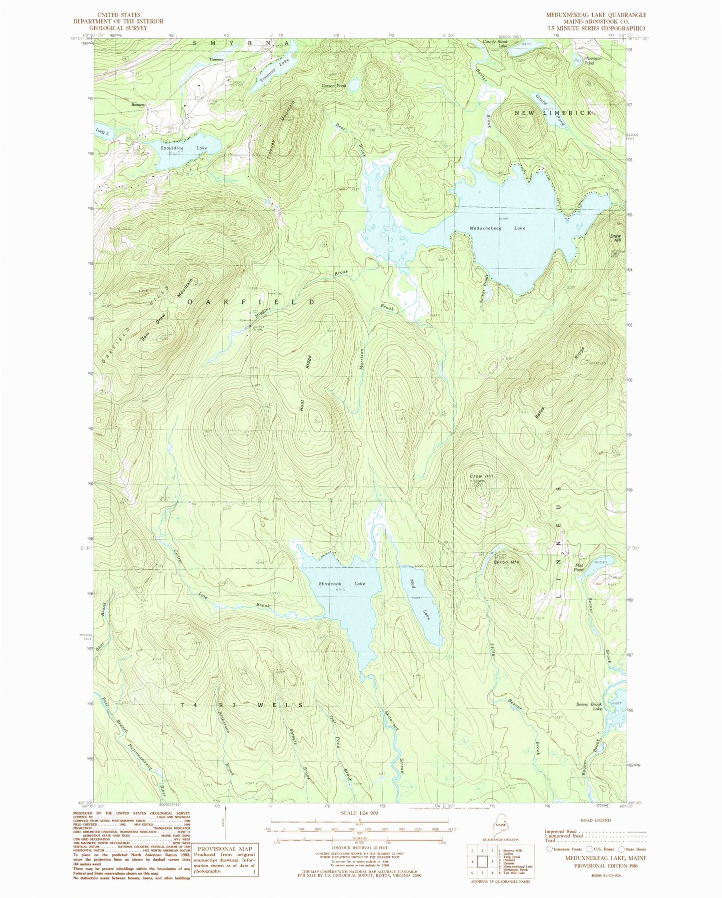
Classic USGS Meduxnekeag Lake Maine 7.5'x7.5' Topo Map
Couldn't load pickup availability
Historical USGS topographic quad map of Meduxnekeag Lake in the state of Maine. Typical map scale is 1:24,000, but may vary for certain years, if available. Print size: 24" x 27"
This quadrangle is in the following counties: Aroostook.
The map contains contour lines, roads, rivers, towns, and lakes. Printed on high-quality waterproof paper with UV fade-resistant inks, and shipped rolled.
Contains the following named places: Bates Ridge, Baxter Brook, Bear Brook, Bear Brook, Beaver Brook Lake, Byron Mountain, Byron School, Carson Pond, Center Line Brook, County Road Lake, Crow Hill, Drew Hill, Gould Pond, Hannigan Pond, Higgins Brook, Hunt Ridge, Meduxnekeag Lake, Morrison Brook, Mud Lake, Mud Pond, Oakfield Hills, Sam Drew Mountain, Skitacook Lake, Spaulding Lake, Sucker Brook, Timoney Lake, Timoney Mountain, Bennett, Timoney, Town of Oakfield, Drews Lake Dam, Timoney Cemetery, Oakfield Cemetery