MyTopo
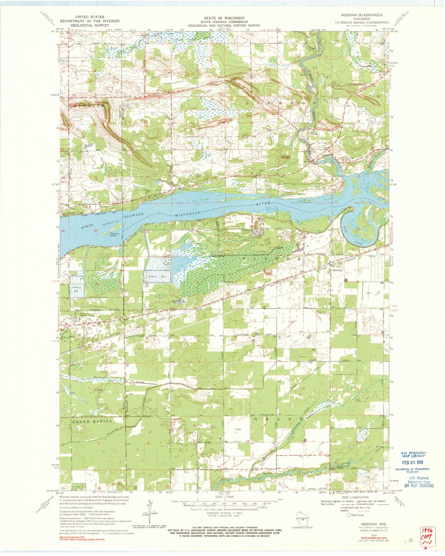
Classic USGS Meehan Wisconsin 7.5'x7.5' Topo Map
Couldn't load pickup availability
Historical USGS topographic quad map of Meehan in the state of Wisconsin. Map scale may vary for some years, but is generally around 1:24,000. Print size is approximately 24" x 27"
This quadrangle is in the following counties: Portage, Wood.
The map contains contour lines, roads, rivers, towns, and lakes. Printed on high-quality waterproof paper with UV fade-resistant inks, and shipped rolled.
Contains the following named places: Bear Creek, Biron Flowage, Hill View School, La Follette School, Linwood Union Cemetery, Love Creek, Meehan, Mill Creek, Pearl School, Pleasure Island, Restlawn Memorial Park, Rocky Run, Rudolph Volunteer Fire Department Station 2 - Linwood, Town of Linwood, WIZD-FM (Rudolph), Woodville School