MyTopo
Classic USGS Meeks Cabin Reservoir Wyoming 7.5'x7.5' Topo Map
Couldn't load pickup availability
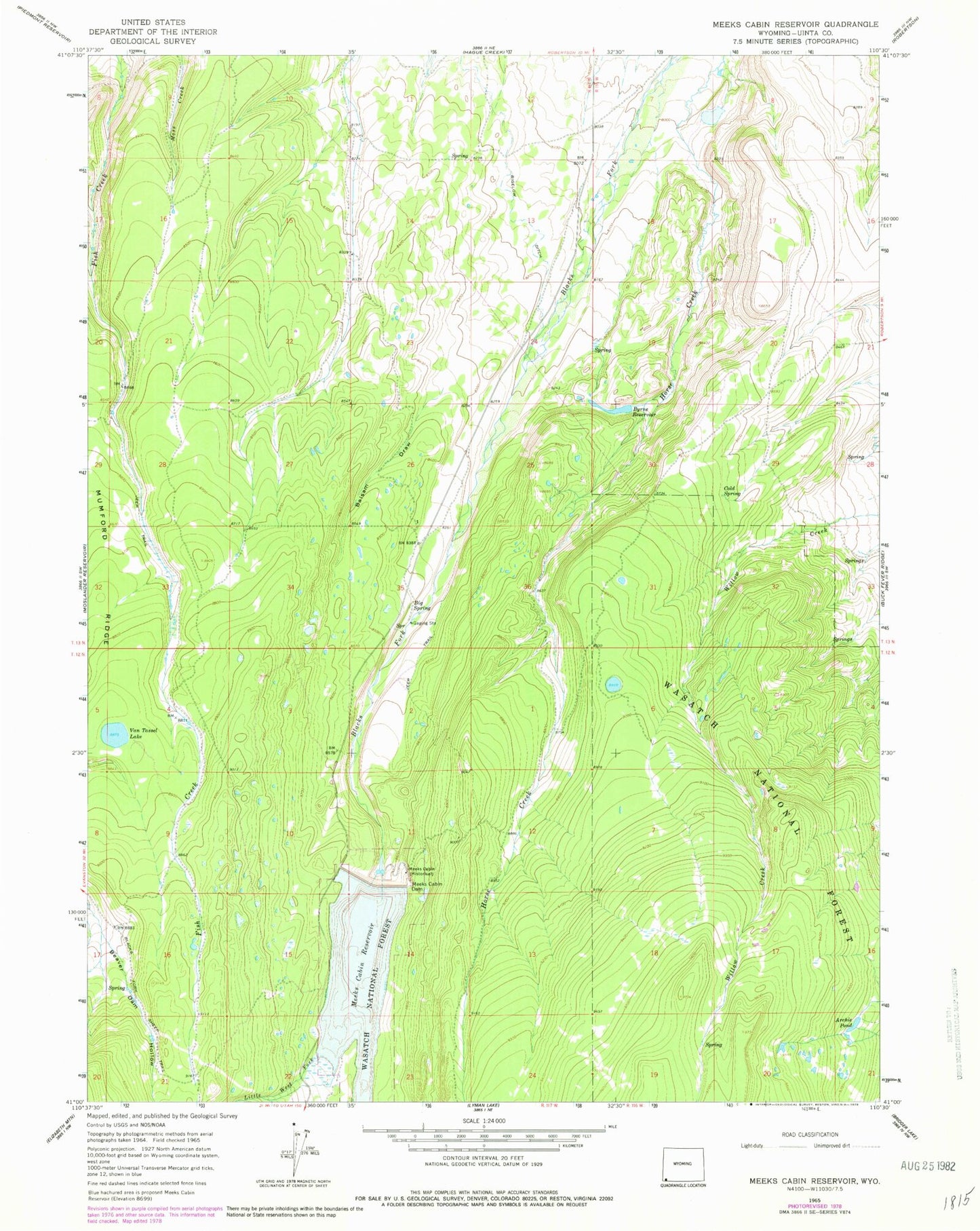
Historical USGS topographic quad map of Meeks Cabin Reservoir in the state of Wyoming. Map scale may vary for some years, but is generally around 1:24,000. Print size is approximately 24" x 27"
This quadrangle is in the following counties: Uinta.
The map contains contour lines, roads, rivers, towns, and lakes. Printed on high-quality waterproof paper with UV fade-resistant inks, and shipped rolled.
Contains the following named places: Archie Pond, Balsam Draw, Beaver Lake, Beaver Lake Dam, Bigelow Ditch, Byrne Dam, Byrne Reservoir, Cold Spring, Drown Creek, Little West Fork Blacks Fork, Meeks Cabin, Meeks Cabin Campground, Meeks Cabin Dam, Meeks Cabin Reservoir, Uinta County Youth Camp, Van Tassel Lake, Van Tassel Lake Dam