MyTopo
Classic USGS Meeks Table Washington 7.5'x7.5' Topo Map
Couldn't load pickup availability
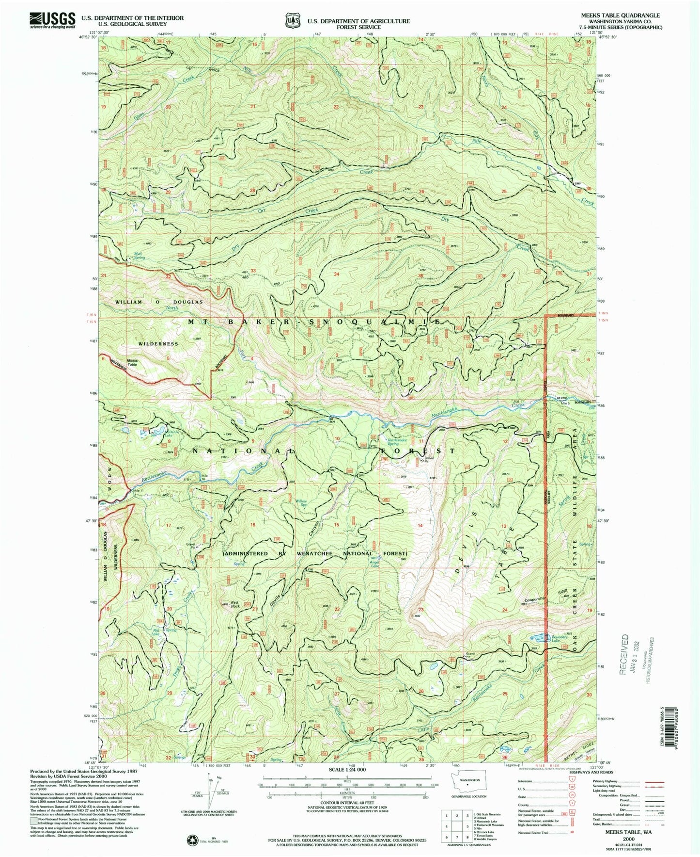
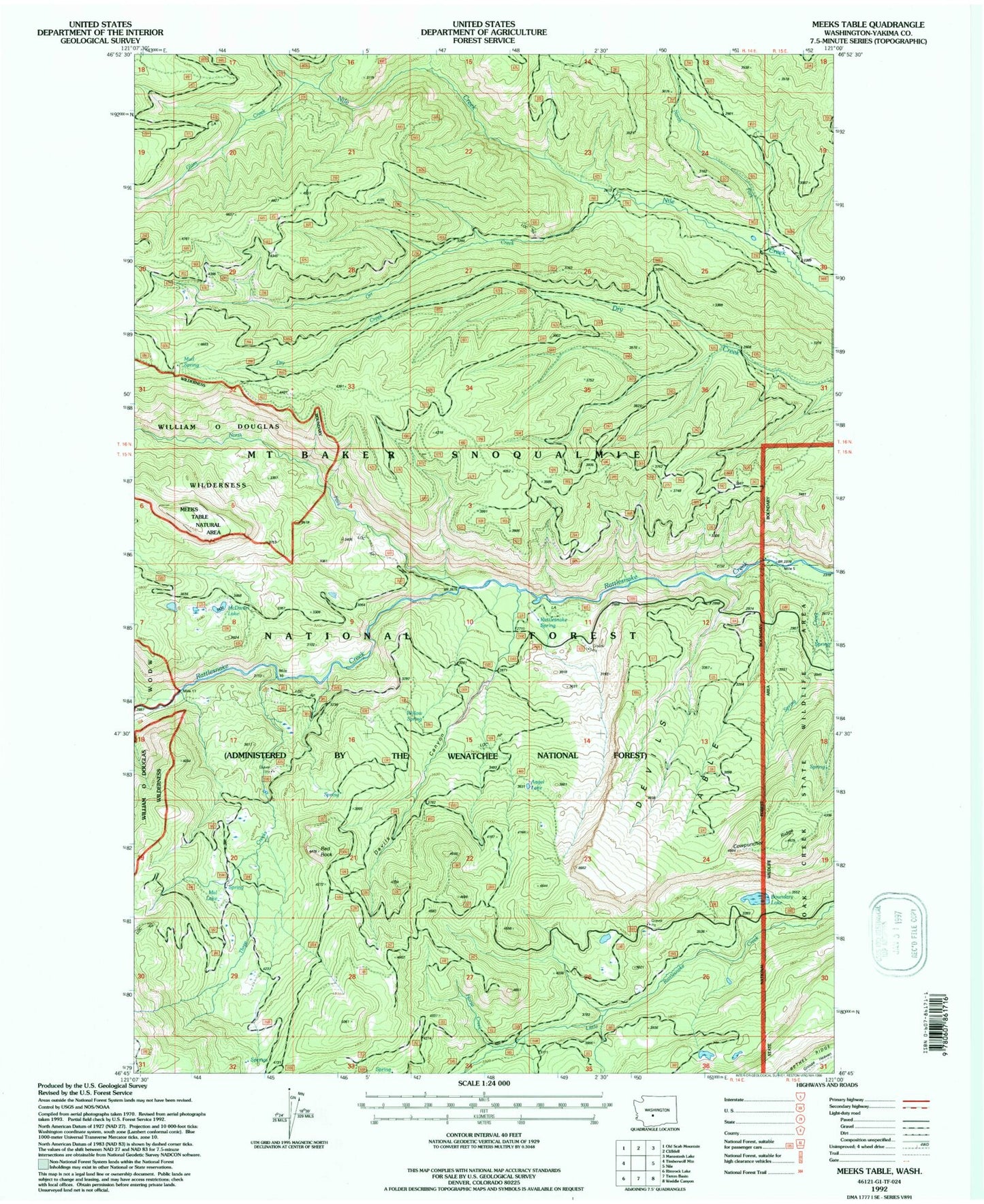
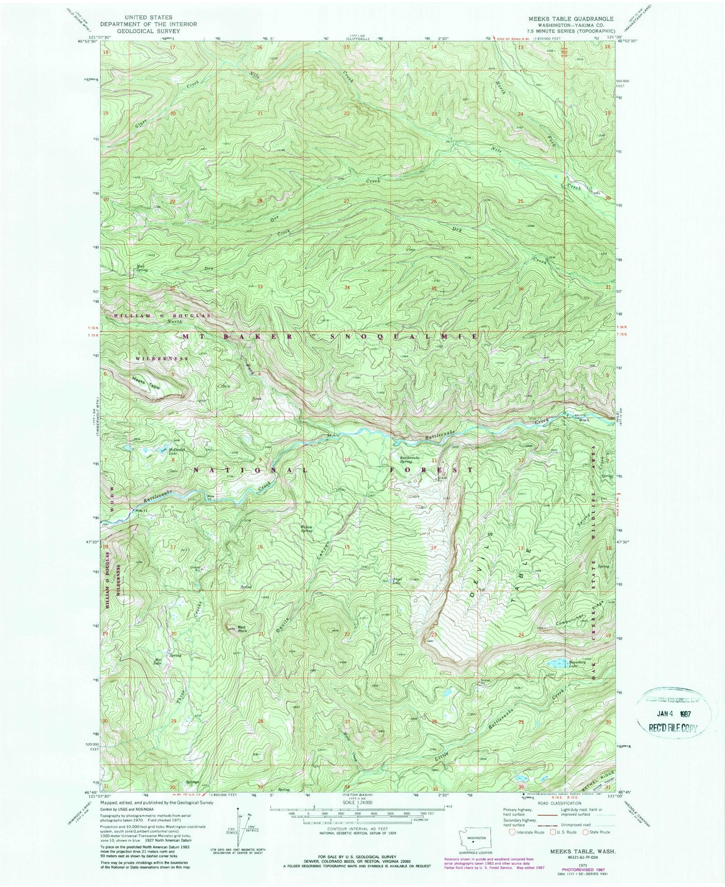
Historical USGS topographic quad map of Meeks Table in the state of Washington. Typical map scale is 1:24,000, but may vary for certain years, if available. Print size: 24" x 27"
This quadrangle is in the following counties: Yakima.
The map contains contour lines, roads, rivers, towns, and lakes. Printed on high-quality waterproof paper with UV fade-resistant inks, and shipped rolled.
Contains the following named places: Angel Lake, Boundary Lake, Cowpuncher Ridge, Devils Canyon, Devils Table, Glass Creek, Grouse Heaven, Horse Creek, Mal Lake, McDaniel Lake, Meeks Table, Mud Spring, North Fork Nile Creek, North Fork Rattlesnake Creek, Orr Creek, Rattlesnake Spring, Red Rock, Spring Creek, Three Creeks, Willow Spring, Meeks Table Natural Area, Mount Aix Vista, Rattlesnake Forks, Rattlesnake Guard Station, Northwest Yakima Division, Angel Lake, Boundary Lake, Cowpuncher Ridge, Devils Canyon, Devils Table, Glass Creek, Grouse Heaven, Horse Creek, Mal Lake, McDaniel Lake, Meeks Table, Mud Spring, North Fork Nile Creek, North Fork Rattlesnake Creek, Orr Creek, Rattlesnake Spring, Red Rock, Spring Creek, Three Creeks, Willow Spring, Meeks Table Natural Area, Mount Aix Vista, Rattlesnake Forks, Rattlesnake Guard Station, Northwest Yakima Division