MyTopo
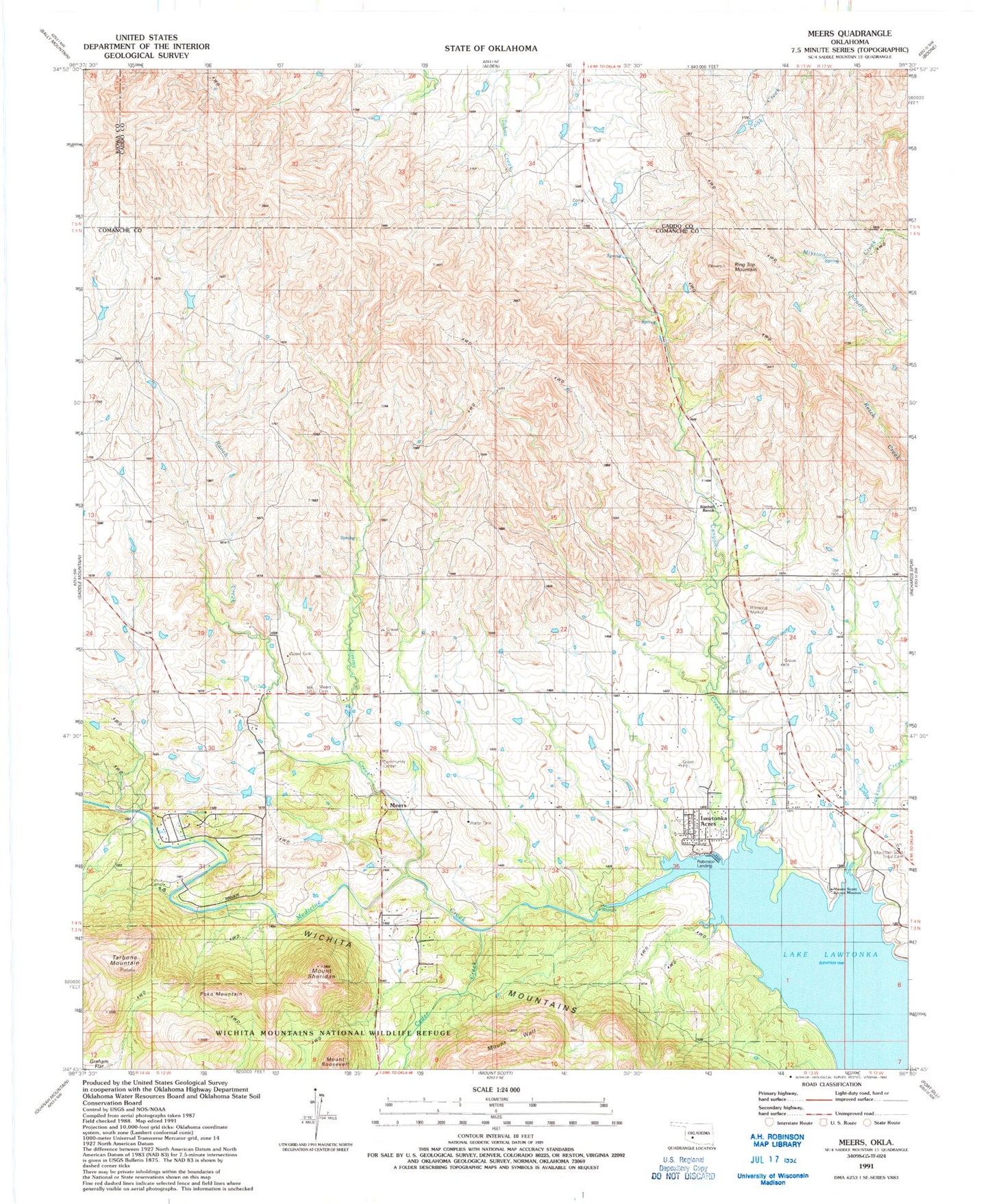
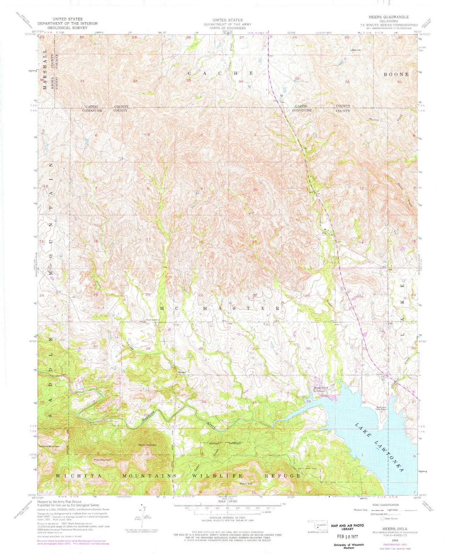
Classic USGS Meers Oklahoma 7.5'x7.5' Topo Map
Couldn't load pickup availability
Historical USGS topographic quad map of Meers in the state of Oklahoma. Map scale may vary for some years, but is generally around 1:24,000. Print size is approximately 24" x 27"
This quadrangle is in the following counties: Caddo, Comanche, Kiowa.
The map contains contour lines, roads, rivers, towns, and lakes. Printed on high-quality waterproof paper with UV fade-resistant inks, and shipped rolled.
Contains the following named places: Canyon Creek, Cedar Creek, Curtright Springs, Jackson Creek, Jimmy Creek, Kimbell Ranch, Lake Lawtonka, Lawtonka Acres, Lawtonka Acres Census Designated Place, Meers, Meers Cemetery, Meers Volunteer Fire Department, Mount Roosevelt, Mount Scott Kiowa Mission, Mount Scott Tribal Cemetery, Mount Sheridan, Mount Wall, Mountain Scott Tribal Cemetery, Northwest Comanche Division, Paradise Valley Fire Department, Poko Mountain, Ranch Creek, Ring Top Mountain, Robinson Landing, Robison Landing, Tarbone Mountain, Township of McMaster, Yshua Sports Camp