
MyTopo
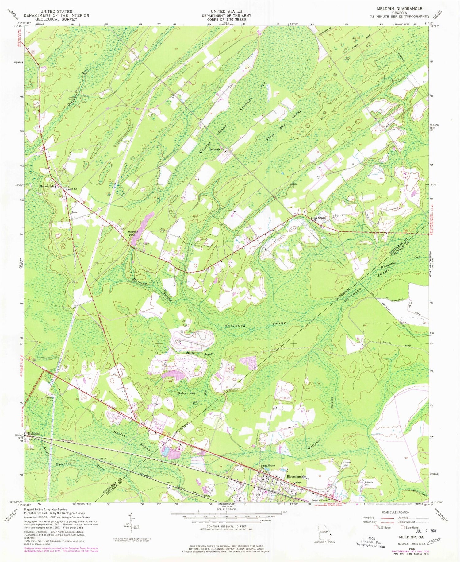
Classic USGS Meldrim Georgia 7.5'x7.5' Topo Map
Couldn't load pickup availability
Historical USGS topographic quad map of Meldrim in the state of Georgia. Map scale may vary for some years, but is generally around 1:24,000. Print size is approximately 24" x 27"
This quadrangle is in the following counties: Chatham, Effingham.
The map contains contour lines, roads, rivers, towns, and lakes. Printed on high-quality waterproof paper with UV fade-resistant inks, and shipped rolled.
Contains the following named places: Alpha United Methodist Church, Berea Southern Methodist Church, Bethesda Church, Bloomingdale, Bloomingdale Alliance Church, Bloomingdale City Hall, Bloomingdale Elementary School, Bloomingdale Fire Department, Bloomingdale Municipal Court, Bloomingdale Police Department, Bloomingdale Post Office, Church of Christ, Coldbrook Swamp, Country Side Church, Effingham Fire / Rescue Station 3, Effingham Fire / Rescue Station 8, Effingham Fire / Rescue Station 9, Falkville Church, Fetzer School, Gadny Bay, Hardin Swamp, Hester Cemetery, Horning Swamp, International Worship Center, Kingdom Hall, Marlow Elementary School, Meldrim Cemetery, Miller Chapel Church, Monterey Park Church, Morgans Pond, Morgans Pond Dam, Old Hill Cemetery, Ottawa Estates, Piney Grove Church, Pooler Fire and Rescue Station 2, Rincon Division, River Styx, Scuffletown School, Skinners Bay, South Effingham Elementary School, South Effingham High School, South Effingham Middle School, Spirit Branch, Three Men Swamp, Union Church, Walthour Swamp, Zeigler Pond, Zeigler Pond Dam, Zion Church, ZIP Code: 31318


