MyTopo
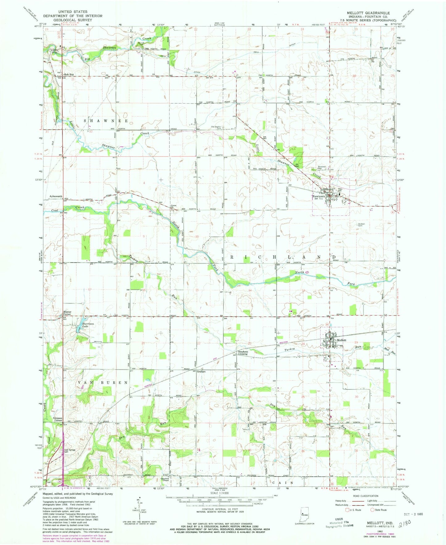
Classic USGS Mellott Indiana 7.5'x7.5' Topo Map
Couldn't load pickup availability
Historical USGS topographic quad map of Mellott in the state of Indiana. Map scale may vary for some years, but is generally around 1:24,000. Print size is approximately 24" x 27"
This quadrangle is in the following counties: Fountain.
The map contains contour lines, roads, rivers, towns, and lakes. Printed on high-quality waterproof paper with UV fade-resistant inks, and shipped rolled.
Contains the following named places: Aylesworth, Beulah Cemetery, Campbell Chapel, Campbell Field, Cold Spring Cemetery, Graham, Harrison Lake, Hodson Cemetery, Hunter Corner, Kell Ditch, Mellott, Mellott Post Office, Mellott Volunteer Fire Department, Mud Run, Newtown, Newtown Cemetery, Newtown Post Office, North Fork Coal Creek, Old Baptist Cemetery, Rob Roy, Simpson Corner, Stephens Crossing, Town of Mellott, Town of Newtown, Township of Richland, Turkey Run, Union Church, ZIP Codes: 47958, 47969, 47987