MyTopo
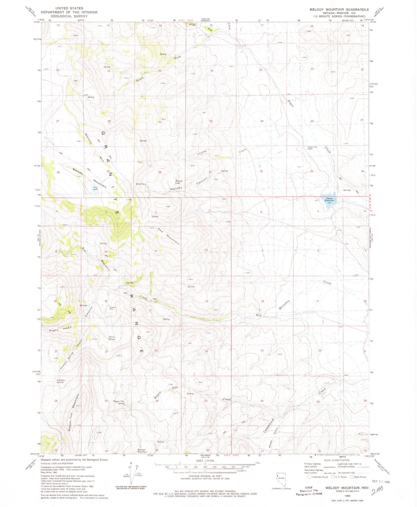
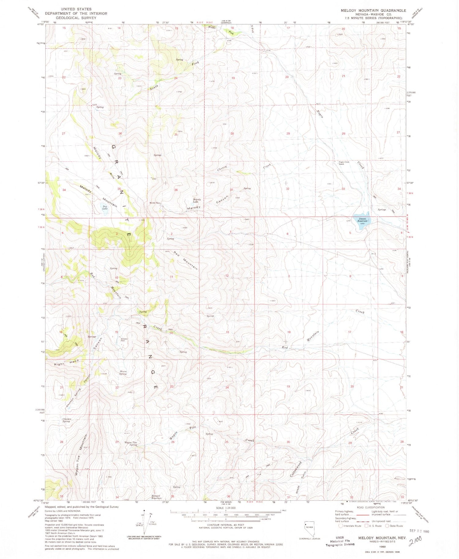
Classic USGS Melody Mountain Nevada 7.5'x7.5' Topo Map
Couldn't load pickup availability
Historical USGS topographic quad map of Melody Mountain in the state of Nevada. Map scale may vary for some years, but is generally around 1:24,000. Print size is approximately 24" x 27"
This quadrangle is in the following counties: Washoe.
The map contains contour lines, roads, rivers, towns, and lakes. Printed on high-quality waterproof paper with UV fade-resistant inks, and shipped rolled.
Contains the following named places: Aspen Spring, Cherry Creek, Chicken Spring, Chicken Spring Canyon, Iveson Reservoir, Melody Canyon, Melody Lake, Melody Mountain, Melody Place, Melody Rim, Middle Fork Negro Creek, Negro Creek Dam, Negro Creek Ranch, North Fork Negro Creek, Red Mountain, Right Hand Canyon, Sheds Gulch, South Fork Negro Creek, South Fork Red Mountain Creek, Wagon Tire Creek, Wagon Tire Mountain, Wagon Tire Spring, Warm Spring, Williams Place