MyTopo
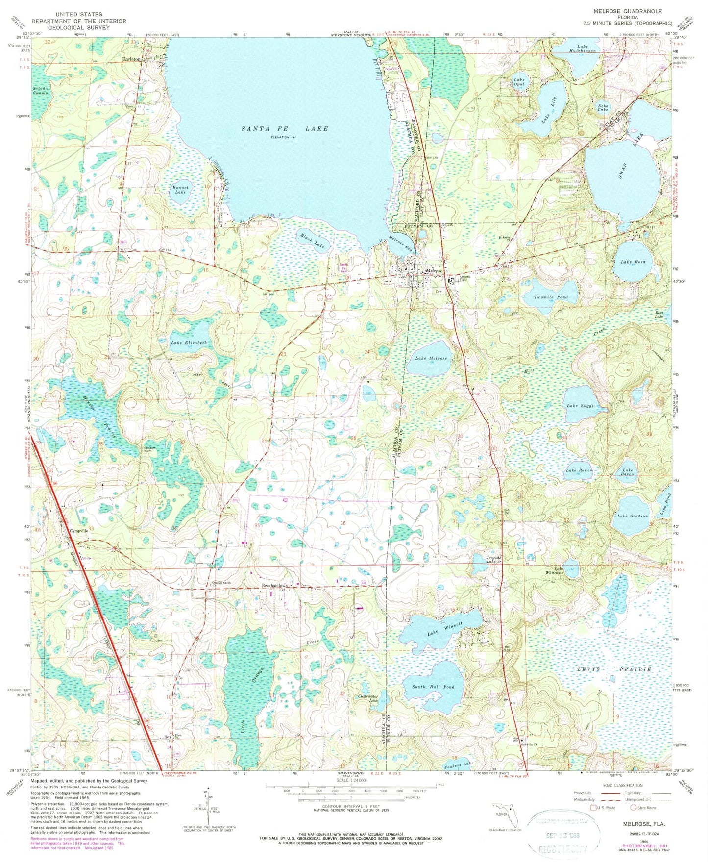
Classic USGS Melrose Florida 7.5'x7.5' Topo Map
Couldn't load pickup availability
Historical USGS topographic quad map of Melrose in the state of Florida. Typical map scale is 1:24,000, but may vary for certain years, if available. Print size: 24" x 27"
This quadrangle is in the following counties: Alachua, Bradford, Clay, Putnam.
The map contains contour lines, roads, rivers, towns, and lakes. Printed on high-quality waterproof paper with UV fade-resistant inks, and shipped rolled.
Contains the following named places: Lake Barco, Black Lake, Bonnet Lake, Clearwater Lake, Echo Lake, Eden Baptist Church, Lake Elizabeth, Fowlers Lake, Lake Goodson, Lake Hutchinson, Jergans Lake, Levys Prairie, Lake Lily, Melrose, Melrose Bay, Lake Melrose, Mill Creek, Morans Prairie, Nelson - Starke Cemetery, Ochwilla Baptist Church, Lake Opal, Orange Creek Church, Lake Rosa, Lake Rowan, Saint John Missionary Baptist Church, Santa Fe Lake, South Bull Pond, Lake Suggs, Swan Lake, Twomile Pond, Lake Whitcomb, Lake Winnott, Earleton, Beckhamtown, Campville, Rex, Fawlers Prairie, Orange Creek Camp Lake, Melrose Elementary School, Campville Methodist Church, Damascus Baptist Church, Orange Creek Methodist Church, Sanders Ranch Airport, The Flying Horseman Ranch Airport, Ochwilla Elementary School, Ochwilla Cemetery, Putnam County EMS Rescue Unit 7, Melrose Cemetery, Melrose Electric Substation, Melrose Water Association Tower, Saint John Cemetery, Church of Christ Melrose, Believers Worship Center Church of God, Melrose Post Office, Trinity Episcopal Church, Eliam Baptist Church, Melrose Volunteer Fire Department, Melrose Heritage Park, Little Melrose Church of Old Regular Baptist Faith and Order, Melrose United Methodist Church, Santa Fe Lake Park, Melrose Church of God of the Mountain Assembly, Saint Johns Cemetery, Earleton Post Office, Roundup Cowboy Church, Waters Cemetery, Whispering Pines Commmunity Mobile Home Park, Putnam County Library System Melrose Public Library, Rescue 87 - Emergency Care Service


