MyTopo
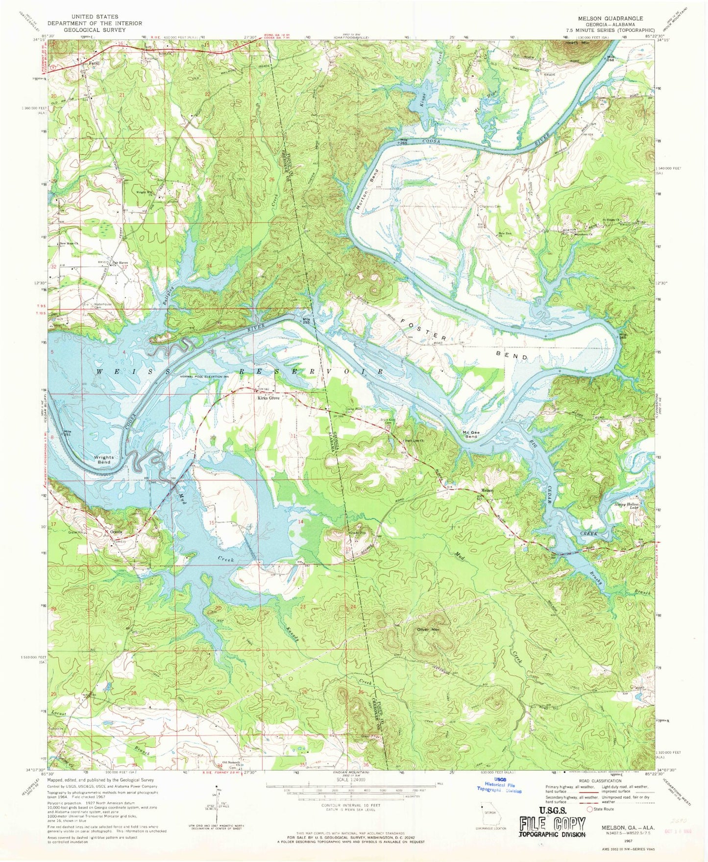
Classic USGS Melson Georgia 7.5'x7.5' Topo Map
Couldn't load pickup availability
Historical USGS topographic quad map of Melson in the states of Georgia, Alabama. Map scale may vary for some years, but is generally around 1:24,000. Print size is approximately 24" x 27"
This quadrangle is in the following counties: Cherokee, Floyd.
The map contains contour lines, roads, rivers, towns, and lakes. Printed on high-quality waterproof paper with UV fade-resistant inks, and shipped rolled.
Contains the following named places: Anniedelle, Ballplay Creek, Big Cedar Creek, Brushy Branch, Clemones Cemetery, Coosa River Cemetery, Davenport Cemetery, Early, Fair Haven Baptist Church, Farill, Farill Baptist Church, Farill Post Office, Foster Bend, Foster Bend School, Grantville, Hardman Cemetery, Kanady Creek, Kings Creek, Kirks Grove, Kirks Landing, Macedonia Cemetery, Macedonia Church, McGee Bend, McGee School, Melson, Melson School, Morton Bend, Morton School, Mount Hope, Mount Hope Creek, Mud Creek, New Hope Church, New Zion Church, Oceola, Old Nazareth Baptist Church, Oliver Mountain, Perkins Ferry, Potash Landing, Saint Peters Church, Salem Church, Salem Church Cemetery, Sleepy Hollow Lake, State Line Cemetery, State Line Church, Waterhouse, Waterhouse Cemetery, Wright Will Church, Wrights Bend