MyTopo
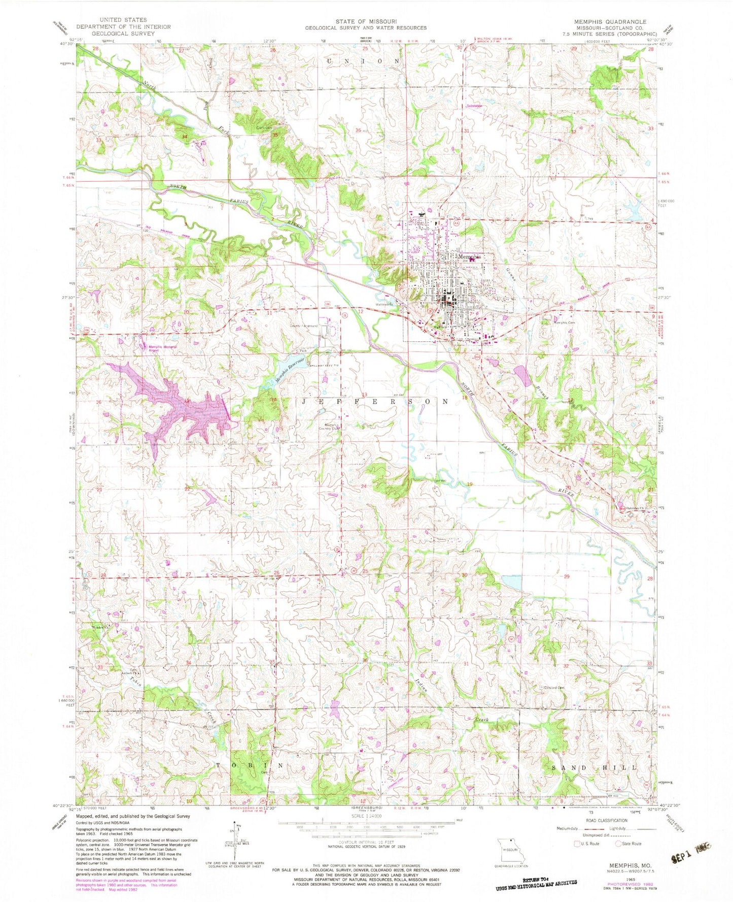
Classic USGS Memphis Missouri 7.5'x7.5' Topo Map
Couldn't load pickup availability
Historical USGS topographic quad map of Memphis in the state of Missouri. Map scale may vary for some years, but is generally around 1:24,000. Print size is approximately 24" x 27"
This quadrangle is in the following counties: Scotland.
The map contains contour lines, roads, rivers, towns, and lakes. Printed on high-quality waterproof paper with UV fade-resistant inks, and shipped rolled.
Contains the following named places: Antioch Cemetery, Antioch Church, City of Memphis, Clark Cemetery, Concord Cemetery, Concord Church, Edinburg School, Hazel Dell School, Jayne School, Kerr Dam, Kerrs Pond, KMEM-FM (Memphis), Memphis, Memphis Cemetery, Memphis Country Club, Memphis Fire Department, Memphis Lake, Memphis Lake and Park Dam, Memphis Memorial Airport, Memphis Police Department, Memphis Post Office, Memphis Reservoir, Memphis Reservoir Dam, Meyers Lake Dam, Miller and Sons Lake Dam, Miller School, Mount Adow Church, Nauvoo, North Fork North Fabius River, North Liberty School, Oak Forest School, Oakridge Church, Pony Creek, Scotland County, Scotland County Hospital, Scotland County Rural Fire Department, Scotland County Sheriff's Office, Township of Jefferson, White School, ZIP Code: 63555