
MyTopo
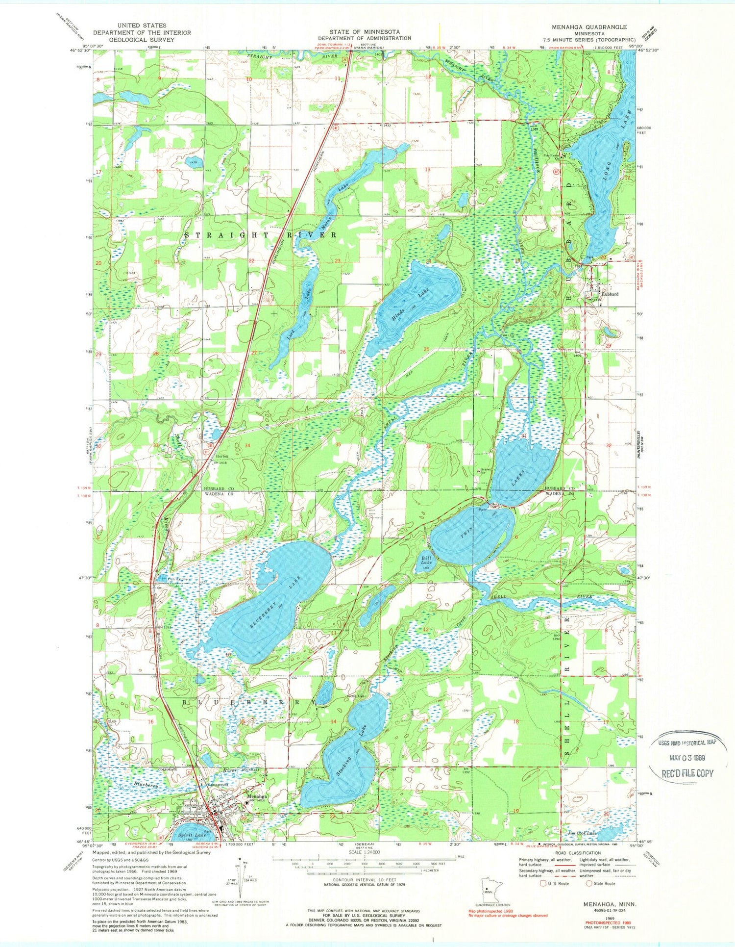
Classic USGS Menahga Minnesota 7.5'x7.5' Topo Map
Couldn't load pickup availability
Historical USGS topographic quad map of Menahga in the state of Minnesota. Map scale may vary for some years, but is generally around 1:24,000. Print size is approximately 24" x 27"
This quadrangle is in the following counties: Hubbard, Wadena.
The map contains contour lines, roads, rivers, towns, and lakes. Printed on high-quality waterproof paper with UV fade-resistant inks, and shipped rolled.
Contains the following named places: Ames Post Office, Bethany Lutheran Church, Bill Lake, Blueberry Lake, Blueberry River, Fair Havens Golf Course, Falk Private Airport, Fishhook River, Hinds Lake, Horton, Hubbard, Hubbard Census Designated Place, Hubbard Post Office, Latona Post Office, Long Lake, Long Lake Dam, Lord Lake, Menahga, Menahga Apostolic Lutheran Church, Menahga Fire Department, Menahga Police Department, Menahga Post Office, Moran Lake, Pine Haven Church, Stocking Creek, Stocking Lake, Straight River, Township of Blueberry, Township of Straight River, Twin Lakes, ZIP Code: 56464


