MyTopo
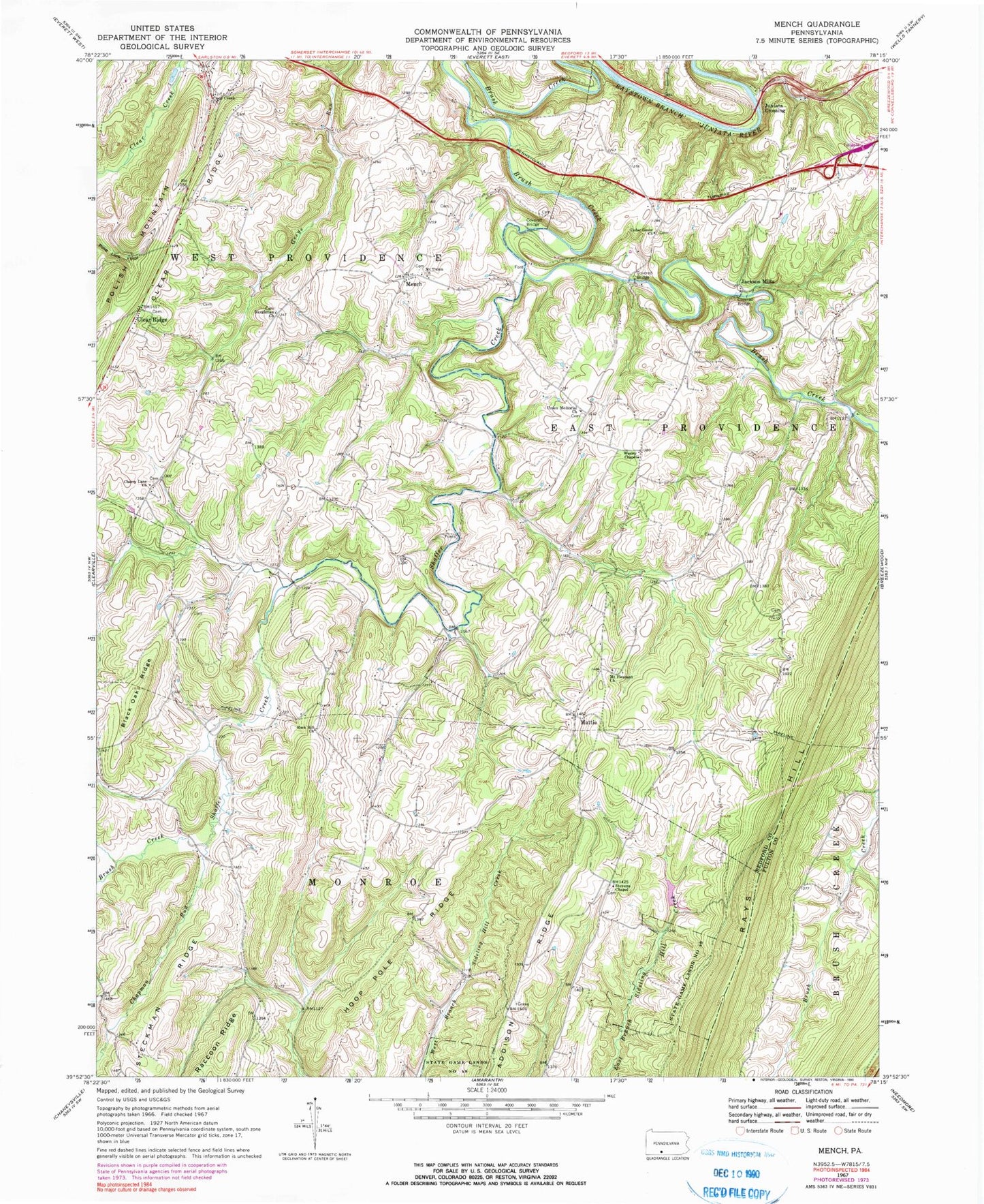
Classic USGS Mench Pennsylvania 7.5'x7.5' Topo Map
Couldn't load pickup availability
Historical USGS topographic quad map of Mench in the state of Pennsylvania. Map scale may vary for some years, but is generally around 1:24,000. Print size is approximately 24" x 27"
This quadrangle is in the following counties: Bedford, Fulton.
The map contains contour lines, roads, rivers, towns, and lakes. Printed on high-quality waterproof paper with UV fade-resistant inks, and shipped rolled.
Contains the following named places: Baughman Church, Baughman Union Cemetery, Blackhart Farm Cemetery, Brush Creek, Buchanan School, Calhoun Farm Cemetery, Calhoun School, Cedar Grove Cemetery, Cedar Grove Church, Chapman Run, Cherry Lane Brethren Cemetery, Cherry Lane Church, Clark School, Clear Creek Church, Clear Ridge, Cooper Farm Cemetery, Dibert Farm Cemetery, Emerson, Felten's Covered Bridge, Jackson Mills, Jackson's Mill Covered Bridge, James O'Neal Cemetery, Juniata Crossing, Kagarise - Burger Farm Cemetery, Mattie, Mench, Mount Pleasant Cemetery, Mount Pleasant Church, Mount Union Christian Church Cemetery, Mount Union Church, Oak Grove School, Rays Hill, Rock Hill Church, Rockhill Cemetery, Shaffer Creek, Sparks Family Cemetery, Stevens Chapel, Stevens Methodist Chapel Church Cemetery, Township of West Providence, Union Memorial Cemetery, Union Memorial Church, Weimer Run, Wesley Chapel, Wildcat Hollow, Woodbush School