
MyTopo
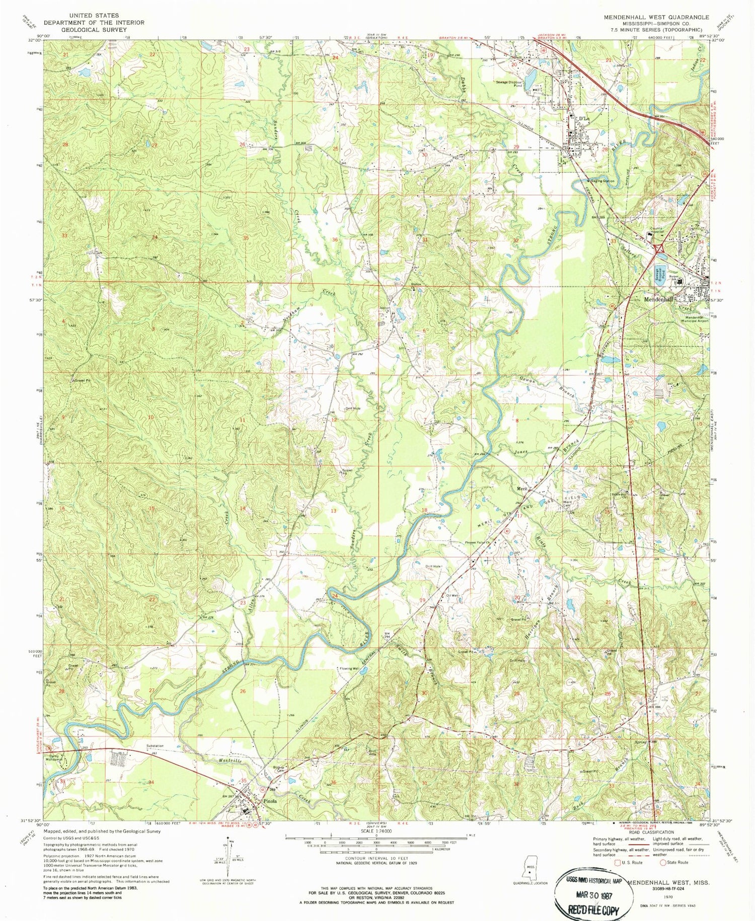
Classic USGS Mendenhall West Mississippi 7.5'x7.5' Topo Map
Couldn't load pickup availability
Historical USGS topographic quad map of Mendenhall West in the state of Mississippi. Map scale may vary for some years, but is generally around 1:24,000. Print size is approximately 24" x 27"
This quadrangle is in the following counties: Simpson.
The map contains contour lines, roads, rivers, towns, and lakes. Printed on high-quality waterproof paper with UV fade-resistant inks, and shipped rolled.
Contains the following named places: Adams Egg Farm Lagoon Dam, Allen Creek, Bishop Cemetery, Boggan Branch, Boggan School, Cable Bridge, Camp Mondamin, Dabbs Creek, D'Lo, D'Lo Cemetery, D'Lo Post Office, Fellowship Church, Gowan Branch, Gullage Lake Dam, Harper School, Harrigan Branch, Indian Creek, Jones Branch, Jupiter Church, Mendenhall Bible Church, Merit, Merit Cemetery, Merit Oil and Gas Field, Mississippi No Name 35 Dam, Nazareth Baptist Church, Needham Creek, Pinola, Pinola Attendance Center, Pinola Post Office, Pinola Volunteer Fire Department Station 1, Pleasant Valley Church, Rials Creek, Riverside Chapel, Sanders Creek, Scotts Bridge, Sellers Creek, Shallow Church, Simpson County, Simpson General Hospital, Smith Branch, Tanyard Creek, Town of D'Lo, Westville Creek, ZIP Code: 39062


