MyTopo
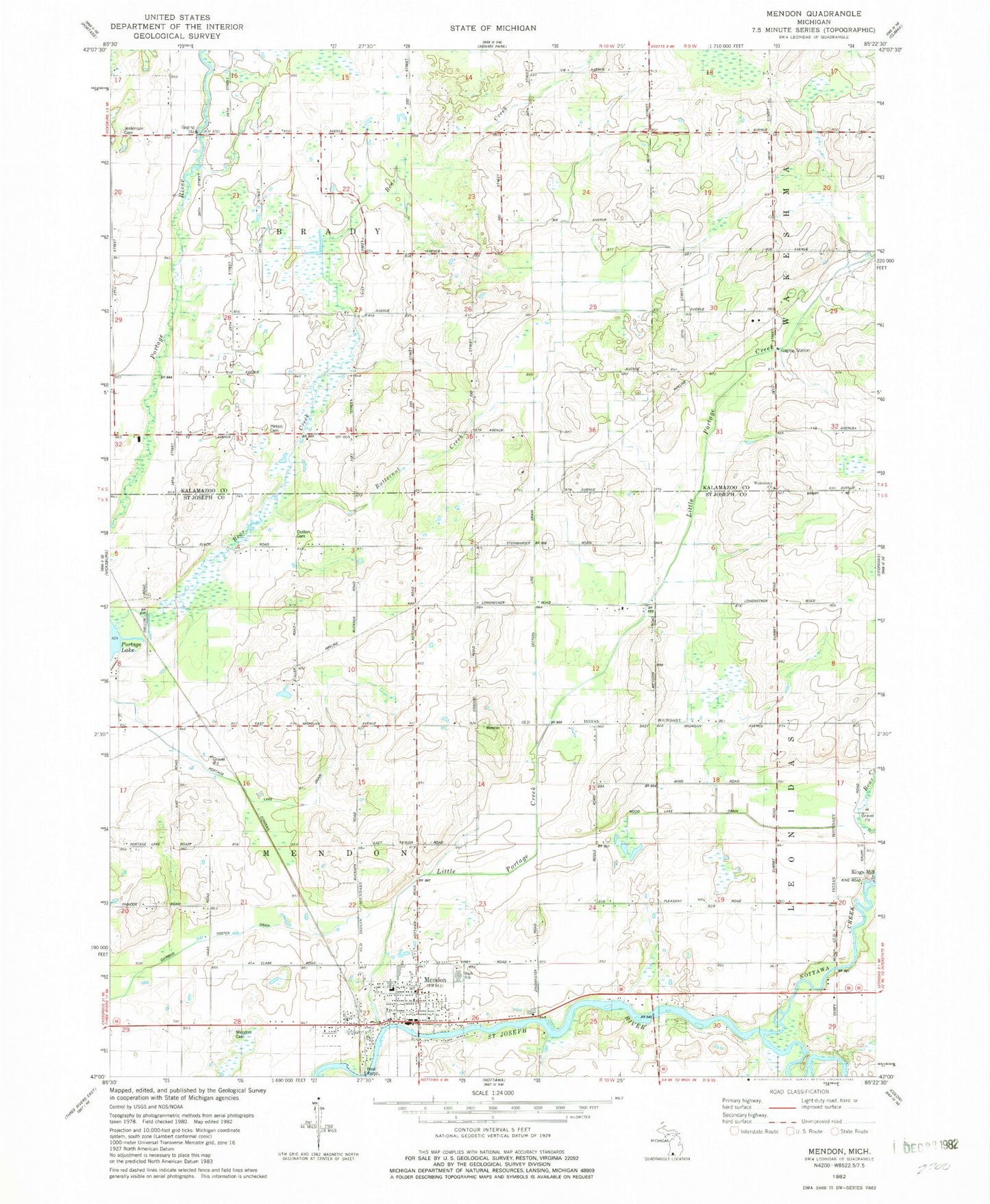
Classic USGS Mendon Michigan 7.5'x7.5' Topo Map
Couldn't load pickup availability
Historical USGS topographic quad map of Mendon in the state of Michigan. Map scale may vary for some years, but is generally around 1:24,000. Print size is approximately 24" x 27"
This quadrangle is in the following counties: Kalamazoo, St. Joseph.
The map contains contour lines, roads, rivers, towns, and lakes. Printed on high-quality waterproof paper with UV fade-resistant inks, and shipped rolled.
Contains the following named places: Bear Creek, Beard Cemetery, Brady School, Brown School, Butternut Creek, Dinger School, Dutton Cemetery, Freedom Baptist Church, Garman Foster Drain, Hall School, Hassic Cemetery, Holcomb School, Jenkinson Cemetery, Jenkinson School, Kings Mill, Life Care Ambulance Service, Little Portage Creek, Maple Grove School, Mendon, Mendon Cemetery, Mendon Community High School, Mendon Elementary School, Mendon Fire Department, Mendon Police Department, Mendon Post Office, Mendon Station, Mendon Township Hall, Mendon Township Library, Mendon United Methodist Church, Nottawa Creek, Oak Shores Resort Campground, Olney Bridge Park, Portage Lake Drain, Rawson's King Mill Park, Reserve School, Saint Edwards Catholic Church, Saint Edward's Catholic Church Cemetery, Saint Patrick Parish, Sprung Cemetery, Township of Brady, Township of Mendon, Village of Mendon, Wakeshma Church, ZIP Codes: 49072, 49097