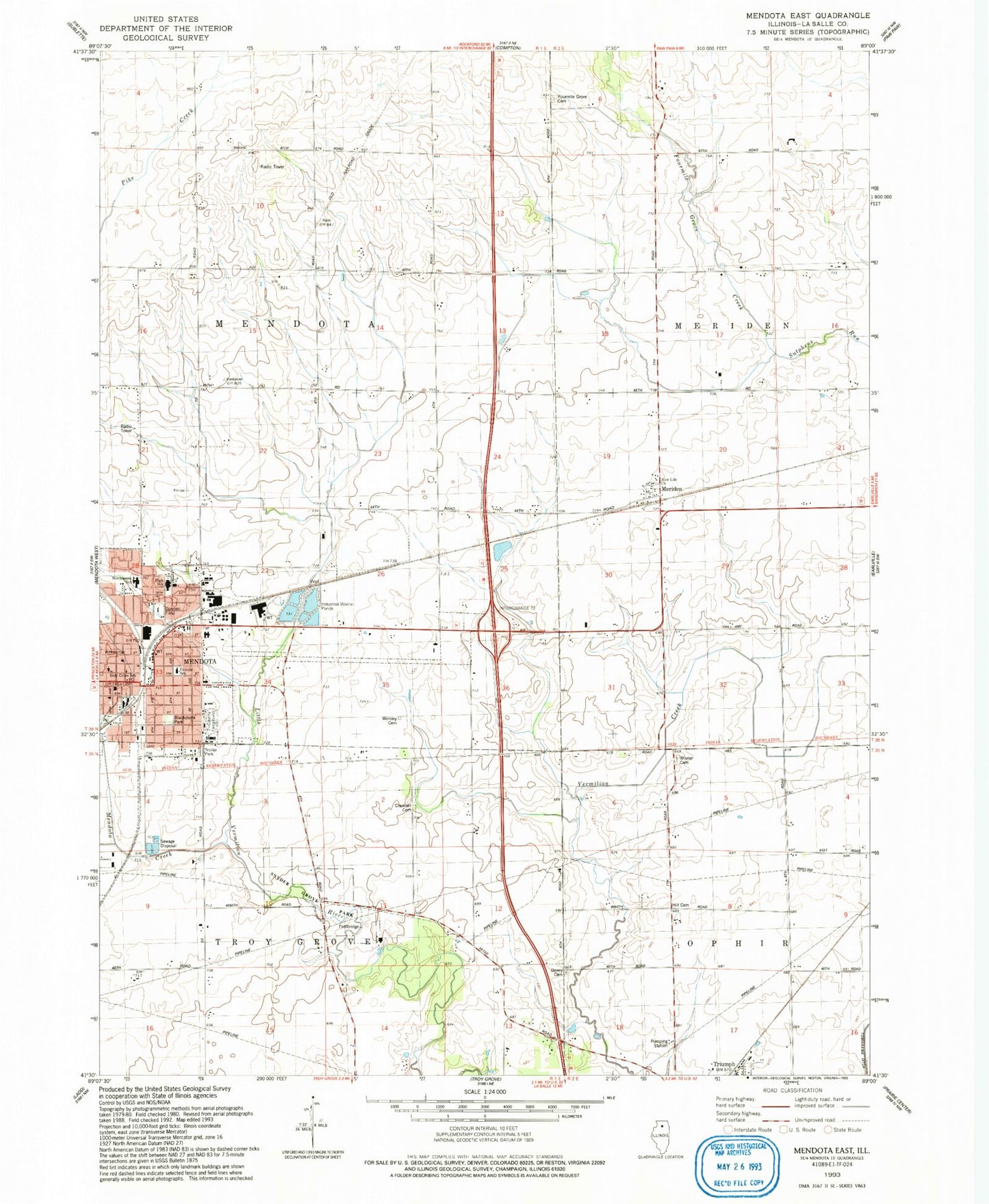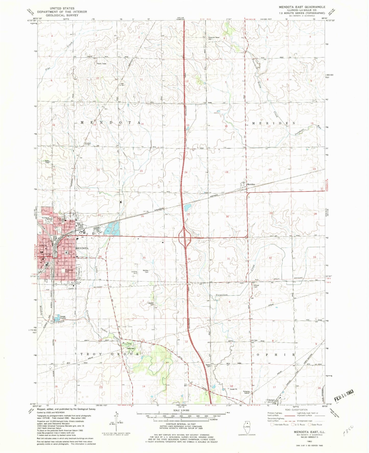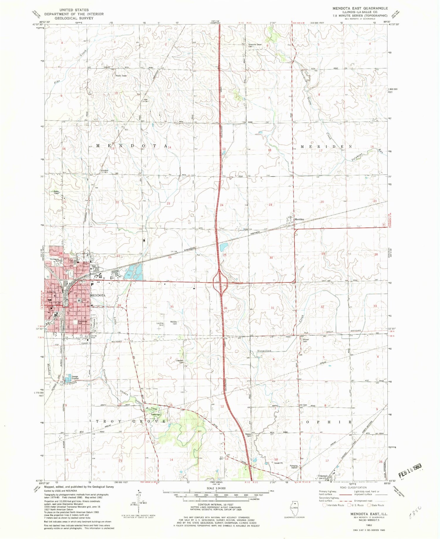
MyTopo
Classic USGS Mendota East Illinois 7.5'x7.5' Topo Map
Couldn't load pickup availability
Historical USGS topographic quad map of Mendota East in the state of Illinois. Map scale may vary for some years, but is generally around 1:24,000. Print size is approximately 24" x 27"
This quadrangle is in the following counties: LaSalle.
The map contains contour lines, roads, rivers, towns, and lakes. Printed on high-quality waterproof paper with UV fade-resistant inks, and shipped rolled.
Contains the following named places: Advent Christian Church, Apple Orchard Park, Blackstone Park, City of Mendota, Crandall Cemetery, Dewey Cemetery, Doeneir Field, Faith Fellowship Church, First Baptist Church, First United Methodist Church, First United Presbyterian Church, Four Mile Grove Cemetery, Fourmile Grove Creek, Gorman School, Graves Public Library, Heritage Manor Nursing Home, Hill Cemetery, Holy Cross Catholic Church, Holy Cross School, Lincoln Elementary School, Mendota, Mendota Creek, Mendota Fire Department Station 1, Mendota Fire Department Station 2, Mendota Police Department, Mendota Post Office, Mendota Swimming Pool, Mendota Township High School, Meriden, New Life Church, Northbrook Middle School, Northbrook Missionary Baptist Church, OSF HealthCare Saint Paul Medical Center, Saint Johns Lutheran Church, Schlesinger School, Snyder Grove Park, Township of Mendota, Tri-County Fairground, WGLC-FM (Mendota), Wisner Cemetery, Worsley Cemetery, Zion United Methodist Church, ZIP Code: 61342