MyTopo
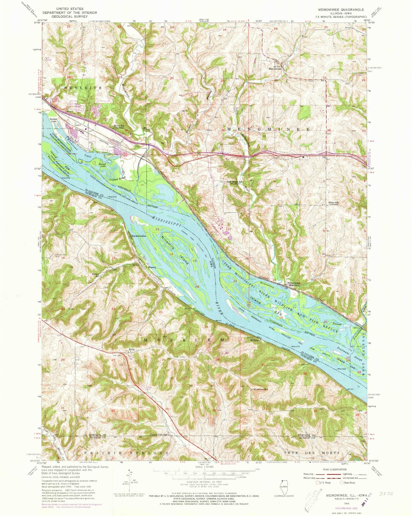
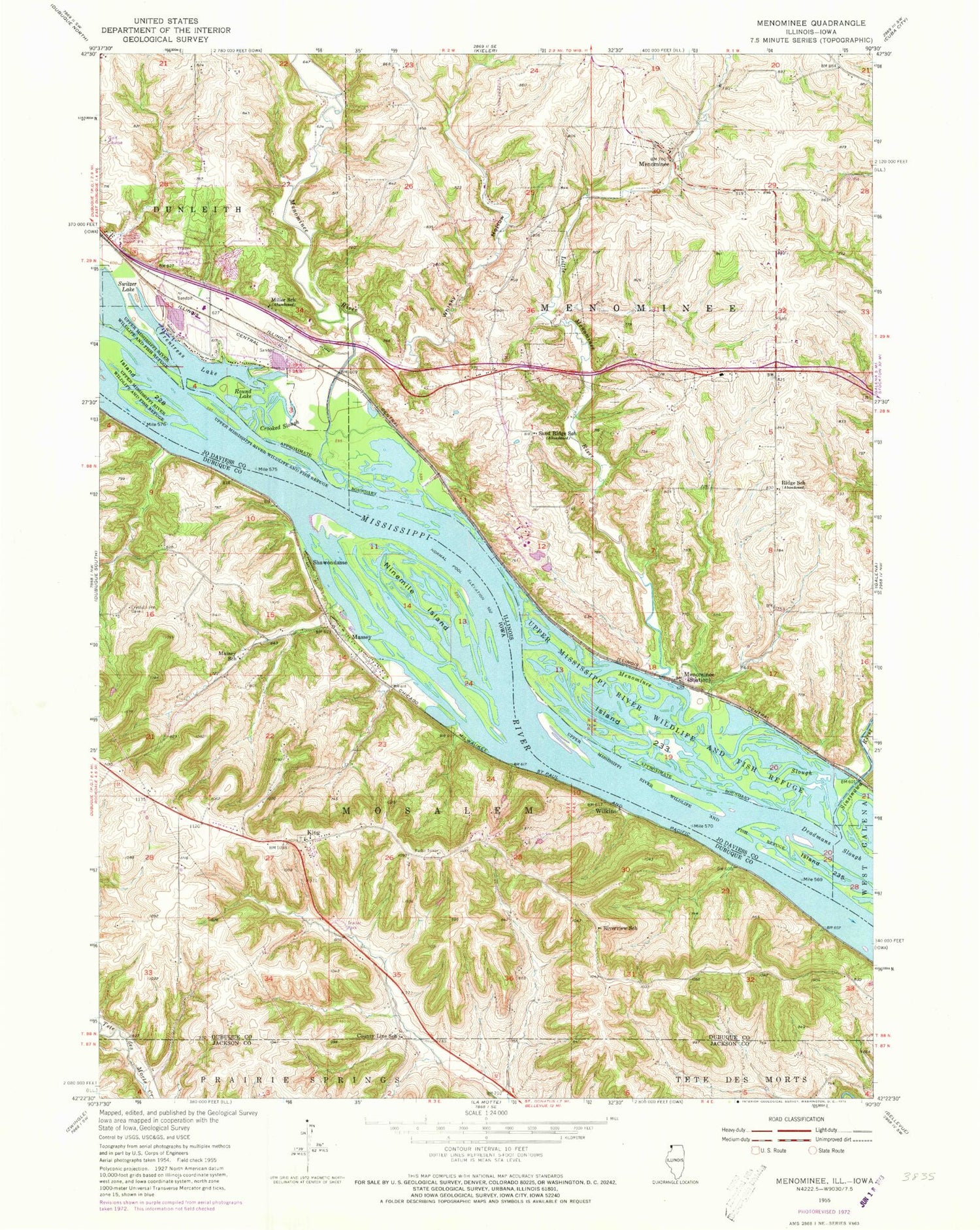
Classic USGS Menominee Illinois 7.5'x7.5' Topo Map
Couldn't load pickup availability
Historical USGS topographic quad map of Menominee in the states of Illinois, Iowa. Map scale may vary for some years, but is generally around 1:24,000. Print size is approximately 24" x 27"
This quadrangle is in the following counties: Dubuque, Jackson, Jo Daviess.
The map contains contour lines, roads, rivers, towns, and lakes. Printed on high-quality waterproof paper with UV fade-resistant inks, and shipped rolled.
Contains the following named places: Berning Acres, Briggs Brothers Airfield, County Line School, Crooked Slough, Frentress Lake, Frentress Lake Marine Center, Frentress Lake Slough, Green Cemetery, Green Lake, Hires Lake, Island 228, Island 233, Island 235, King, King Post Office, Little Menominee River, Massey, Massey Marina Campgrounds, Massey Marina Park, Massey School, Menominee, Menominee - Dunleith Fire Department Station 1, Menominee - Dunleith Fire Department Station 3, Menominee River, Menominee Slough, Miller School, Molo Slough, Nativity Blessed Virgin Mary Catholic Church, Ninemile Island, Preston Cemetery, Ridge School, Riverview School, Round Lake, Saint Catherine Cemetery, Sand Ridge School, Shawon Dasse Slough, Shawondasse, Sinsinawa River, Stone Lake, Switzer Lake, Tippy Lake, Township of Dunleith, Township of Menominee, Township of Mosalem, Village of Menominee, Whisky Hollow, Wilkins, ZIP Code: 61025