MyTopo
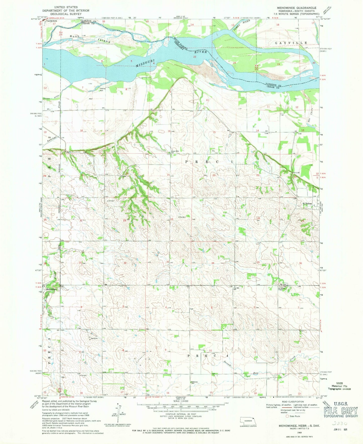
Classic USGS Menominee Nebraska 7.5'x7.5' Topo Map
Regular price
$16.95
Regular price
Sale price
$16.95
Unit price
per
Couldn't load pickup availability
Historical USGS topographic quad map of Menominee in the states of Nebraska, South Dakota. Map scale may vary for some years, but is generally around 1:24,000. Print size is approximately 24" x 27"
This quadrangle is in the following counties: Cedar, Yankton.
The map contains contour lines, roads, rivers, towns, and lakes. Printed on high-quality waterproof paper with UV fade-resistant inks, and shipped rolled.
Contains the following named places: Antelope Creek, Election Precinct 1, James River, Joy Hill School, Menominee, Menominee Post Office, Precinct One, Rush Island, Saint Helena Chapel, Schremp School, Sunny Side School, ZIP Code: 68774