MyTopo
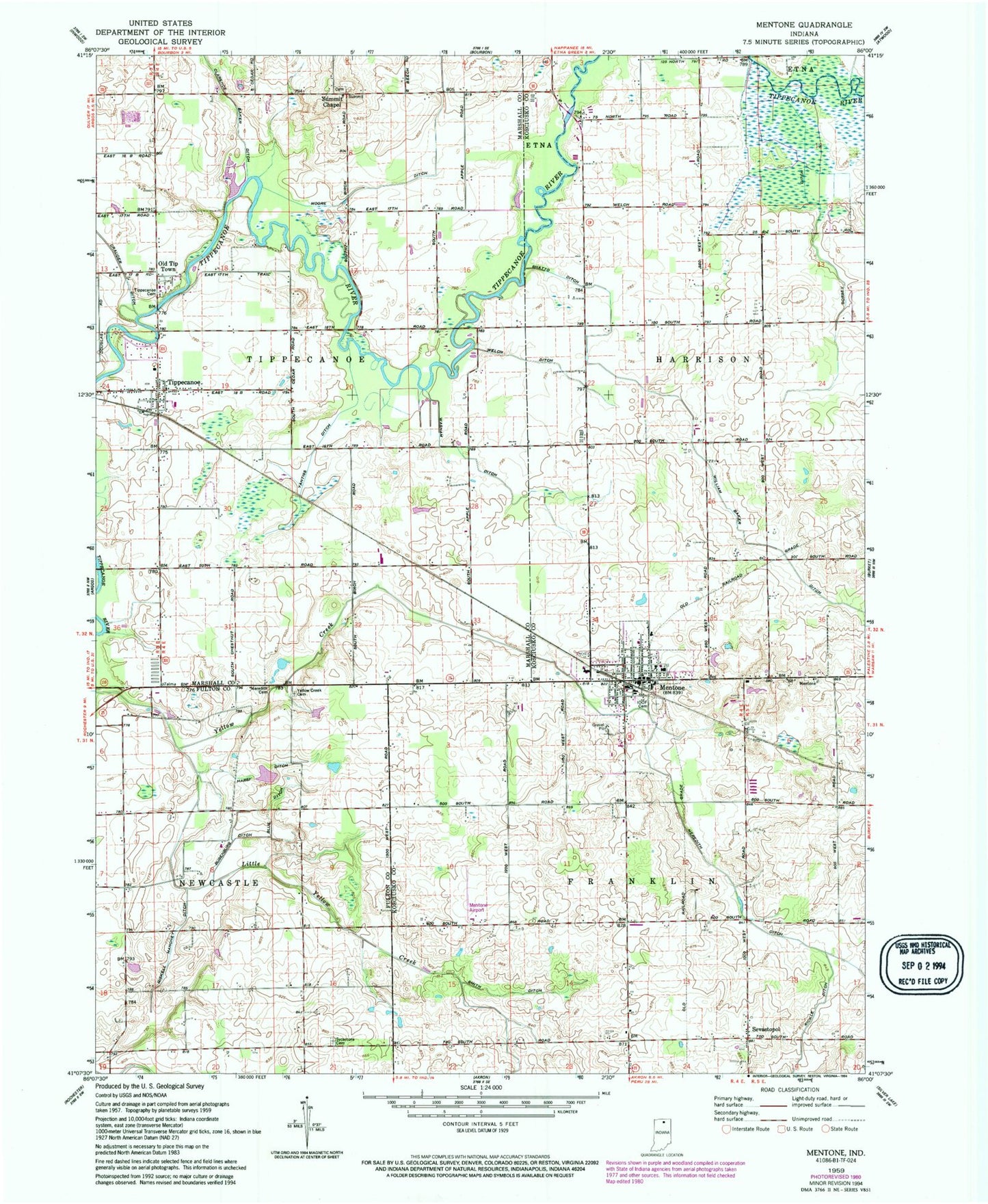
Classic USGS Mentone Indiana 7.5'x7.5' Topo Map
Couldn't load pickup availability
Historical USGS topographic quad map of Mentone in the state of Indiana. Map scale may vary for some years, but is generally around 1:24,000. Print size is approximately 24" x 27"
This quadrangle is in the following counties: Fulton, Kosciusko, Marshall.
The map contains contour lines, roads, rivers, towns, and lakes. Printed on high-quality waterproof paper with UV fade-resistant inks, and shipped rolled.
Contains the following named places: Apple Farms, Blue Ditch, Busenburg Ditch, Clarence Baker Ditch, Crauder Ditch, Dorsey Ditch, East Farms, Feldman Farms, Four Way Ambulance Emergency Medical Service, Harsh Ditch, Little Yellow Creek, Mentone, Mentone Airport, Mentone Cemetery, Mentone Elementary School, Mentone Post Office, Mentone Town Police Department, Mentone Volunteer Fire Department, Meredith Cemetery, Meredith Ditch, Miskell Mahoney Ditch, Moore Ditch, Old Tip Town, Sevastopol, Shatto Ditch, Smith Ditch, Summit Chapel, Sycamore Memorial Park, Tippecanoe, Tippecanoe Cemetery, Tippecanoe Fire Department, Tippecanoe Post Office, Tippecanoe Township Emergency Medical Services First Responders, Town of Mentone, Township of Tippecanoe, Tucker Ditch, Washam Ditch, Welch Ditch, White Ditch, William Baker Ditch, Yantiss Ditch, Yellow Creek Cemetery, ZIP Codes: 46539, 46570