MyTopo
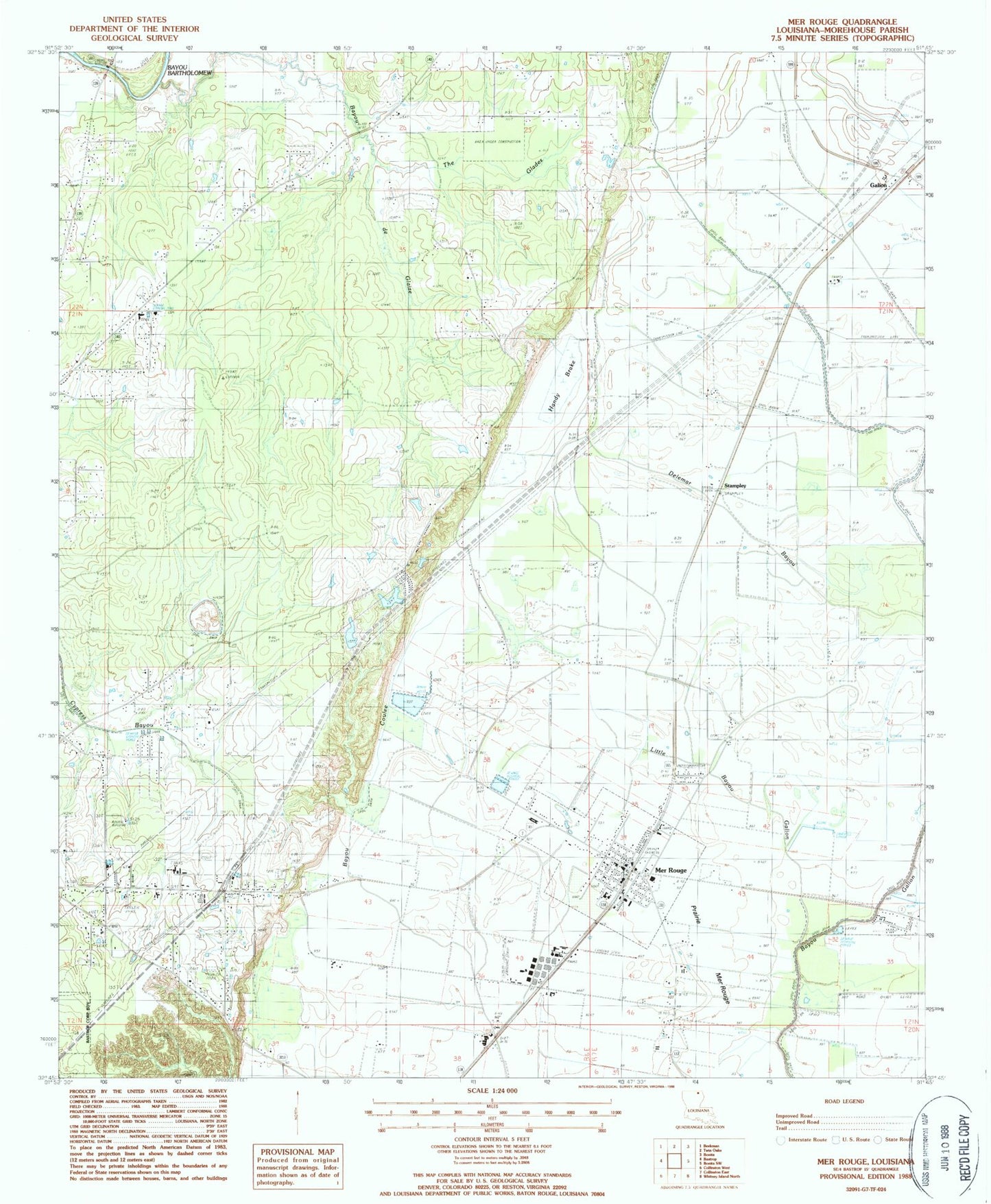
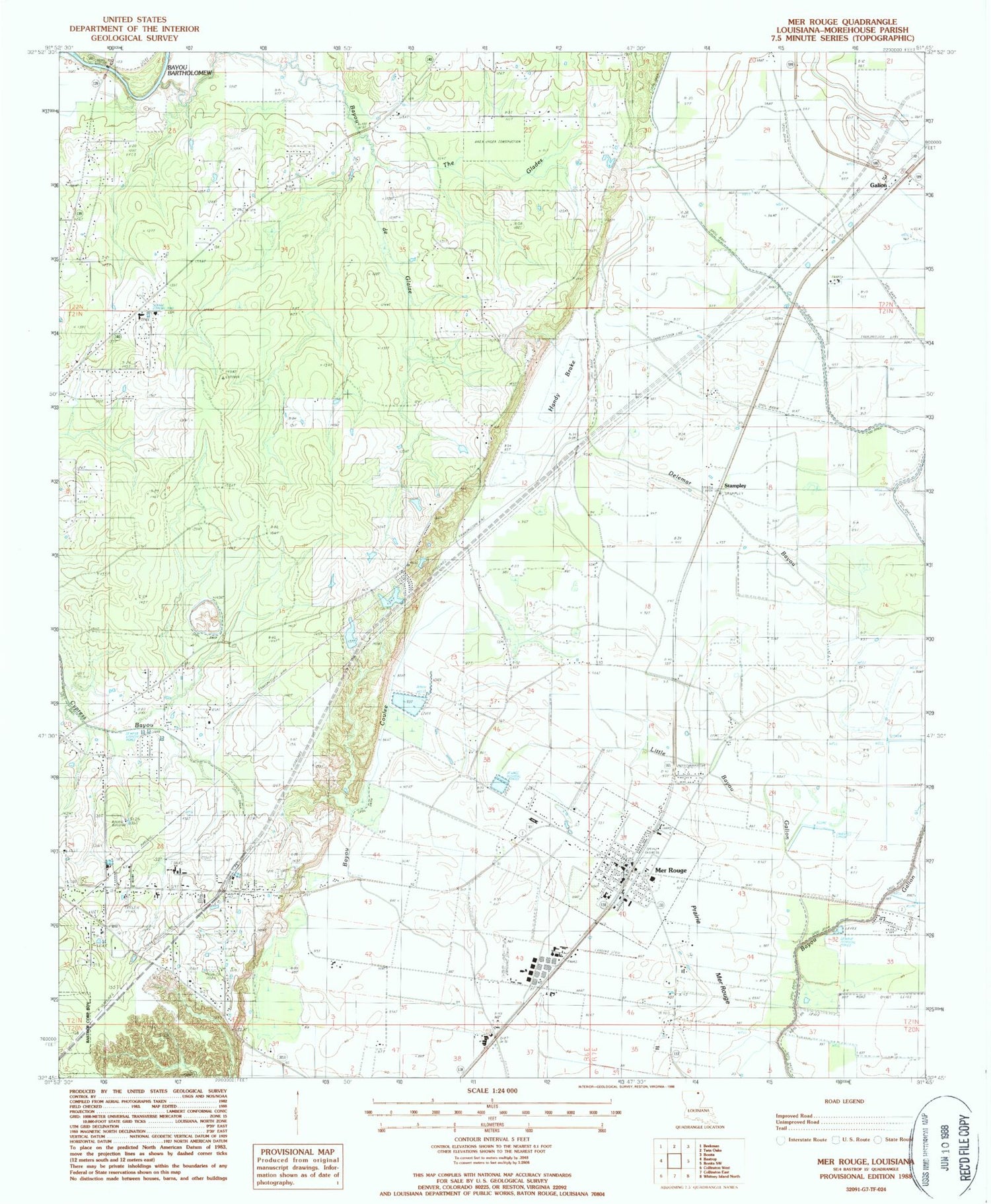
Classic USGS Mer Rouge Louisiana 7.5'x7.5' Topo Map
Couldn't load pickup availability
Historical USGS topographic quad map of Mer Rouge in the state of Louisiana. Map scale may vary for some years, but is generally around 1:24,000. Print size is approximately 24" x 27"
This quadrangle is in the following counties: Morehouse.
The map contains contour lines, roads, rivers, towns, and lakes. Printed on high-quality waterproof paper with UV fade-resistant inks, and shipped rolled.
Contains the following named places: Arkla Flyers Inc Airport, Bastrop, Bastrop Fire Department Station 4, Bayou de Glaize, Cooper Lake, Cooper Lake Cemetery, Delta Elementary School, Dunmore Cemetery, Galion, Handy Brake, Handy Brake National Wildlife Refuge, Hillview Church, Jelks Bayou, Little Bayou Galion, Mer Rouge, Mer Rouge Cemetery, Mer Rouge Elementary School, Mer Rouge Police Department, Mer Rouge Post Office, Mer Rouge Volunteer Fire Department, Morehouse Parish, Moses Temple, New Baptist Church, Parish Governing Authority District 3, Pine Grove Elementary School, Prairie Mer Rouge, Saint Matthew Church Number 2, Saint Matthew School, Stampley, The Glades, Village of Mer Rouge, Ward Six, Wards Ferry, Washington Chapel