MyTopo
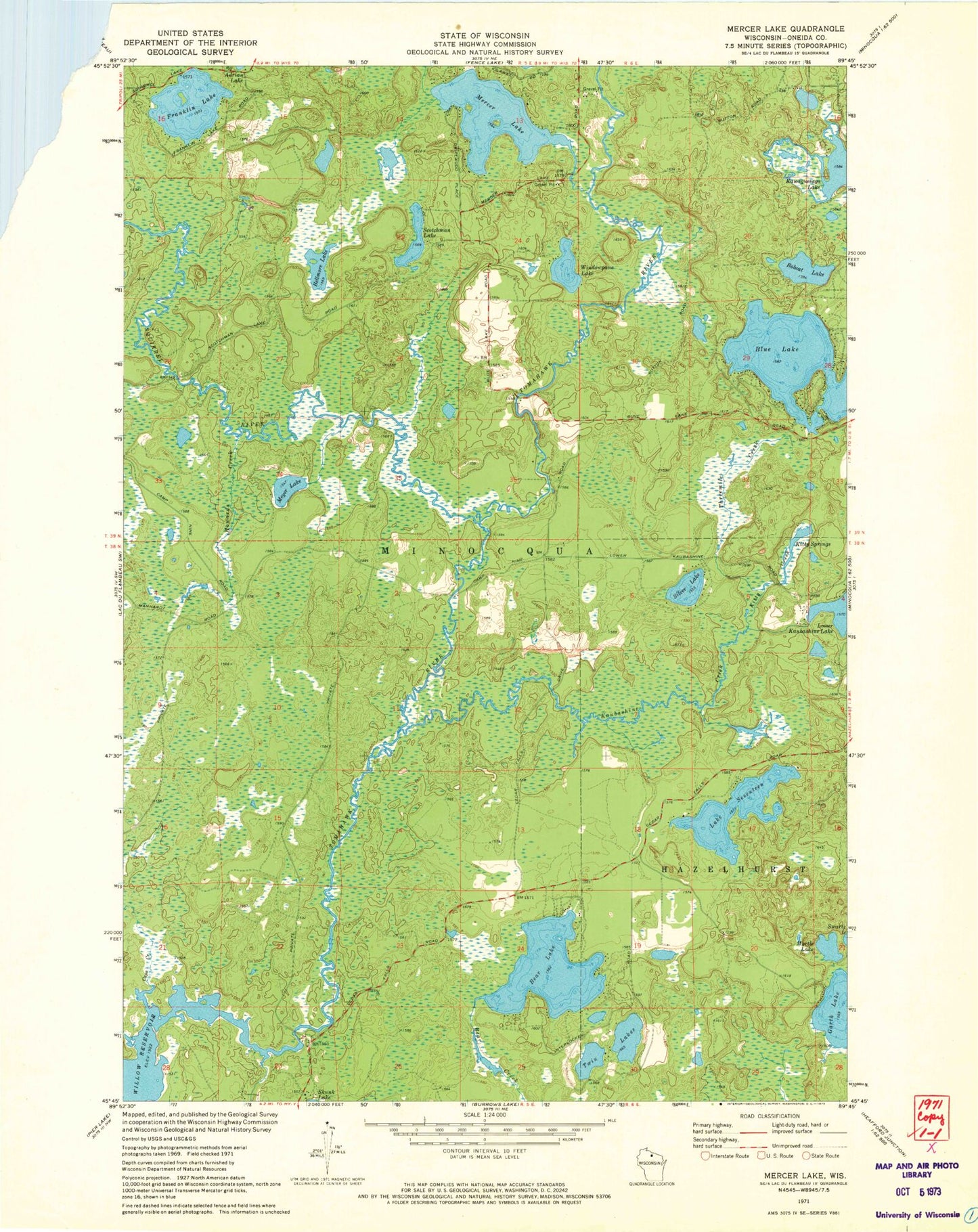
Classic USGS Mercer Lake Wisconsin 7.5'x7.5' Topo Map
Couldn't load pickup availability
Historical USGS topographic quad map of Mercer Lake in the state of Wisconsin. Map scale may vary for some years, but is generally around 1:24,000. Print size is approximately 24" x 27"
This quadrangle is in the following counties: Oneida.
The map contains contour lines, roads, rivers, towns, and lakes. Printed on high-quality waterproof paper with UV fade-resistant inks, and shipped rolled.
Contains the following named places: Bear Lake, Bellmore Lake, Blue Lake, Bobcat Lake, Caps Creek, Franklin Lake, Garth Lake, Howards Creek, Kaubashine Creek, Kitty Creek, Kitty Springs, Lake Seventeen, Mercer Lake, Meyer Lake, Myrtle Lake, Scotchman Lake, Silver Lake, Squirrel River, Squirrel River Pines State Natural Area, Threemile Creek, Tomahawk River Pines State Natural Area, Twin Lakes, Windowpane Lake, ZIP Codes: 54531, 54548