MyTopo
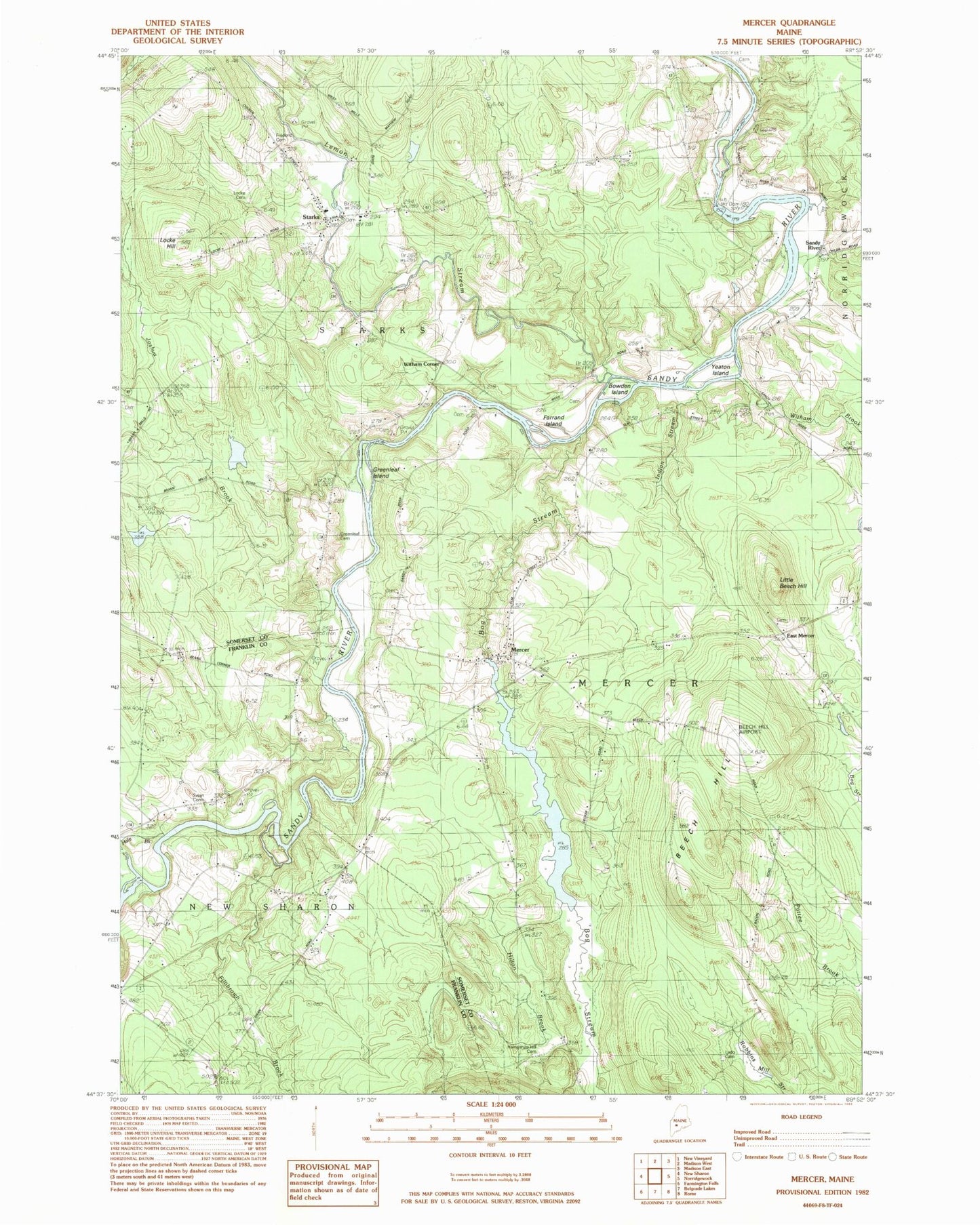
Classic USGS Mercer Maine 7.5'x7.5' Topo Map
Couldn't load pickup availability
Historical USGS topographic quad map of Mercer in the state of Maine. Typical map scale is 1:24,000, but may vary for certain years, if available. Print size: 24" x 27"
This quadrangle is in the following counties: Franklin, Somerset.
The map contains contour lines, roads, rivers, towns, and lakes. Printed on high-quality waterproof paper with UV fade-resistant inks, and shipped rolled.
Contains the following named places: Beech Hill, Bog Stream, Bowden Island, East Mercer, Farrand Island, Fillibrown Brook, Frederic Cemetery, Greenleaf Cemetery, Hale Brook, Hampshire Hill Cemetery, Hilton Brook, Indian Stream, Josiah Brook, Ladd - Mercer Cemetery, Lemon Stream, Little Beech Hill, Locke Cemetery, Mercer, Starks, Swan Cemetery, Wiley School, Witham Brook, Sandy River, Witham Corner, Beech Hill Airport, Town of Mercer, Town of Starks, Sandy River Dam (historical), Sandy River Reservoir, Mercer Bog Dam, Mercer Bog, Starks Elementary School (historical), Yeaton Island, Starks Volunteer Fire Department, Elliot - Young Cemetery, Dickinson Cemetery, Mercer Village Cemetery, Mercer Elementary School, Shaw Public Library