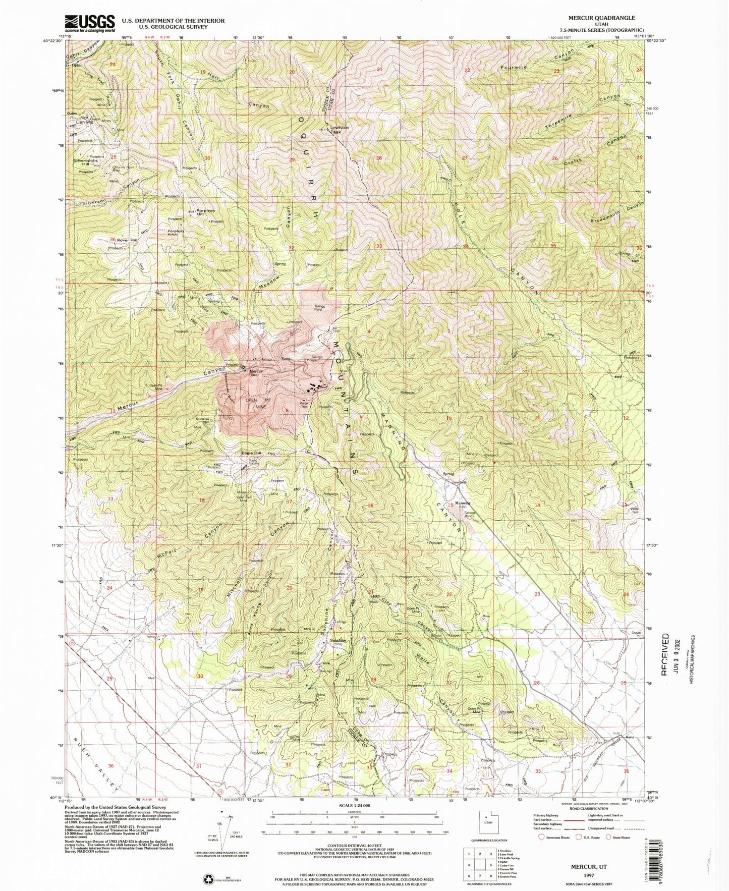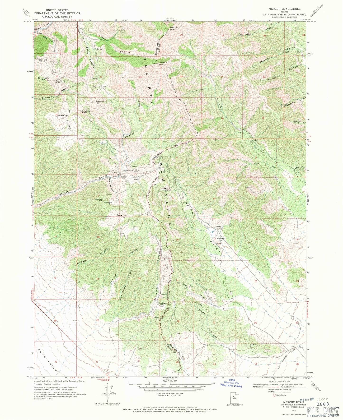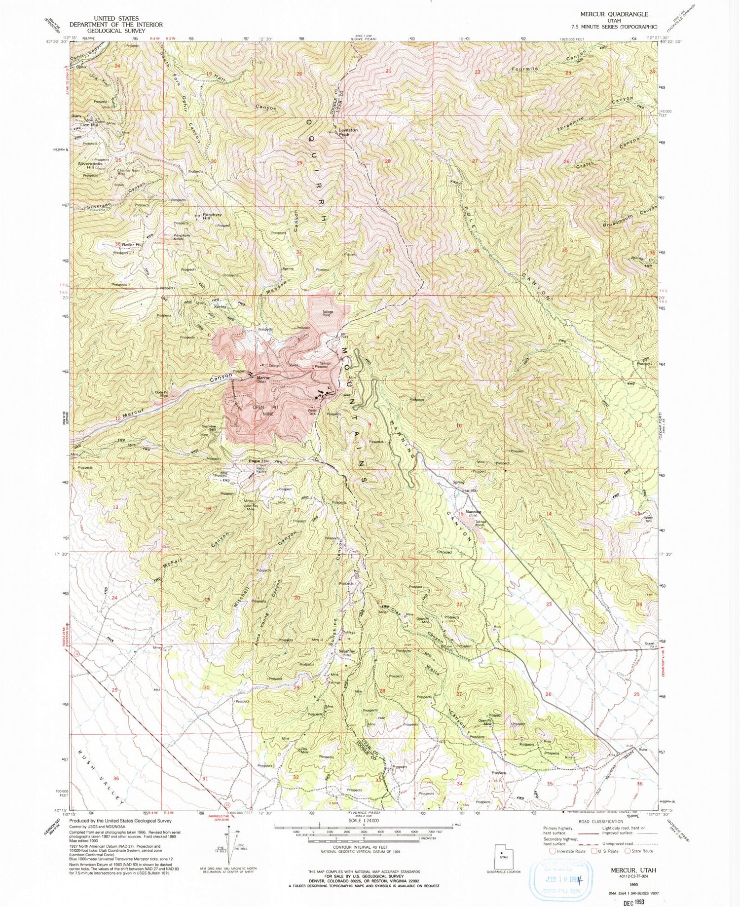
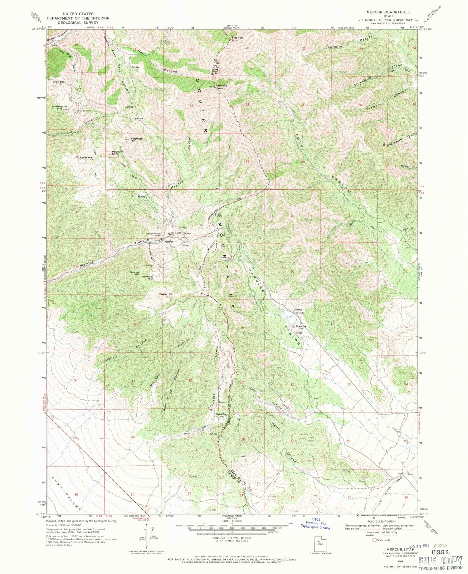
MyTopo
Classic USGS Mercur Utah 7.5'x7.5' Topo Map
Couldn't load pickup availability
Historical USGS topographic quad map of Mercur in the state of Utah. Map scale may vary for some years, but is generally around 1:24,000. Print size is approximately 24" x 27"
This quadrangle is in the following counties: Tooele, Utah.
The map contains contour lines, roads, rivers, towns, and lakes. Printed on high-quality waterproof paper with UV fade-resistant inks, and shipped rolled.
Contains the following named places: Alma Young Canyon, Chloride Point Mine, Clay Canyon, Clay Mine, Eagle Hill, Fairfield Station, Flat Top Mountain, Geyser-Marion Mine, Golden Gate Mine, Hall Canyon, Lewiston Peak, Lion Hill, Long Trail Gulch, Manning, Manning Canyon, McFait Canyon, Meadow Canyon, Mercur, Mitchell Canyon, Ophir Census Designated Place, Pole Canyon, Porphyry Hill, Porphyry Knob, Rover Hill, Sacramento Gulch, Sacramento Mine, Silveropolis Hill, Sunrise Hill, Sunshine, Sunshine Canyon, Violet Ray Mine, Wells Canyon