MyTopo
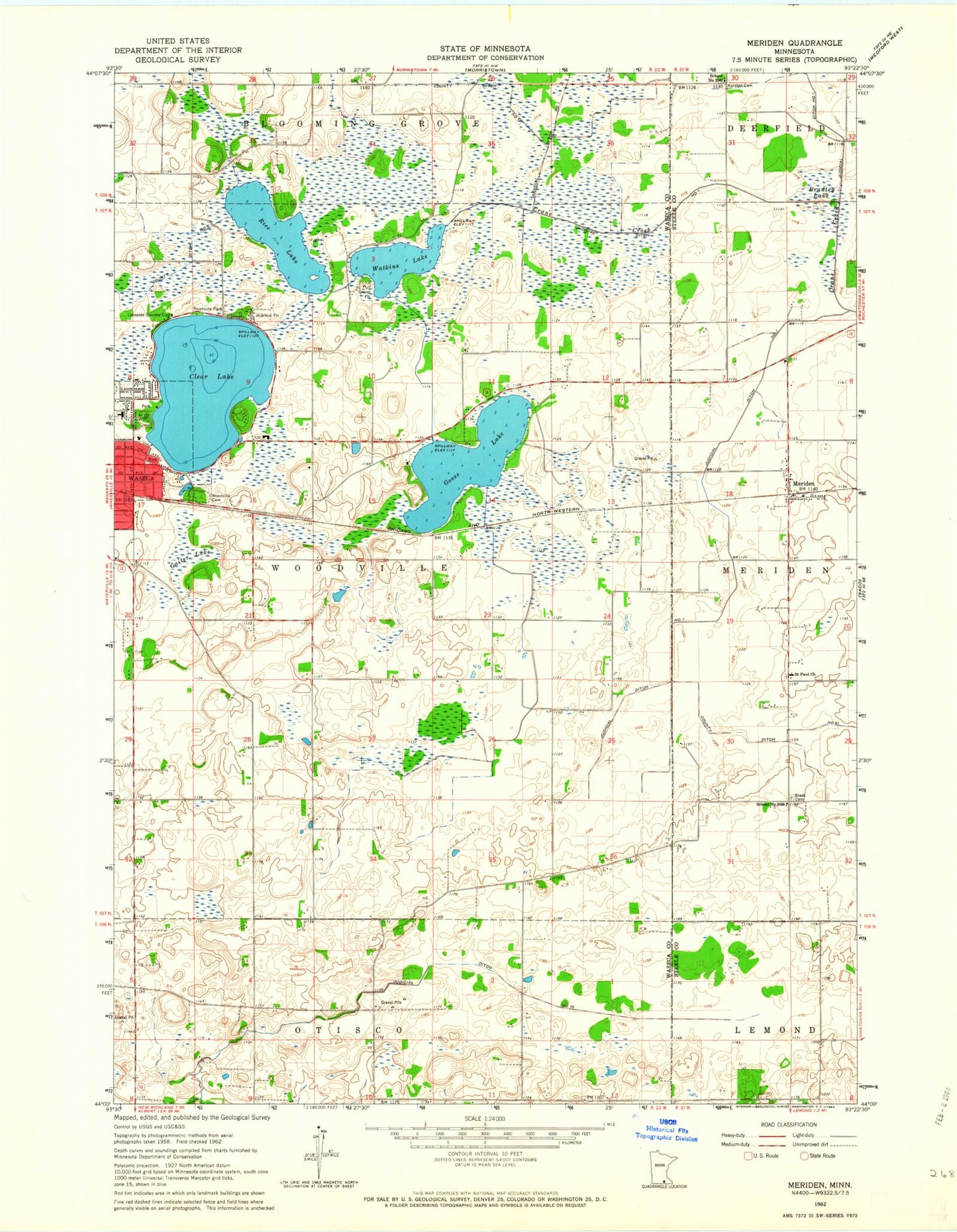
Classic USGS Meriden Minnesota 7.5'x7.5' Topo Map
Couldn't load pickup availability
Historical USGS topographic quad map of Meriden in the state of Minnesota. Map scale may vary for some years, but is generally around 1:24,000. Print size is approximately 24" x 27"
This quadrangle is in the following counties: Steele, Waseca.
The map contains contour lines, roads, rivers, towns, and lakes. Printed on high-quality waterproof paper with UV fade-resistant inks, and shipped rolled.
Contains the following named places: Bradley Lake, Brase Cemetery, Clear Lake, Clear Lake Park, County Ditch Number Eleven, County Ditch Number Nine, Emerson Park, Faith United Methodist Church, Findley State Wildlife Management Area, Gaiter Lake, Goose Lake, Grace Baptist Church, Hartley Elementary School, Judicial Ditch Number Ten, Karsten Cemetery, Kieslers Campground, KOWO-AM (Waseca), KOWO-FM (Waseca), Lakeside Country Club, Maplewood Park, Memorial Park, Meriden, Meriden Post Office, Moonan State Wildlife Management Area, Oak Park, Rice Lake, Saint Paul Church, Saint Paul's Lutheran Cemetery, School Number 2098, School Number 2142, Southview Park, Sportsmans Park, Township of Woodville, Waseca County Waterfowl Production Area, Waseca State Wildlife Management Area, Watkins Lake, Watkins Lake Dam, Woodville Cemetery