MyTopo
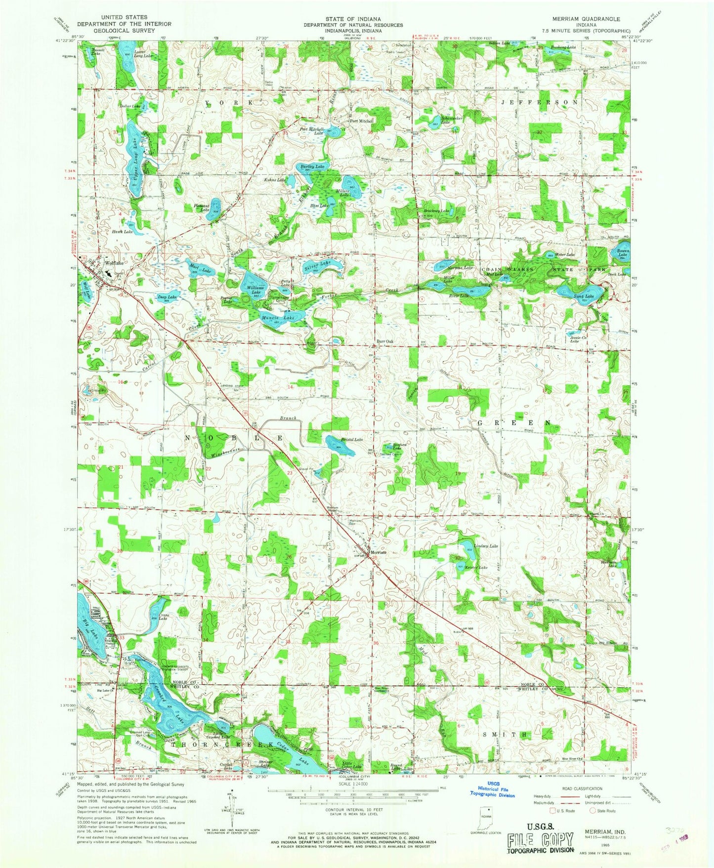
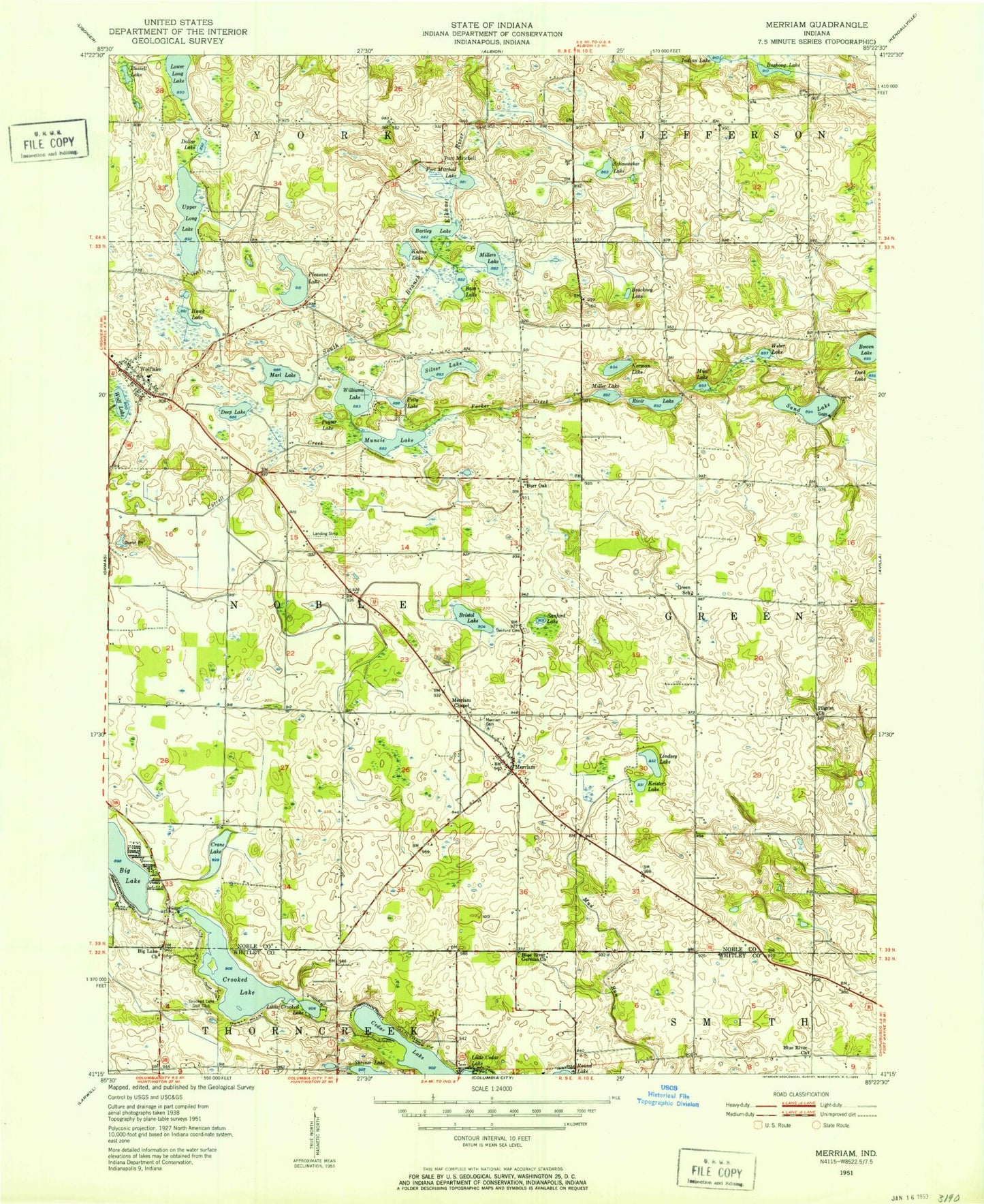
Classic USGS Merriam Indiana 7.5'x7.5' Topo Map
Couldn't load pickup availability
Historical USGS topographic quad map of Merriam in the state of Indiana. Typical map scale is 1:24,000, but may vary for certain years, if available. Print size: 24" x 27"
This quadrangle is in the following counties: Noble, Whitley.
The map contains contour lines, roads, rivers, towns, and lakes. Printed on high-quality waterproof paper with UV fade-resistant inks, and shipped rolled.
Contains the following named places: Big Lake Church, Blue River Church, Blue River German Church, Catfish Lake, Cedar Lake, Crooked Lake, Little Crooked Lake, Lower Long Lake, Merriam, Rivir Lake, Wolf Lake, Wolf Lake Elementary School, Winebrenner Airport (historical), Stangland Airport, Brackney Lake, Crane Lake, Correll Creek, Thumma Ditch, Akers Ditch, Bass Lake, Bowen Lake, Bristol Lake, Brown Ditch, Burr Oak, Bushong Lake, Chain O'Lakes State Park, Deep Lake, Dollar Lake, Forker Creek, Gandy Ditch, Hawk Lake, Hickman Lake, Indiana University Biological Station, Jessie-Ca Lake, Keister Lake, Kuhns Lake, Lindsey Lake, Marl Lake, Christian Chapel Cemetery, Merriam Chapel, Miller Lake, Millers Lake, Mud Lake, Muncie Lake, Norman Lake, Parker Ditch, Petty Lake, Pilgrim Church, Pleasant Lake, Port Mitchell, Port Mitchell Lake, Poyser Lake, Russell Lake, Sand Lake, Sanford Lake, Schauweker Lake, Sell Branch, Silver Lake, Stanford Cemetery, Steffy Ditch, Summers Ditch, Upper Long Lake, Weber Lake, Williams Lake, Winebrenner Branch, Wolflake, Crooked Lake Golf Club, Bartley Lake, Township of Noble, Clouse Lake, Tri-Lakes Census Designated Place, Wolf Lake Fire Department, Noble Township Fire Department, Riddle Farms, Shaffer Airport, Wolflake Post Office