MyTopo
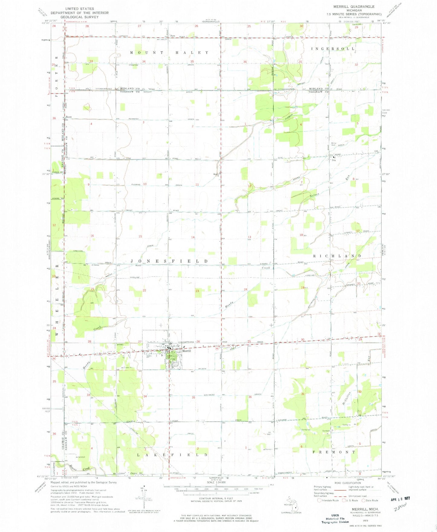
Classic USGS Merrill Michigan 7.5'x7.5' Topo Map
Couldn't load pickup availability
Historical USGS topographic quad map of Merrill in the state of Michigan. Map scale may vary for some years, but is generally around 1:24,000. Print size is approximately 24" x 27"
This quadrangle is in the following counties: Gratiot, Midland, Saginaw.
The map contains contour lines, roads, rivers, towns, and lakes. Printed on high-quality waterproof paper with UV fade-resistant inks, and shipped rolled.
Contains the following named places: Congregational Christian Church, Corbat Drain, Greison Drain, Handy Creek, Iva, Iva Post Office, Jam, Jam Post Office, Jonesfield - Lakefield Fire Department, Jonesfield Township Hall, Kennedy Drain, Lake of Dreams Campground, Meridian Station, Merrill, Merrill Church, Merrill District Library, Merrill Elementary School, Merrill High School, Merrill Middle School, Merrill Post Office, Merrill Station, Mount Haley Drain, Price Drain, Randall Post Office, Richland Township Police Department Substation, Ryan, Sacred Heart Church, Saint Patrick Ryan Church, Stanton Drain, Township of Jonesfield, Village of Merrill, West's Mill Post Office, Whitmore Drain, Wilson Drain, Wright Drain, Zeitler Airport, Zion Lutheran Church, Zion Lutheran School, ZIP Code: 48637