MyTopo
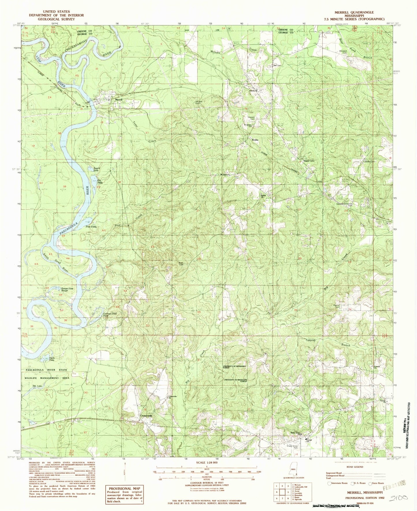
Classic USGS Merrill Mississippi 7.5'x7.5' Topo Map
Couldn't load pickup availability
Historical USGS topographic quad map of Merrill in the state of Mississippi. Map scale may vary for some years, but is generally around 1:24,000. Print size is approximately 24" x 27"
This quadrangle is in the following counties: George, Greene.
The map contains contour lines, roads, rivers, towns, and lakes. Printed on high-quality waterproof paper with UV fade-resistant inks, and shipped rolled.
Contains the following named places: Ball Cemetery, Baptist Center, Bexley, Bexley Baptist Church, Bexley School, Bexley Volunteer Fire Department, Big Eddy, Booger Hole Slough, Bush Cemetery, Canaan Baptist Church, Canaan Cemetery, Central, Central Lookout, Central School, Central Volunteer Fire Department, Chickasawhay River, Cochran Dead River, Corinth Cemetery, Corinth Missionary Baptist Church, Cross Roads Cemetery, Cross Roads Methodist Church, Crossroads, Crossroads Church, Davis Eddy, Eubanks, Eubanks - Dickerson Cemetery, Eubanks Cemetery, Holmes Cemetery, Holmes Missionary Baptist Church, Howard Cemetery, Leaf River, Merrill, Merrill Boat Ramp, Merrill Cemetery, Mount Sinai Church, Pascagoula River County Road 123 Bridge, Pipkins Cemetery, Pree Creek, Pree Eddy, Round Eddy, Saint James Church, Shady Grove Baptist Church, Shady Grove Cemetery, Shady Grove Park, Smith Dead River, Straight Way Church, Supervisor District 4, Tappley Branch, Toms Creek, Woodard Cemetery