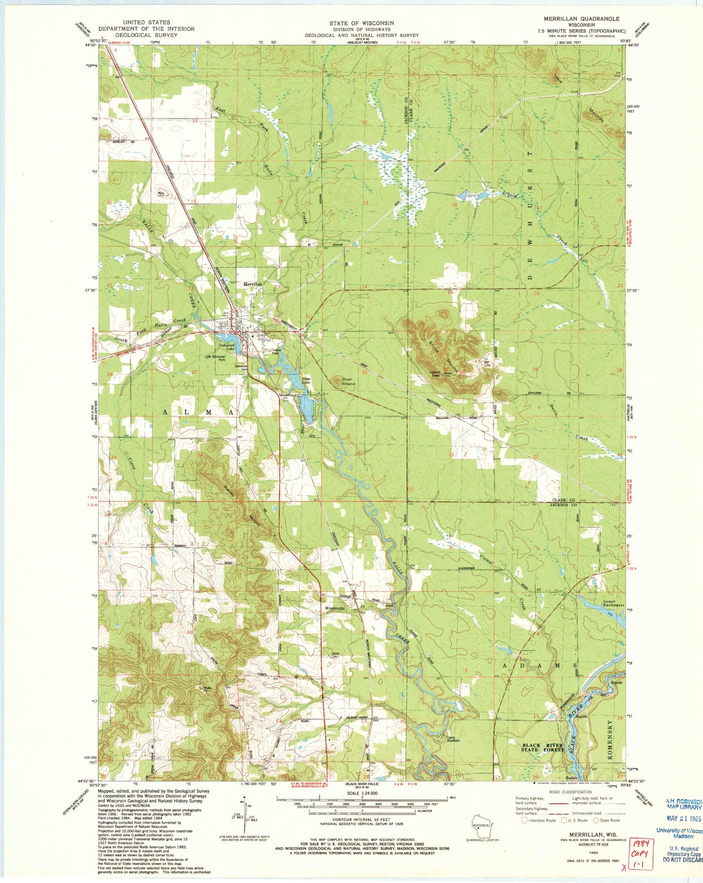
MyTopo
Classic USGS Merrillan Wisconsin 7.5'x7.5' Topo Map
Couldn't load pickup availability
Historical USGS topographic quad map of Merrillan in the state of Wisconsin. Map scale may vary for some years, but is generally around 1:24,000. Print size is approximately 24" x 27"
This quadrangle is in the following counties: Clark, Jackson.
The map contains contour lines, roads, rivers, towns, and lakes. Printed on high-quality waterproof paper with UV fade-resistant inks, and shipped rolled.
Contains the following named places: Avon School, Bruce Mound, Bruce Mound School, Camp Bradfield, Cisna Creek, East Fork Halls Creek, Gile Memorial Park, Hatfield School, Lincoln Elementary School, Lower Backwater, Merillan Mills Dam, Merrillan, Merrillan Fire and EMS Department, Merrillan Police Department, Merrillan Post Office, Oakwood Cemetery, Oakwood Lake, Paines Creek, Small Mound, South Fork Halls Creek, Stanley Mound, Town of Alma, Trow, Trow Lake, Trow Mounds, Trows 2WP481 Dam, Village of Merrillan, Vismal Creek, Wright Station, Wrightsville, Wrightsville Creek, Wrightsville Post Office, Wrightsville School, ZIP Code: 54754