MyTopo
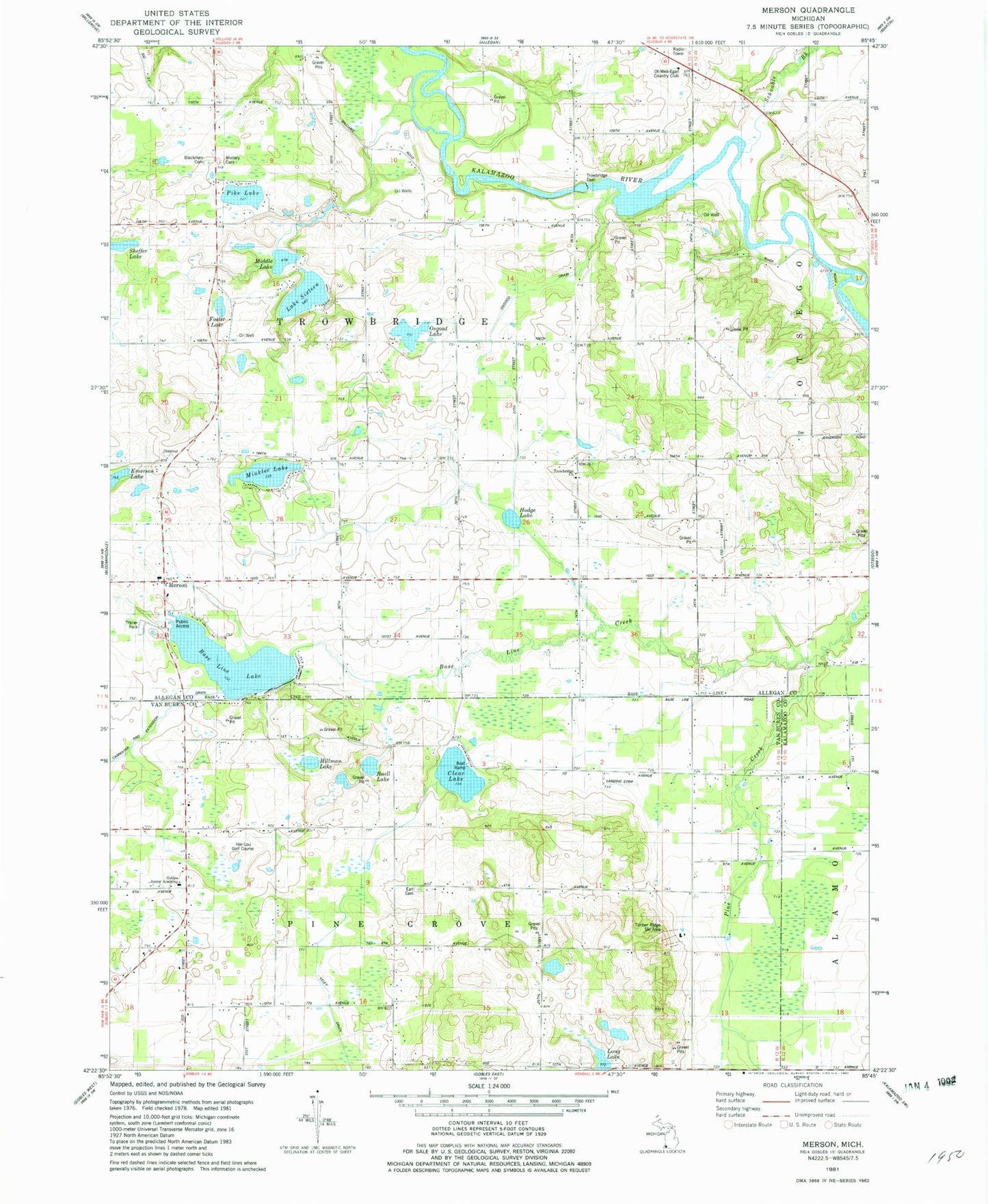
Classic USGS Merson Michigan 7.5'x7.5' Topo Map
Couldn't load pickup availability
Historical USGS topographic quad map of Merson in the state of Michigan. Map scale may vary for some years, but is generally around 1:24,000. Print size is approximately 24" x 27"
This quadrangle is in the following counties: Allegan, Kalamazoo, Van Buren.
The map contains contour lines, roads, rivers, towns, and lakes. Printed on high-quality waterproof paper with UV fade-resistant inks, and shipped rolled.
Contains the following named places: Base Line Creek, Base Line Lake, Becker School, Bittersweet Ski Resort, Blackman Cemetery, Buell Lake, Clear Lake, Clifford School, Eagle Creek Golf Club, Earl Cemetery, Foster Lake, Foster School, Gobles Junior Academy, Har-Lou Golf Course, Harper School, Hart School, Hicks School, Hillman Lake, Hodge Lake, Lake Sixteen, Long Lake, Lynx Golf Course, Mallery Cemetery, Merson, Merson Church, Merson Post Office, Middle Lake, Minkler Lake, North Point Hall, Osgood Drain, Osgood Lake, Otto School, Pike Lake, Pine Grove School, Prouty School, Quail Trap School, Ross School, Schnable Brook, Sheffer Lake, Timber Ridge Ski Area, Township of Pine Grove, Township of Trowbridge, Trow Bridge Church, Trowbridge Dam, Trowbridge Methodist Cemetery, Veley Drain