MyTopo
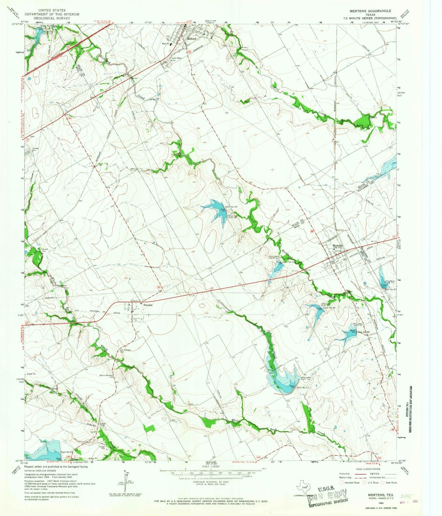
Classic USGS Mertens Texas 7.5'x7.5' Topo Map
Couldn't load pickup availability
Historical USGS topographic quad map of Mertens in the state of Texas. Map scale may vary for some years, but is generally around 1:24,000. Print size is approximately 24" x 27"
This quadrangle is in the following counties: Ellis, Hill, Navarro.
The map contains contour lines, roads, rivers, towns, and lakes. Printed on high-quality waterproof paper with UV fade-resistant inks, and shipped rolled.
Contains the following named places: Brandon, Brandon Post Office, Bynum-Brandon Cemetery, Cottonwood Creek, Dam Number 42, Dam Number 44, Dam Number 45, Dam Number 46, Dam Number 47, Dam Number 48, Dam Number 57, Dam Number 63, Grove Creek, Kelly-Miller School, Mertens, Mertens City Office, Mertens Post Office, Mertens Volunteer Fire Department, Milford, Milford City Hall, Milford Police Department, Milford Volunteer Fire Department, Old Brandon Cemetery, Soil Conservation Service Site 42 Dam, Soil Conservation Service Site 42 Reservoir, Soil Conservation Service Site 44 Dam, Soil Conservation Service Site 44 Reservoir, Soil Conservation Service Site 45 Dam, Soil Conservation Service Site 45 Reservoir, Soil Conservation Service Site 46 Dam, Soil Conservation Service Site 46 Reservoir, Soil Conservation Service Site 47 Dam, Soil Conservation Service Site 47 Reservoir, Soil Conservation Service Site 48 Dam, Soil Conservation Service Site 48 Reservoir, Soil Conservation Service Site 57 Dam, Soil Conservation Service Site 57 Reservoir, Soil Conservation Service Site 63 Dam, Soil Conservation Service Site 63 Reservoir, Town of Mertens, Town of Milford, ZIP Codes: 76628, 76666