MyTopo
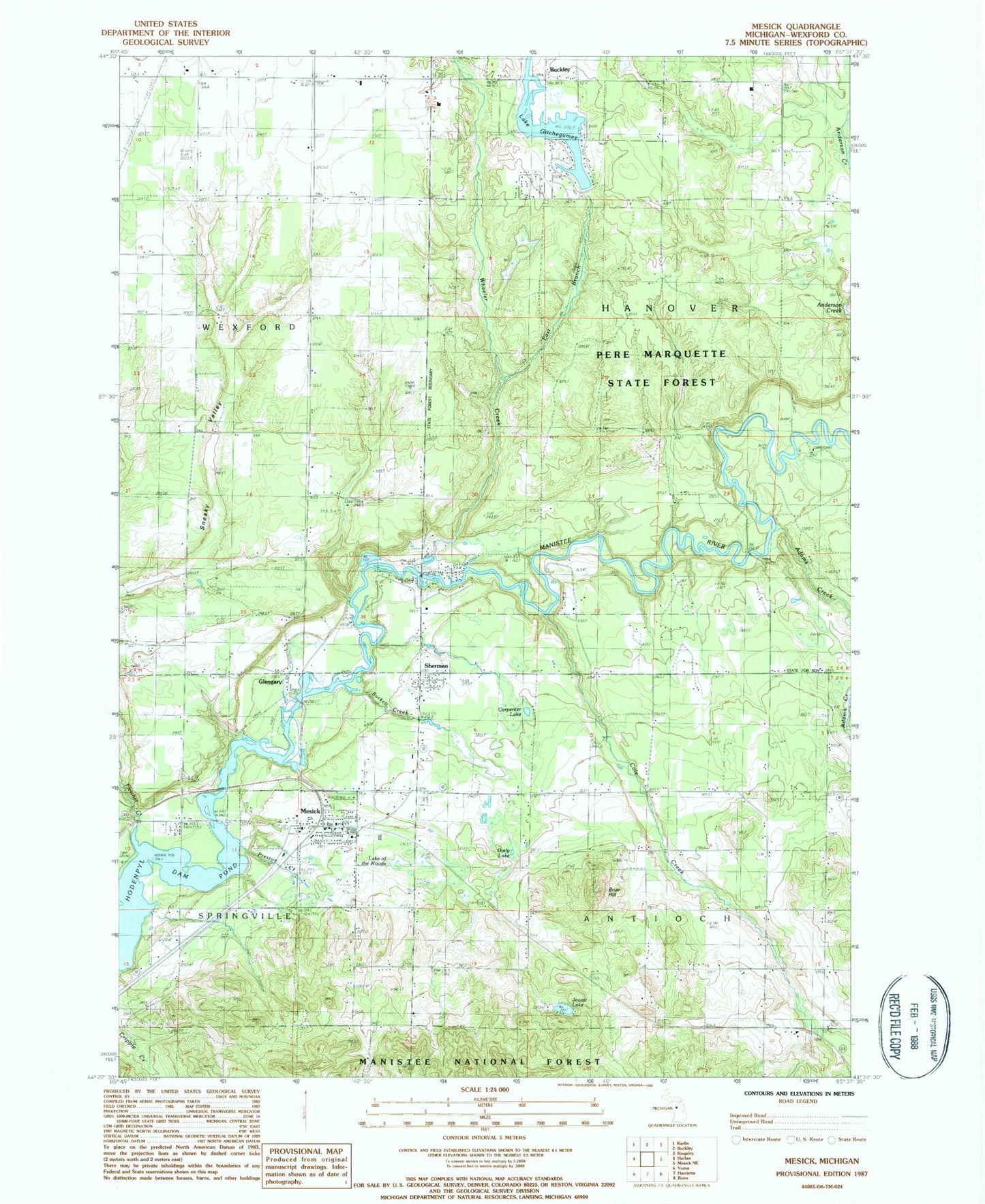
Classic USGS Mesick Michigan 7.5'x7.5' Topo Map
Couldn't load pickup availability
Historical USGS topographic quad map of Mesick in the state of Michigan. Map scale may vary for some years, but is generally around 1:24,000. Print size is approximately 24" x 27"
This quadrangle is in the following counties: Wexford.
The map contains contour lines, roads, rivers, towns, and lakes. Printed on high-quality waterproof paper with UV fade-resistant inks, and shipped rolled.
Contains the following named places: Adams Creek, Antioch Church, Antioch Township Cemetery, Bible Believers Fellowship Church, Briar at Mesick Golf Club, Briar Hill, Briar Hill Ski Jump, Burkett Creek, Carpenter Lake, Cole Creek, Cornell Cemetery, Cornell School, Dennis Family Campground, East Branch Wheeler Creek, Faith Lutheran Church, First Wexford County Courthouse Historical Marker, Fletcher Creek, Free Methodist Church, Glengary, Harvey Bridge, Indian Crossing Campground, Jewett Lake, Lake Gitchegumee, Lake of the Woods, Mesick, Mesick - Sherman Cemetery, Mesick High School, Mesick Medical Center, Mesick Middle School, Mesick Post Office, Mesick Public Library, Mesick Rescue Squad, Mesick Seventh Day Adventist Church, Mesick Station, Oatly Lake, Preston Creek, Sherman, Sherman Post Office, Springville Township Fire Department, Township of Antioch, Township of Hanover, United Methodist Church, Village of Mesick, Wheeler Creek, WTCM-FM (Traverse City), ZIP Code: 49668