MyTopo
Classic USGS Mesquite Nevada 7.5'x7.5' Topo Map
Couldn't load pickup availability
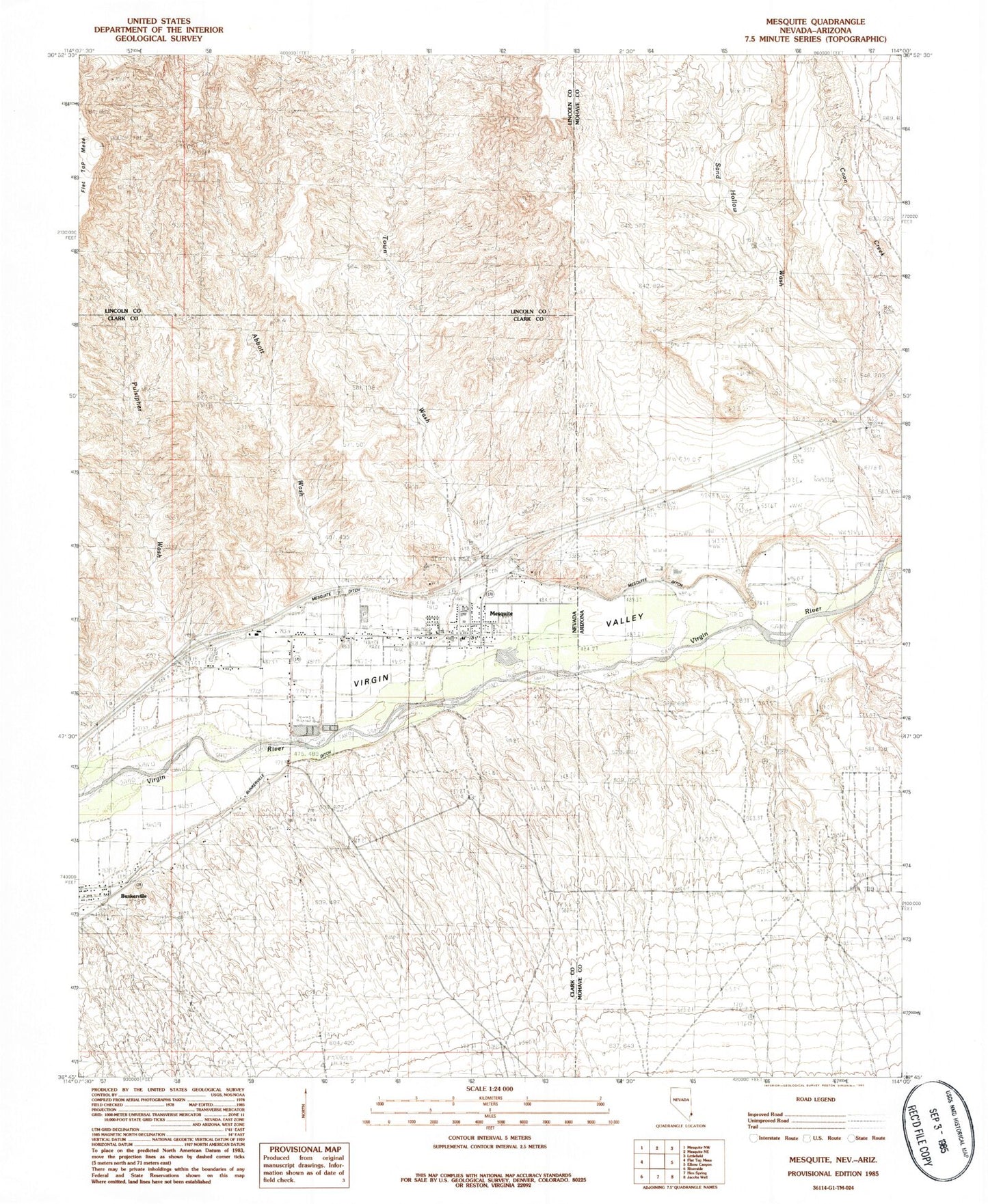
Historical USGS topographic quad map of Mesquite in the states of Nevada, Arizona. Map scale may vary for some years, but is generally around 1:24,000. Print size is approximately 24" x 27"
This quadrangle is in the following counties: Clark, Lincoln, Mohave.
The map contains contour lines, roads, rivers, towns, and lakes. Printed on high-quality waterproof paper with UV fade-resistant inks, and shipped rolled.
Contains the following named places: Abbott Wash, Bronze Boot Airport, Bunkerville Ditch, Carmen Plaza, Charles Hughes Middle School, City of Mesquite Animal Shelter, Community College of Southern Nevada Mesquite Center, Elementary Park, Flat Top Mesa, Hafen Lane Park, Highland Manor Mesquite, Hughes Middle School, Jensen Park, KIPP-FM (Mesquite), Library Park, Marilyn Redd Park, Mercy Air, Mesa View Regional Hospital, Mesquite, Mesquite Airport, Mesquite City Cemetery, Mesquite City Hall, Mesquite Community Center, Mesquite Detention Center, Mesquite Ditch, Mesquite Fine Arts Center, Mesquite Fire and Rescue Department Station 3, Mesquite Fire and Rescue Station 1, Mesquite Fire and Rescue Station 2, Mesquite Library, Mesquite Medical Center, Mesquite Police Department, Mesquite Post Office, Mesquite Recreation Center, Mesquite Rodeo Grounds, Mesquite Township, Nevada Visitor Center, Pioneer Park, Pulsipher Park, Pulsipher Wash, Recreation Center Park, Scenic Census Designated Place, Town Wash, Trailside Park, Virgin Valley Elementary School, Virgin Valley Heritage Museum, Virgin Valley High School, Virgin Valley Middle School and High School Park, Virgin Valley School Park, ZIP Code: 89027