MyTopo
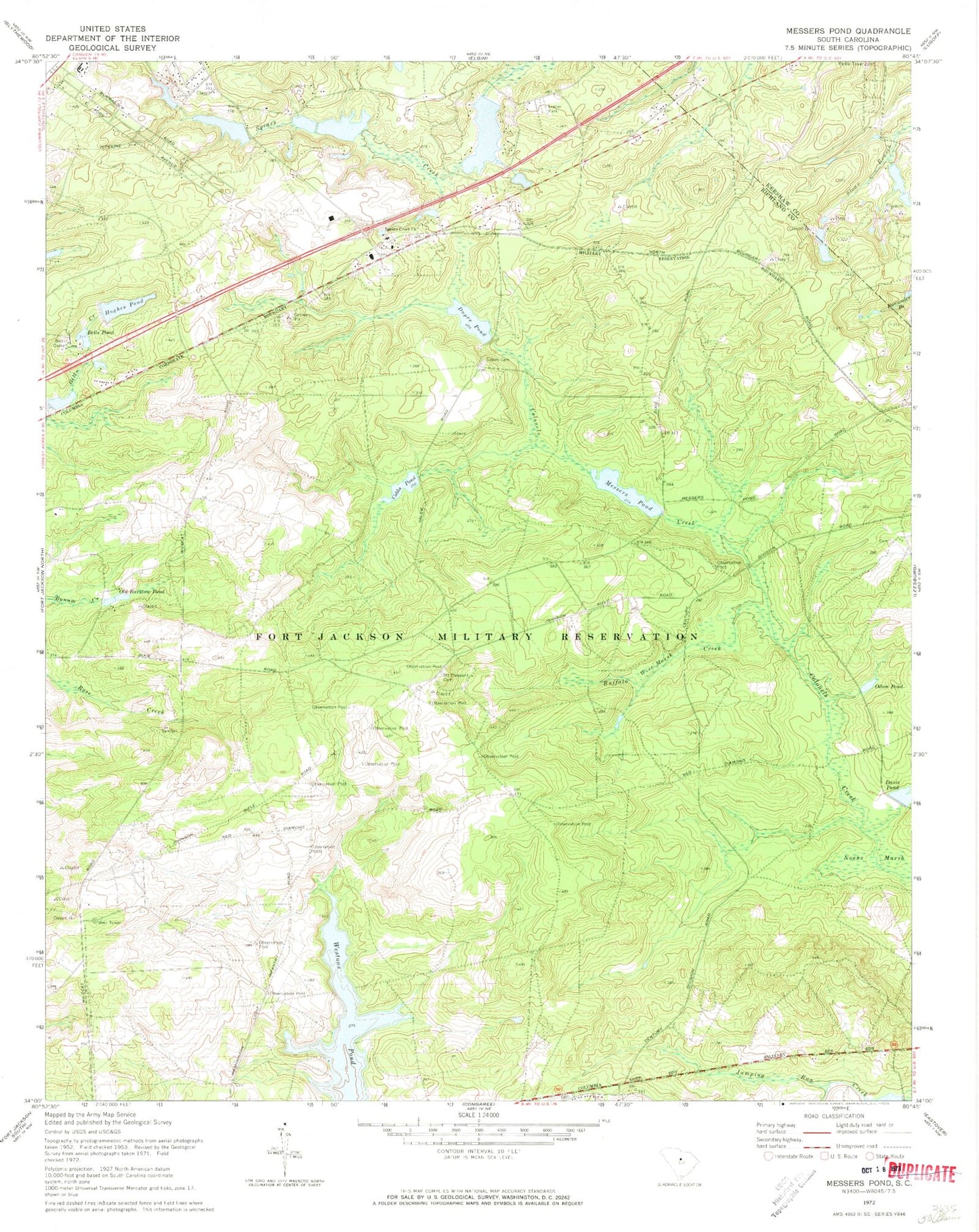
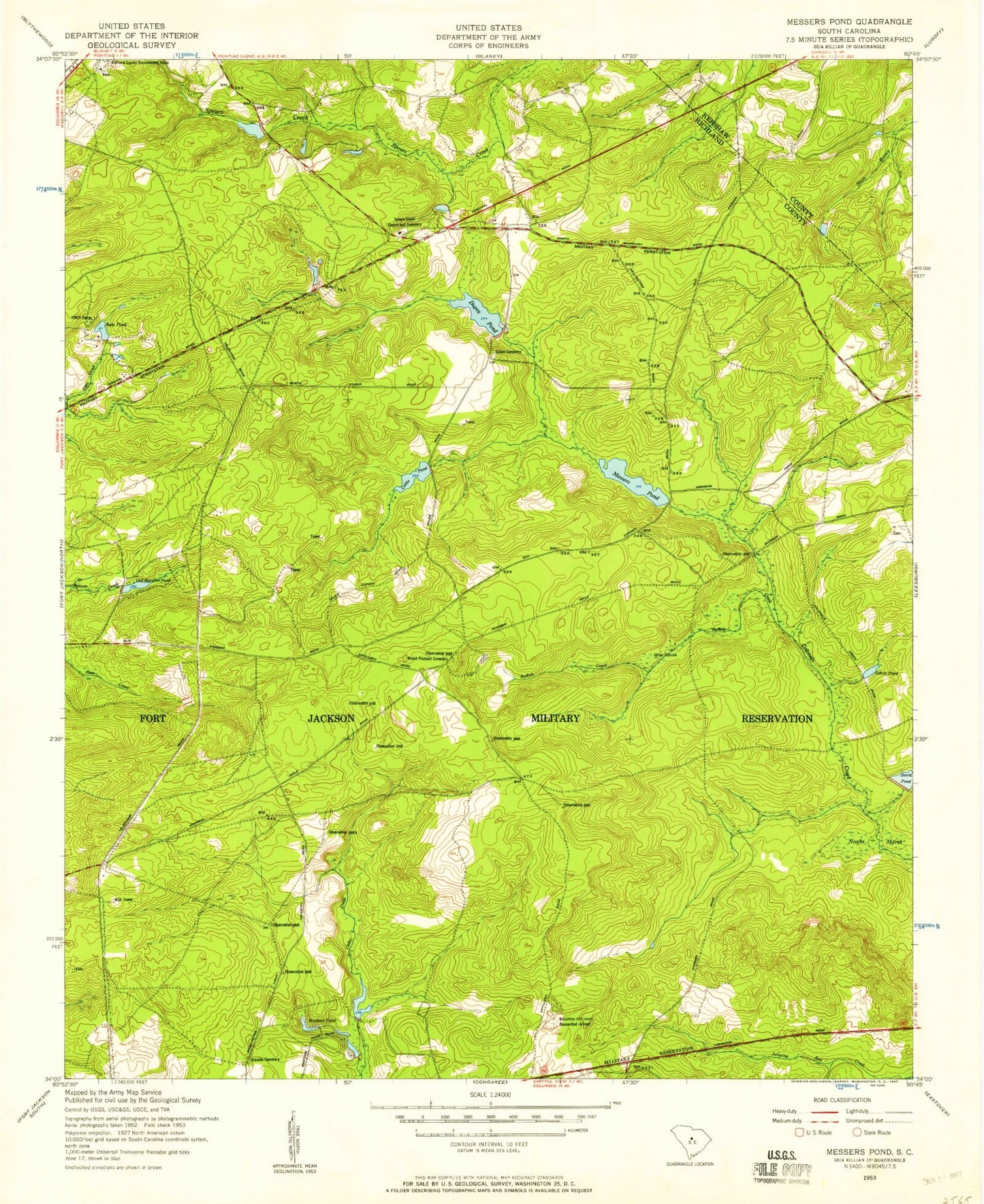
Classic USGS Messers Pond South Carolina 7.5'x7.5' Topo Map
Couldn't load pickup availability
Historical USGS topographic quad map of Messers Pond in the state of South Carolina. Typical map scale is 1:24,000, but may vary for certain years, if available. Print size: 24" x 27"
This quadrangle is in the following counties: Kershaw, Richland.
The map contains contour lines, roads, rivers, towns, and lakes. Printed on high-quality waterproof paper with UV fade-resistant inks, and shipped rolled.
Contains the following named places: Bells Camp, Bells Pond, Buffalo Creek, Cobbs Pond, Dupre Pond, Hughes Pond, Messers Pond, Mount Pleasant Cemetery, Noahs Marsh, Salem Cemetery, Spears Creek Church, Westons Pond, Wise Marsh, Rotureau Lake Dam D-0572, Rotureau Lake, Rutledges Pond D-0137 Dam, Ruthledges Pond, Coopers Lake D-0574 Dam, Coopers Lake, South Carolina Noname 40089 D-0575 Dam, F Coopers Pond, Cobbs Pond Dam D-1675, Upper Davis Pond Dam D-1677, Dupre Pond Dam D-1674, Messers Pond Dam D-1676, South Carolina Noname 28045 D-2521 Dam, Powell Pond, Hughes Pond D-0573 Dam, Bardell Graveyard, Buffalo Church (historical), Camp Barstow (historical), Carlisle School (historical), Chimney Ridge, Gills Creek School (historical), Lisbon (historical), Messer School (historical), Mount Pleasant Church (historical), Mount Pleasant School (historical), Richland Northeast Industrial Park, Royal Pines Estates, Salem Church (historical), Spears Creek School (historical), Wise Pond, Odom Pond, Old Barstow Pond, Weir Tower, WLTX-TV (Columbia), WIS-TV (Columbia), Pontiac Division, Fort Jackson, Columbia - Richland Fire Department Northeast Columbia, Fort Jackson Division, Berkeley Endoscopy Center, Gray Shadow Farm, Fort Jackson National Cemetery