MyTopo
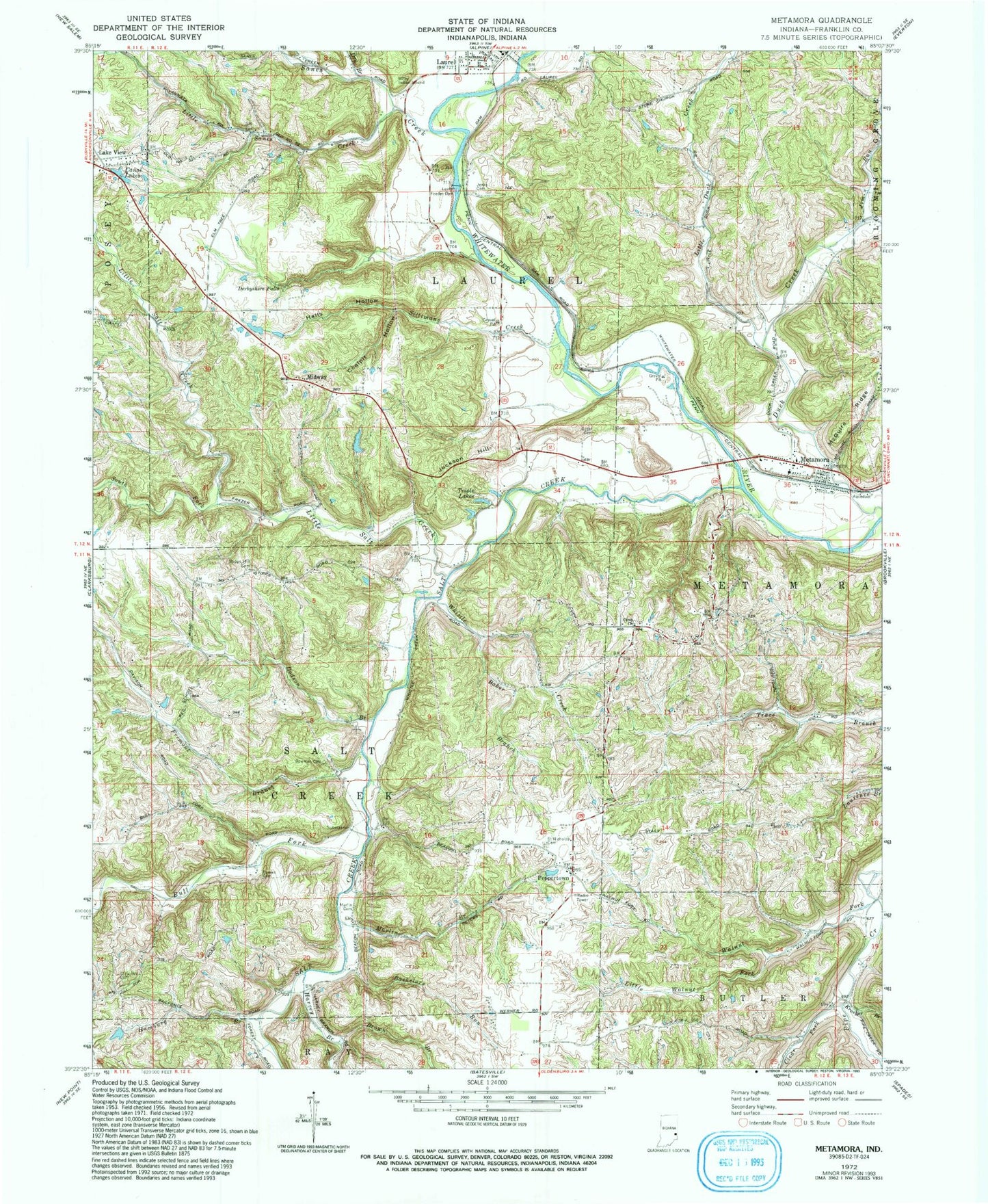
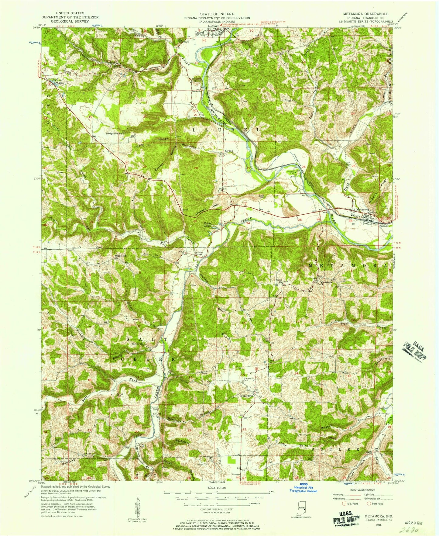
Classic USGS Metamora Indiana 7.5'x7.5' Topo Map
Couldn't load pickup availability
Historical USGS topographic quad map of Metamora in the state of Indiana. Typical map scale is 1:24,000, but may vary for certain years, if available. Print size: 24" x 27"
This quadrangle is in the following counties: Franklin.
The map contains contour lines, roads, rivers, towns, and lakes. Printed on high-quality waterproof paper with UV fade-resistant inks, and shipped rolled.
Contains the following named places: Bachelors Run, Baker Branch, Barnes Cemetery, Bowman Cemetery, Brown Branch, Bull Fork, Canal Lakes, Clear Fork, Coalpit Hollow, Derbyshire Falls, Dodson Branch, Dry Branch, Fremont Branch, Gobel Cemetery, Halls Hollow, Hamburg Branch, Jackson Hill, Jenks Cemetery, Kroeger Branch, Lake View, Laurel Feeder Dam, Little Duck Creek, Little Salt Creek, Little Walnut Fork, Marlin Branch, Marlin Cemetery, McGuire Ridge, Metamora, Midway, Peppertown, Saint Annes Cemetery, Saint Nicholas Cemetery, Salt Creek, Sanes Creek, Sillimans Creek, South Fork Little Salt Creek, Stipps Hill Cemetery, Triple Lakes, Walnut Fork, Wiley Indian Mound, Gemco Lake Dam, Gemco Lake, Swartz School (historical), Stips Hill School (historical), Stips Hill Church (historical), Pilgrim Holiness Church, Gap School (historical), Cupp Church, Harvey Branch, Jim Run, Little Sanes Creek, Whistle Creek, Township of Laurel, Township of Metamora, Township of Salt Creek, Metamora Census Designated Place, Metamora Volunteer Fire Department, Holzhause Stone Quarry, Turner Stone Quarry, Metamora Post Office, Metamora Cemetery