MyTopo
Classic USGS Metigoshe Lake North Dakota 7.5'x7.5' Topo Map
Couldn't load pickup availability
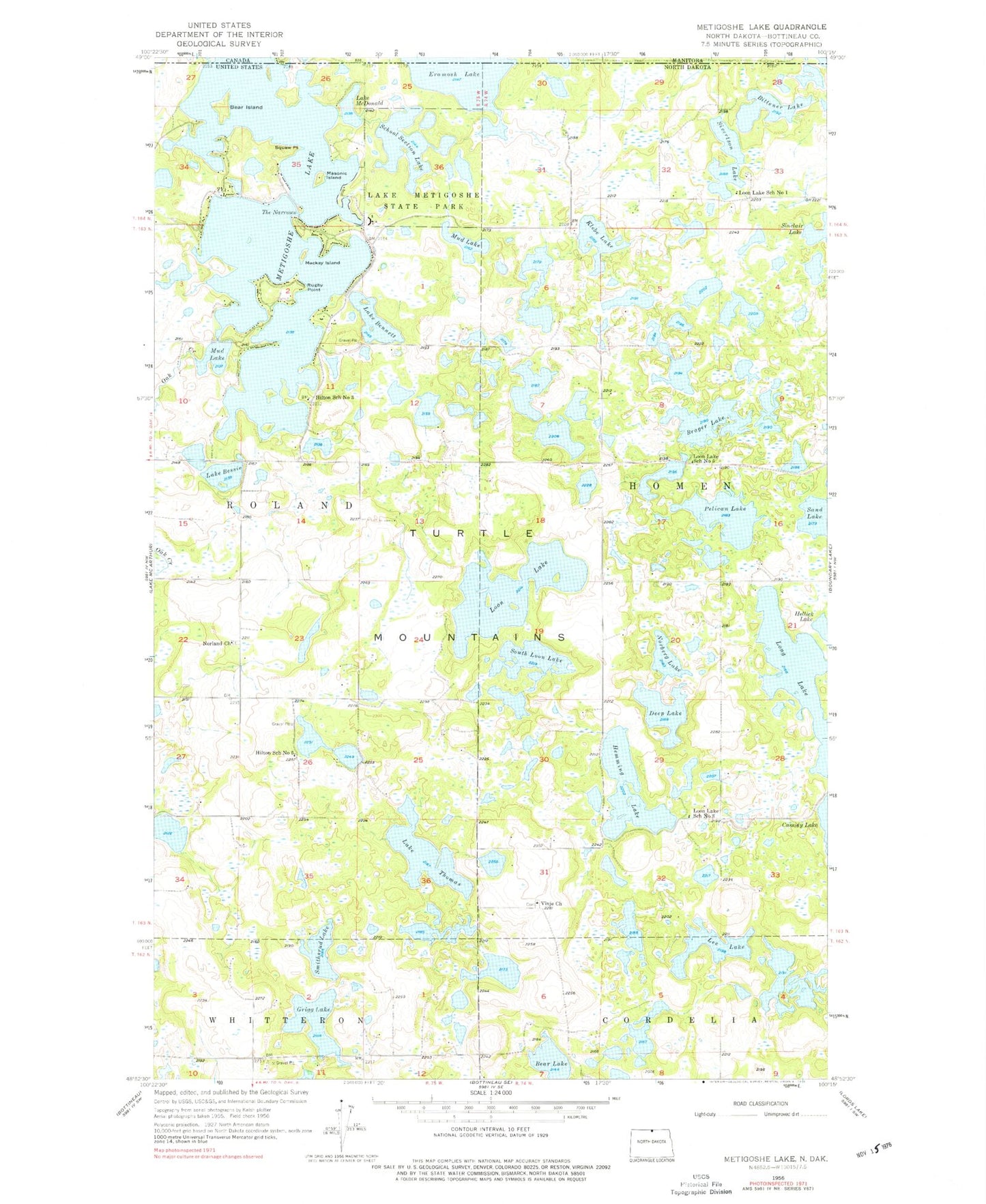
Historical USGS topographic quad map of Metigoshe Lake in the state of North Dakota. Typical map scale is 1:24,000, but may vary for certain years, if available. Print size: 24" x 27"
This quadrangle is in the following counties: Bottineau.
The map contains contour lines, roads, rivers, towns, and lakes. Printed on high-quality waterproof paper with UV fade-resistant inks, and shipped rolled.
Contains the following named places: Bear Lake, Lake Bennett, Lake Bessie, Bittener Lake, Brager Lake, Deep Lake, Grigg Lake, Hemming Lake, Hilton School Number 3, Hilton School Number 5, Klebe Lake, Lake Metigoshe State Park, Lee Lake, Long Lake, Loon Lake, Loon Lake School Number 1, Loon Lake School Number 3, Loon Lake School Number 5, Mackay Island, Masonic Island, Lake McDonald, Mud Lake, Mud Lake, Norberg Lake, Norland Church, Pelican Lake, Rugby Point, Sand Lake, School Section Lake, Sinclair Lake, Sivertson Lake, South Loon Lake, Squaw Point, The Narrows, Lake Thomas, Vinje Church (historical), Lake Metigoshe Dam, Bear Island, Smithsrund Lake, Metigoshe Lake, Bottineau Fire Department Station 2, Bottineau County Dive Rescue Squad, Homen State Forest, Hahn's Bay Recreation Area, Long Lake Boat Ramp, Pelican Sandy Recreation Area, Fish Lake Cemetery, Vinje Cemetery, Turtle Mountain Adventist Cemetery, Nordland Cemetery