MyTopo
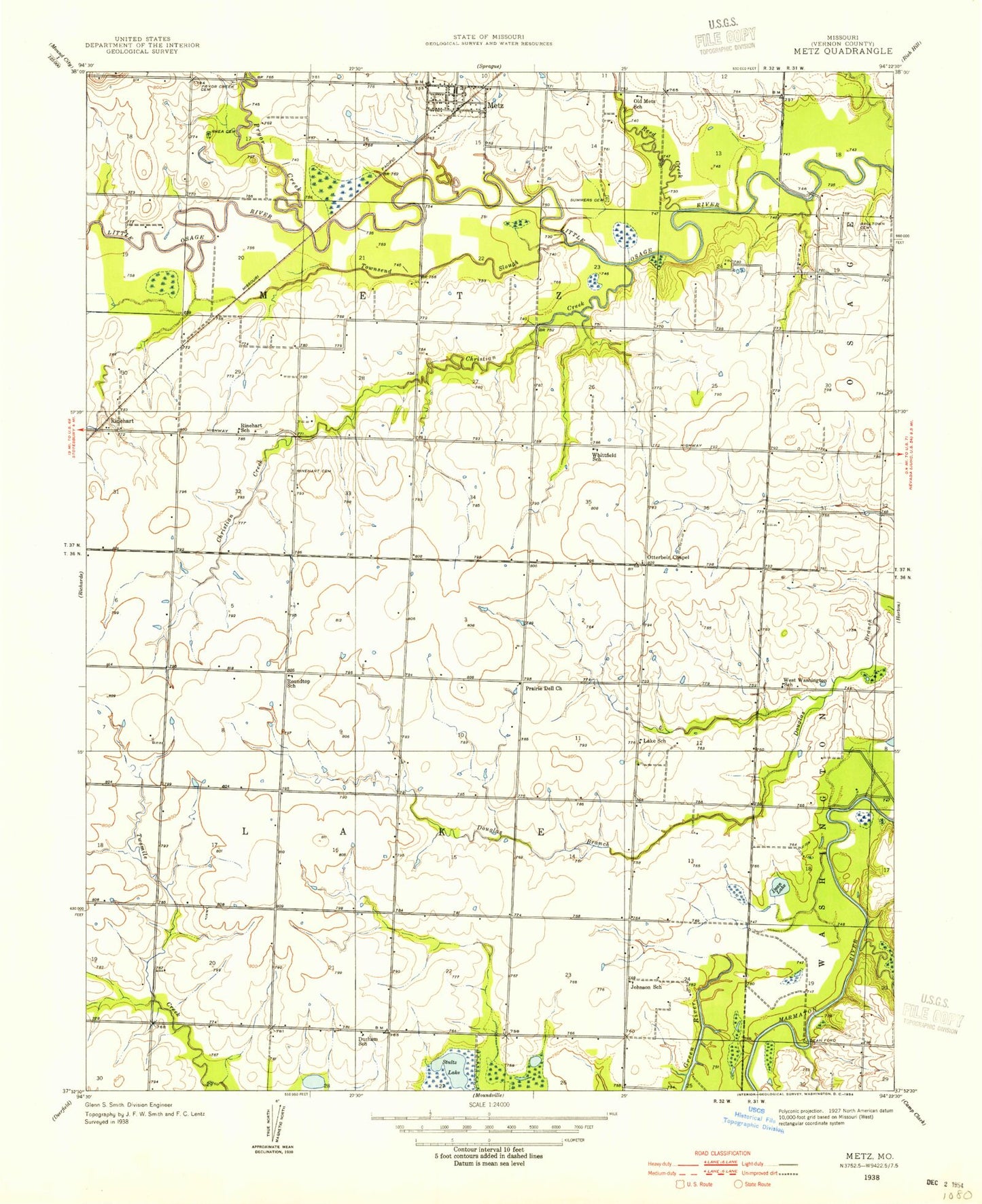
Classic USGS Metz Missouri 7.5'x7.5' Topo Map
Couldn't load pickup availability
Historical USGS topographic quad map of Metz in the state of Missouri. Map scale may vary for some years, but is generally around 1:24,000. Print size is approximately 24" x 27"
This quadrangle is in the following counties: Vernon.
The map contains contour lines, roads, rivers, towns, and lakes. Printed on high-quality waterproof paper with UV fade-resistant inks, and shipped rolled.
Contains the following named places: Backbone Lake, Balltown Cemetery, Blaine, Charles Lake Dam, Christian Creek, Dean Ford, Dean Lake, Durham School, Flight Lake Natural Historic Area, Hong, Johnson School, Lake School, Metz, Metz Post Office, Metz School, Old Metz School, Otterbein Chapel, Prairie Dell Church, Pryor Creek, Pryor Creek Cemetery, Reed Creek, Rhea Cemetery, Rinehart, Rinehart Cemetery, Rinehart School, Roundtop School, Stultz Lake, Sulphur Spring Branch, Summers Cemetery, Temple, Temple Cemetery, Temple Post Office, Town of Metz, Townsend Slough, Township of Lake, Township of Metz, W S Charles Lake, West Washington School, White Branch, Whittfield School, ZIP Codes: 64765, 64778