MyTopo
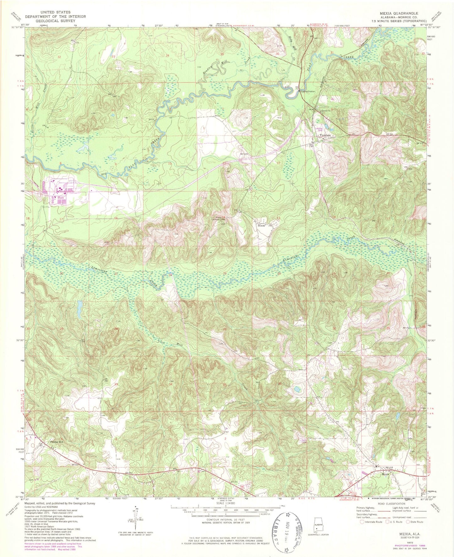
Classic USGS Mexia Alabama 7.5'x7.5' Topo Map
Couldn't load pickup availability
Historical USGS topographic quad map of Mexia in the state of Alabama. Map scale may vary for some years, but is generally around 1:24,000. Print size is approximately 24" x 27"
This quadrangle is in the following counties: Monroe.
The map contains contour lines, roads, rivers, towns, and lakes. Printed on high-quality waterproof paper with UV fade-resistant inks, and shipped rolled.
Contains the following named places: Antioch Baptist Church of Tunnel Springs, Barbara Locklin Baptist Church, Bradley Mill Creek, Carry Mount Baptist Church, Carry Mount Cemetery, Fountain, Fountain Church, Graham Bridge, Gray Creek, Hixon, Hixon Lookout Tower, Holly Mill Creek, Ikner Bridge, Limestone, Lower Bridge, Mexia, Mexia Apostolic Overcoming Holiness Church, Mexia Baptist Church, Mexia Cemetery, Mexia Post Office, Mexia Volunteer Fire Department, Mill Creek, Mineral Springs, Monroeville Division, Mount Rose Missionary Baptist Church, Old Salem, Old Salem Baptist Church, Old Salem Cemetery, Perdue Hill, Perdue Hill Post Office, Perdue Hill Presbyterian Church, Saint Thomas Church, Salem Church, Victoria Church, W Sam Carpenters Dam, W Sam Carpenters Lake, Wiggins Cemetery