MyTopo
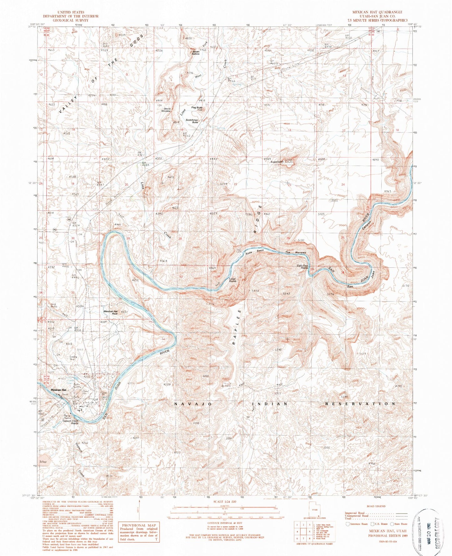
Classic USGS Mexican Hat Utah 7.5'x7.5' Topo Map
Couldn't load pickup availability
Historical USGS topographic quad map of Mexican Hat in the state of Utah. Typical map scale is 1:24,000, but may vary for certain years, if available. Print size: 24" x 27"
This quadrangle is in the following counties: San Juan.
The map contains contour lines, roads, rivers, towns, and lakes. Printed on high-quality waterproof paper with UV fade-resistant inks, and shipped rolled.
Contains the following named places: Halgaitoh Wash, Flag Butte, Gypsum Creek, Lime Creek, Mexican Hat, Mexican Hat Rock, Raplee Ridge, San Juan Canyon, Scotchman Butte, Seven Sailors, Soda Basin, Soda Spring (historical), Sugarloaf, The Narrows, West Fork Lime Creek, Devils Window, Eight Foot Rapids, Gypsum Creek Rapids, Ledge Rapids, Goodridge Rocks, Valles Trailer Park, Mexican Hat Census Designated Place, San Juan Fire Department - Mexican Hat Station, Mexican Hat Post Office