MyTopo
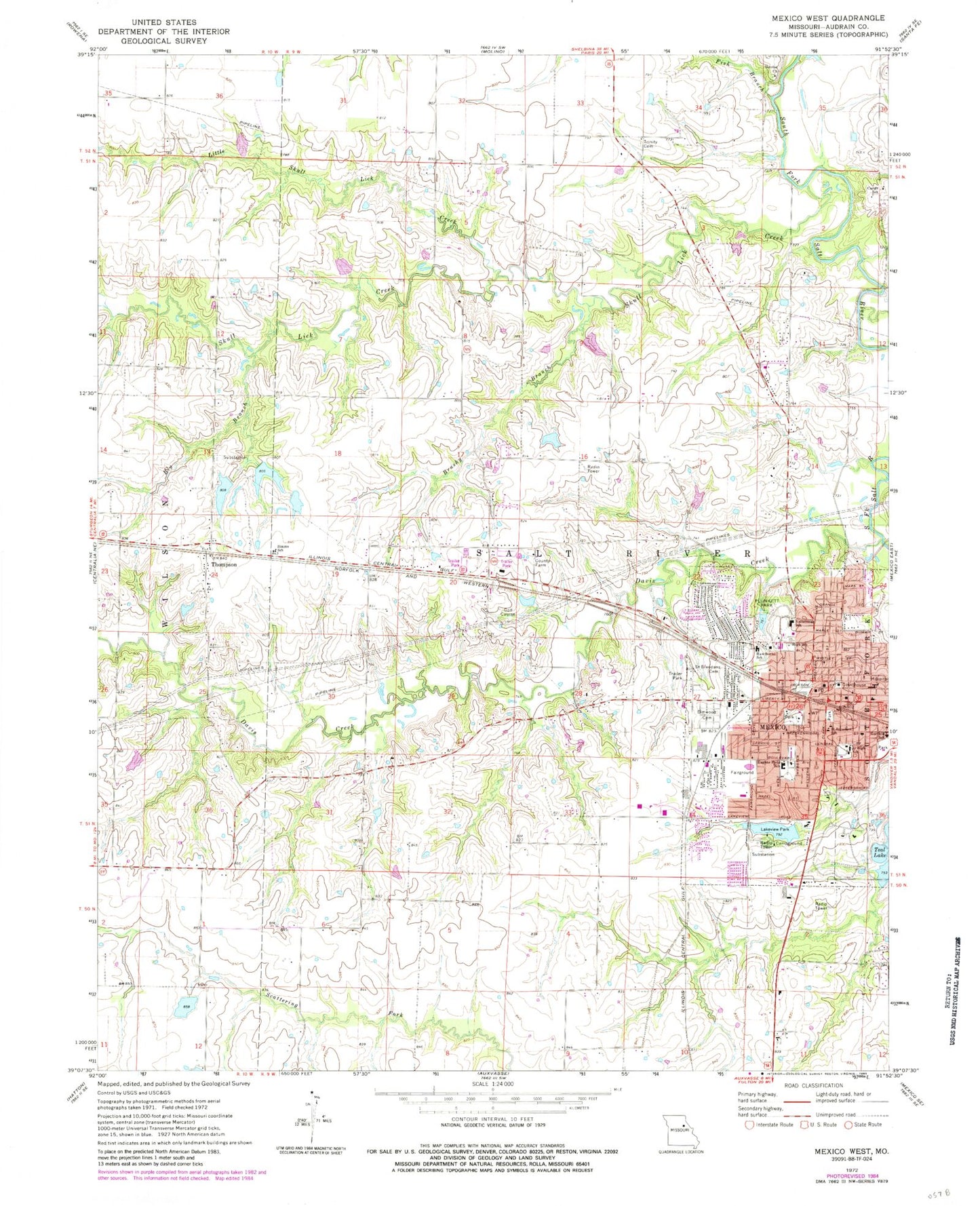
Classic USGS Mexico West Missouri 7.5'x7.5' Topo Map
Couldn't load pickup availability
Historical USGS topographic quad map of Mexico West in the state of Missouri. Map scale may vary for some years, but is generally around 1:24,000. Print size is approximately 24" x 27"
This quadrangle is in the following counties: Audrain.
The map contains contour lines, roads, rivers, towns, and lakes. Printed on high-quality waterproof paper with UV fade-resistant inks, and shipped rolled.
Contains the following named places: Big Branch, Brushy Branch, Carter Lake Dam, Carter School, Davis Creek, Davis H. Hart Career Center, Deimeke Lake, Deimeke Lake Dam, Duly School, Elmwood Cemetery, Eugene Field Elementary School, Fish Branch, Garfield School, Hawthorne Elementary School, Hurdle School, Jesse School, Kallenbach and Becker Lake Dam, KJAB-FM (Mexico), KWWR-FM (Mexico), Lakeview Park, Lakeview Park Lake, Little Skull Lick Creek, Locke Lake, Locke Lake East Dam, Locke Lake North Dam, Locke Lake West Dam, Maple Grove School, Mexico, Mexico High School, Mexico Middle School, Mexico Police Department, Mexico Post Office, Missouri Power and Light Dam, Mrs Sam Locke Lake, Number 102 Dam, Number 221 Reservoir, Paul Veale Lake, Plunkett Park, Saint Brendan School, Saint Brendans Catholic Church Cemetery, Simms School, Skull Lick Creek, South Trails Shopping Center, SSM Health Saint Mary's Hospital - Audrain, Sunrise Church, Thompson, Thompson Post Office, Township of Salt River, Trinity Cemetery, West Plaza, Williams Dam East, ZIP Code: 65265