MyTopo
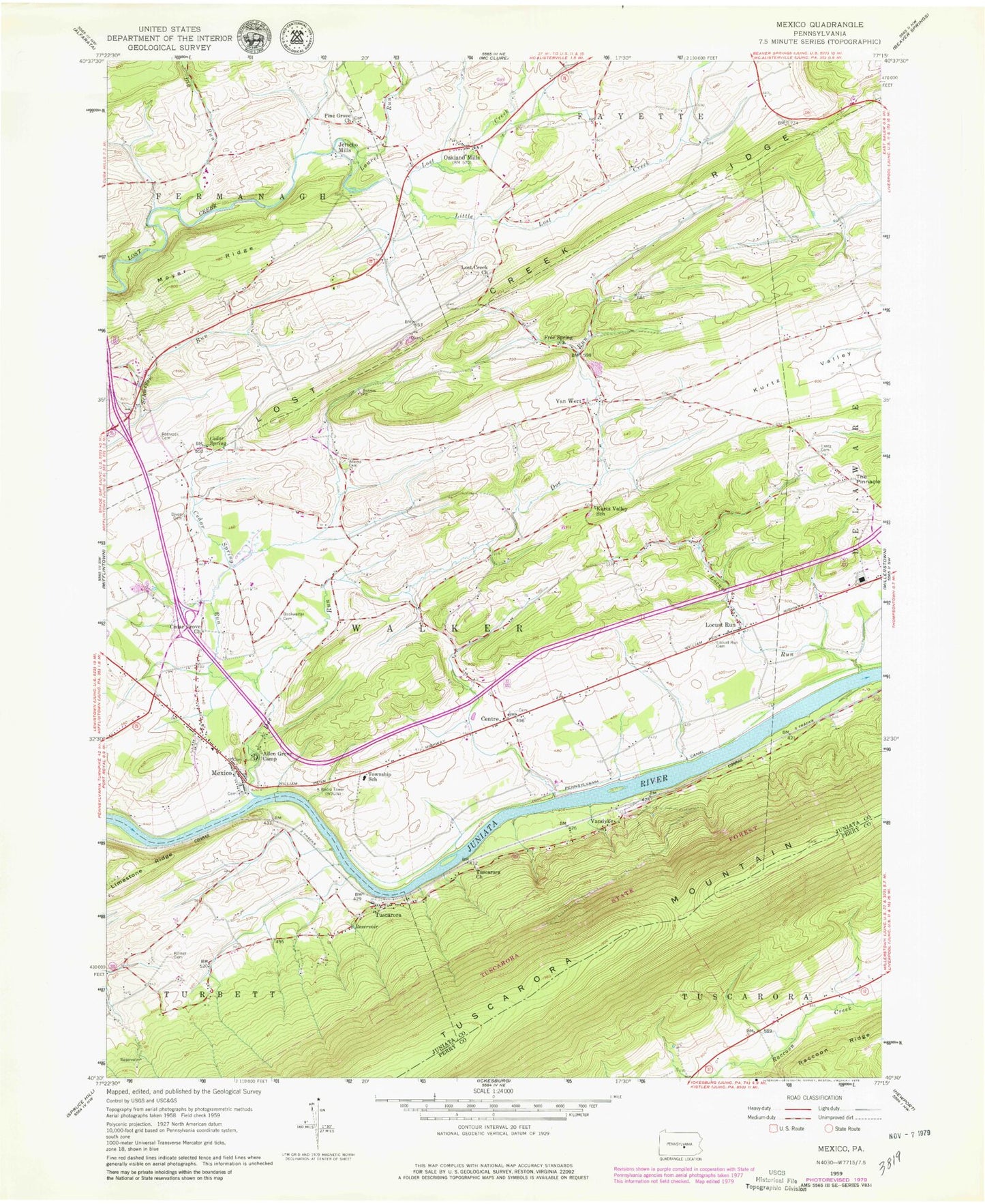
Classic USGS Mexico Pennsylvania 7.5'x7.5' Topo Map
Couldn't load pickup availability
Historical USGS topographic quad map of Mexico in the state of Pennsylvania. Map scale may vary for some years, but is generally around 1:24,000. Print size is approximately 24" x 27"
This quadrangle is in the following counties: Juniata, Perry.
The map contains contour lines, roads, rivers, towns, and lakes. Printed on high-quality waterproof paper with UV fade-resistant inks, and shipped rolled.
Contains the following named places: Adams Cemetery, Allen Grove Camp, Big Run, Big Run School, Bookwalter Cemetery, Cedar Grove Cemetery, Cedar Grove Church, Cedar Spring, Cedar Spring Run, Centre, Centre Lutheran Church Cemetery, Delaware School, Diven Cemetery, Doe Run, Free Spring Church, Free Spring School, Jericho Mills, Kilmer Cemetery, Kurtz Valley School, Lantz Cemetery, Laurel Run, Little Lost Creek, Locust Run, Locust Run Cemetery, Lost Creek Church, Lost Creek Golf Course, Lost Creek Mennonite Cemetery, Lost Creek Ridge, Mexico, Mexico Census Designated Place, Mexico Post Office, Mexico Town Community Cemetery, Mount Hope School, Moyer Ridge, Oakland Mills, Oakland Mills Post Office, Old Order Amish Cemetery, Olive Branch School, Pennsylvania Canal, Pine Grove Church, Pine Grove United Methodist Cemetery, Red Rock School, Rothrock Cemetery, The Pinnacle, Township of Walker, Tuscarora, Tuscarora Church, Van Wert, Vandyke, WJUN-AM (Mexico), ZIP Codes: 17056, 17076